

The Great North Walk – a mammoth 260km one way walk, stretching between Sydney and Newcastle, famous for challenging trails and incredible scenery. Sounds ambitious, but it’s actually split into stages so it is practically a walk in the (national) park. Here are some of the best sections, which have been spread out over the year and make for a pretty unreal experience.
-
STAGE 1: CITY TO THE BUSH
Where: From Macquarie Place in Sydney CBD to Fullers Bridge in Lane Cove National Park.
Distance: 15km
The route:
From the Obelisk in Macquarie Place, you take a ferry to Woolwich Pier, at the lower reaches of the Lane Cove River. Traverse Kellys Bush at Hunters Hill, and pass an industrial ‘heritage’ site – a former uranium dumping ground. As the valley closes in, move through remnant casuarina forests, hiking on through “Fairyland”. This section finishes up at Fullers Bridge in Lane Cove National Park. The next sections will take you on a taster of some of our great national parks.
-
STAGE 2: VALLEY EXPLORATION
Where: From Fullers Bridge, Lane Cove National Park up the Lane Cove River to Thornleigh. The walk starts at Pacific Highway, at Roseville train station in Roseville.
Distance: 17km
The route:
Follow the upper Lane Cove River to Thornleigh Station through a scenic valley. Pass the dividing weir (built near Fullers Bridge during the Great Depression!). Continue along a path of towering trees and stunning sandstone formations, seeing the remains of many large trees previously felled for timber. Approaching Thornleigh, the path heads sharply upwards through Conscript Pass. Here you’ll see iconic graffiti dating back to the depression of the 1930s.
-
STAGE 3: ACROSS THE WATERSHED
Where: From Thornleigh to Hornsby.
Distance: 10km
The route:
Start the walk by leaving the watershed of Lane Cove River and Sydney Harbour. Head towards Hawkesbury and Berowra Valley National Park. Journey by small creeks and streams throughout the day (walking along the drainage basin is considered one of the main highlights of the Great North Walk series!). Continue the walk and pass by remains of an old quarry. You’ll also see the excavations for the zig zag railway which transported gravel, to help build the Strathfield to Hornsby rail line. Stop for lunch at Fish Ponds before taking the “depression steps”. Here you’ll have a steep climb before reaching the last destination in Hornsby.
-
STAGE 4: INTO THE GORGE
View this post on InstagramWhere: Hornsby to Hornsby Heights, Berowra Valley National Park.
Distance: 16km
The route:
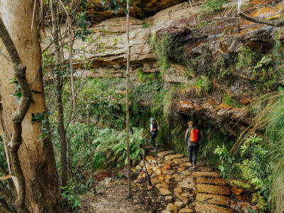
On this 16km hike, you’ll pass waterholes, rock overhangs and a variety of plant life in Sydney’s north. Take in various vantage points around the rim and upper sections of Galston Gorge. Take a break at the historic ‘Steele Bridge’. Next, follow the creek as it descends toward the valley floor. Finally, climb to the top of the ridge where the track emerges at Hornsby Heights.
-
STAGE 5: HIDDEN VALLEYS: AN EXPLORATION - Part 1
Where: Hornsby Heights to Berowra. Walk 12km to explore the hidden valleys of Berowra Valley National Park.
Distance: 12km
The route:
Follow a steep downhill route to the path through lyrebird country. From there, emerge at Berowra Creek near Crosslands Reserve. Shortly into the walk you’ll come across Calna Bridge. Here you’ll see the spectacular scenery of a wooden pathway passing over a delicate salt marsh. Continue the journey north along Berowra Creek for most of the day. If running on time, lunch will be at the subterranean ‘sandstone settee’ just above Sams Creek. From there you’ll climb to Naa Badu lookout to see the breathtaking views of the track. The last part of the journey will be a steep climb to the top of the ridge. This leads to Berowra where you’ll get a chance to stop for a well-earned coffee near the station.
-
Stage 6: HIDDEN VALLEYS: AN EXPLORATION – Part 2
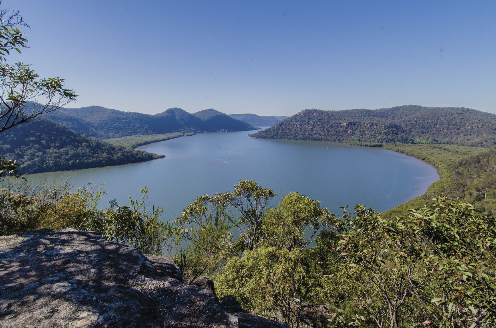 Photo Information
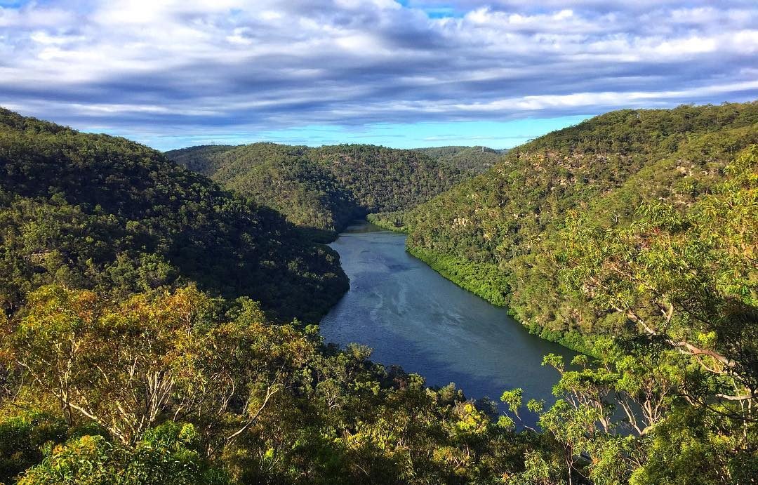
View down to the winding Hawkesbury River from Marramarra National Park
Marramarra National Park
John Spencer/DPIE (2014)
Where: Berowra to Cowan, Berowra Valley National Park
Distance: 14km
The route:
Enjoy spectacular views across Berowra Valley and Marramarra National Parks, where the hidden valleys open. On a clear day, see the distinctive shape of Mount Banks in the centre of the Blue Mountains. From Berowra, the track heads sharply downhill on its meandering path to Berowra Waters. The final stretch of the day is on a much gentler track, finishing up at Cowan railway station.
Ranger’s Tip: This is not an easy walk as there are more than 900m of ascents and descents. Bring at least two litres of drinking water, lunch and snacks. It’s a good idea to wear enclosed shoes and bring a hat, rain gear, sunscreen and insect protection.
-
Stage 7: HAWKESBURY PANORAMA
Where: Cowan to Brooklyn. If you are only able to complete one stage of the Great North Walk throughout the year, this should be it!
Distance: 13km
The route:
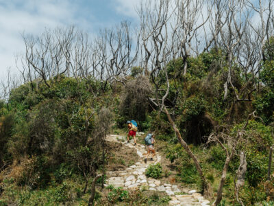
Pass through beautiful foreshore areas such as Jerusalem Bay and across the dry ridges and pocket areas of warm-temperate rainforest. As the views unfold, so too do the wildflowers that line the track. Spectacular sandstone overhangs and outcrops feature throughout the day. As the path gets closer to Brooklyn, sweeping views of the Hawkesbury River open. Before the final descent into the village and Hawkesbury River railway station, you’ll visit Brooklyn Dam.
-
Stage 8: WARATAH SPECTACULAR
Where: Patonga to Wondabyne. This is the first of the final three stages of the walk; all held in Brisbane Water National Park.
Distance: 20km
The route:
The walk features spectacular landscapes with views of Broken Bay, the Hawkesbury River, Cowan Creek, West Head, Pittwater and the iconic Barrenjoey Headland and lighthouse. From Warrah Lookout above Patonga, the track moves on an undulating path to the foot of Mt Wondabyne. The lunch break atop Mt Wondabyne offers panoramic views of the ocean (yes, it’s worth the climb!). Cascading waterfalls, the bellbird song and small isolated valleys with flowing creeks mark the pathway toward Wondabyne station at the end of the day.
-
Stage 9: RAINFOREST WALK
Where: Wondabyne station to Kariong, Brisbane Water National Park.
Distance: 16 km
The route:
The steep climb immediately from the station flattens to a gentler walk over a series of rock platforms leading up to Scopas Peak and its sweeping views over the national park. From this point, the track descends into the warm-temperate rainforest of Piles Creek Gorge and its magnificent stand of Blue Gums. The soils here are deep, the understory damp and the trees majestic – a wonderful rainforest environment. From the gorge, the track gradually climbs out of the valley to the Girrakool picnic area in time for a break and late lunch. Then, catch a bus from nearby Kariong to Gosford station.
-
Stage 10: BRISBANE WATER DREAMING
View this post on InstagramWhere: Kariong to Somersby. This track takes you into the Hawkesbury River Valley on Mooney Mooney Creek, Brisbane Waters National Park
Distance: 18km
The route:
Although surrounded by bushland, the sights and sounds of modern-day life are nearby as you head under the impressive Pacific Motorway. Leaving the motorway behind, the track follows Mooney Mooney Creek gently upstream to a massive rock platform above a waterfall. A great place for lunch. The track heads uphill past Gosford’s original water supply dam and on to Somersby. It is here that the journey ends; a perfect time for reflection on what an epic walk you have just completed.
The details:
- A medium-high level of fitness is required and it’s recommended that you have some bushwalking experience.
- Check the NSW National Parks alerts page for up-to-date info on closed parks and safety alerts.
- National parks are natural,unpredictable environments. Think before you TREK, be prepared with our Bushwalking safety tips
- Tell somebody before you head off, where you’re going and when to expect you back.