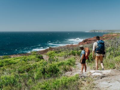
When you think of the NSW North Coast, what springs to mind? Beautiful white-sand beaches? Or perhaps Byron Bay? There’s so much more to this region, and the 4-day, 3-night, Gidjuum Gulganyi Walk showcases some of the best natural wonders it has to offer.
Set on the ancestral lands of the Widjabul Wia-bal and Minjungbal people of the Bundjalung Nation, this 42km trail is made up of mostly grade 4 tracks, linking Mount Jerusalem National Park, Whian Whian State Conservation Area and Nightcap National Park.

In the heart of the rainforest.
Gidjuum Gulganyi Walk
Mount Jerusalem National Park
Daniel Parsons/DCCEEW (2024)
Gidjuum Gulganyi Walk
Mount Jerusalem National Park
Daniel Parsons/DCCEEW (2024)
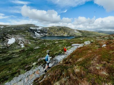
Wanganui Gorge lookout, Gidjuum Gulganyi Walk
Nightcap National Park
Remy Brand/DCCEEW (2024)
Enjoy the serenity from your exclusive camping platform.
Sand Ridge campground, Gidjuum Gulganyi Walk
Mount Jerusalem National Park
Daniel Parsons/DCCEEW (2024)
It’s an adventurous hike that’s best suited to experienced walkers. Be prepared to traverse the rim of an ancient volcano; take in spectacular, sweeping views from high ridge lookouts; explore Gondwanan rainforest teeming with life; and dip your toes in cool, fresh waterholes.
Until you experience this ancient landscape for yourself, you’ll never know just how much more this unique corner of NSW has in store.
Did you know? Gidjuum Gulganyi (pronounced: Gid-yum Gul-gan-yee) means ‘Old People’s Track’. The name was jointly chosen by the Widjabul Wia-bal Native Title Holders and the Minjungbal Bundjalung people. The name reflects the fact that the walk passes through ancient lands that Widjabul Wia-bal and Minjungbal people have traversed and occupied for many thousands of years.
-
Your Gidjuum Gulganyi Walk itinerary
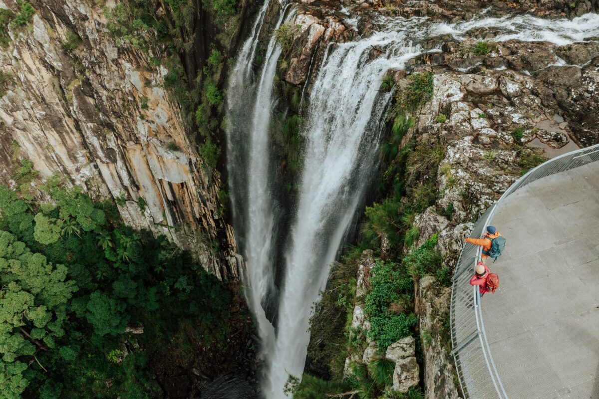 Photo Information
Feel the power of this mighty waterfall.
Minyon Falls, Gidjuum Gulganyi Walk
Nightcap National Park
Daniel Parsons/DCCEEW (2024)
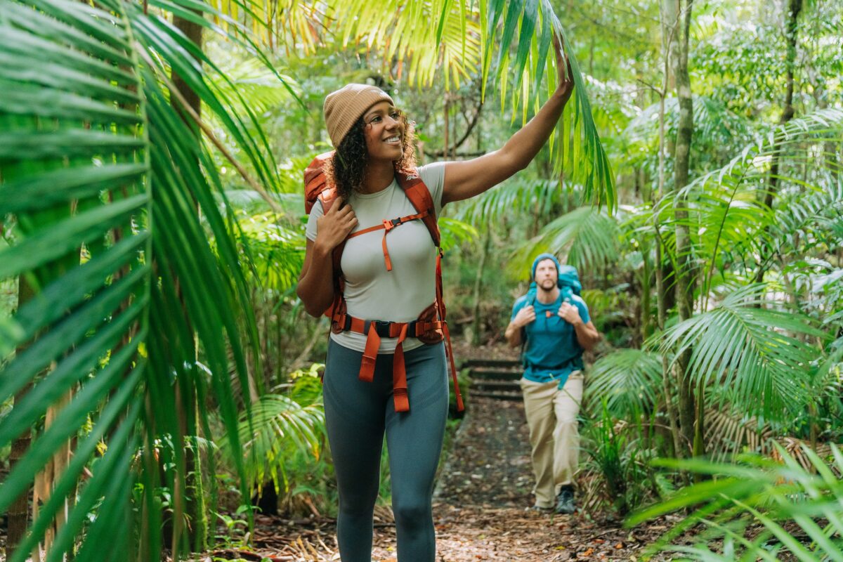 Photo Information
Keep your eyes peeled for wildlife in this biodiversity hotspot.
Peates Mountain track, Gidjuum Gulganyi Walk
Whian Whian State Conservation Area
Remy Brand/DCCEEW (2024)
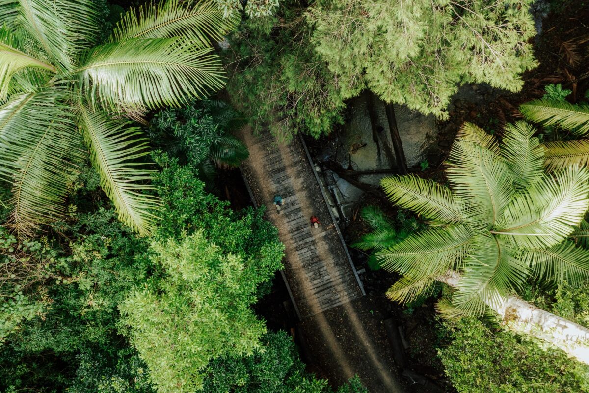 Photo Information
Rainforest wandering.
Gidjuum Gulganyi Walk
Mount Jerusalem National Park
Daniel Parsons/DCCEEW (2024)
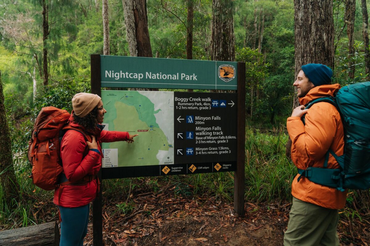 Photo Information
Look how far you’ve come!
Boggy Creek walk, Gidjuum Gulganyi Walk
Whian Whian State Conservation Area
Remy Brand/DCCEEW (2024)
Starting just outside the small historical village of Uki, this hike has limited parking options. The best way to reach the track head is via an optional shuttle bus service, which will transport you from airports and nearby towns and pick you up at the end of the walk.
You can also hit the trail using a local tour operator, with a range of tailored walking experiences to choose from. Opt for an authentic full pack hiking experience or travel light with a day pack and let your tour guide take care of setting up camp each night. After something a bit fancier? Join a luxe guided tour that includes chef-prepared meals and comfortable sleeping arrangements. With environmental scientists and Aboriginal culture specialists as your guides, you’ll also learn about the region along the way. Find more information and make a booking.
Whether you’re walking with mates or a tour guide, you’ll experience a true sense of solitude and escape at campgrounds along the way which are exclusively available to hikers on the Gidjuum Gulganyi Walk. For those keen to take the self-guided option and explore at their own pace, here’s how to do it.
Pro tip: The key to a safe and successful multi-day hike is preparation. Read our extensive guide on how to plan your trip.
-
Day 1 – Manns Road track head to Sand Ridge campground
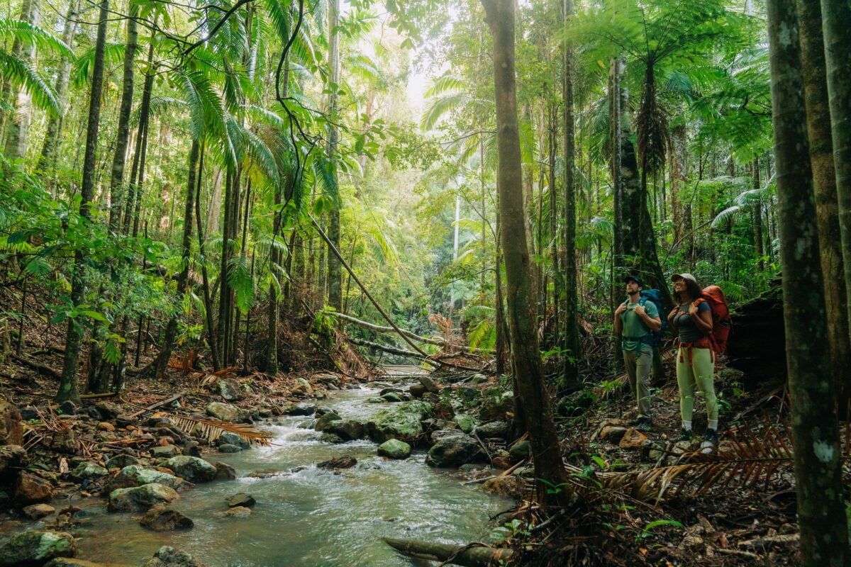 Photo Information
Experience the beauty of this ancient landscape.
Gidjuum Gulganyi Walk
Mount Jerusalem National Park
Remy Brand/DCCEEW (2024)
 Photo Information
Don’t forget to look up.
Gidjuum Gulganyi Walk
Mount Jerusalem National Park
Remy Brand/DCCEEW (2024)
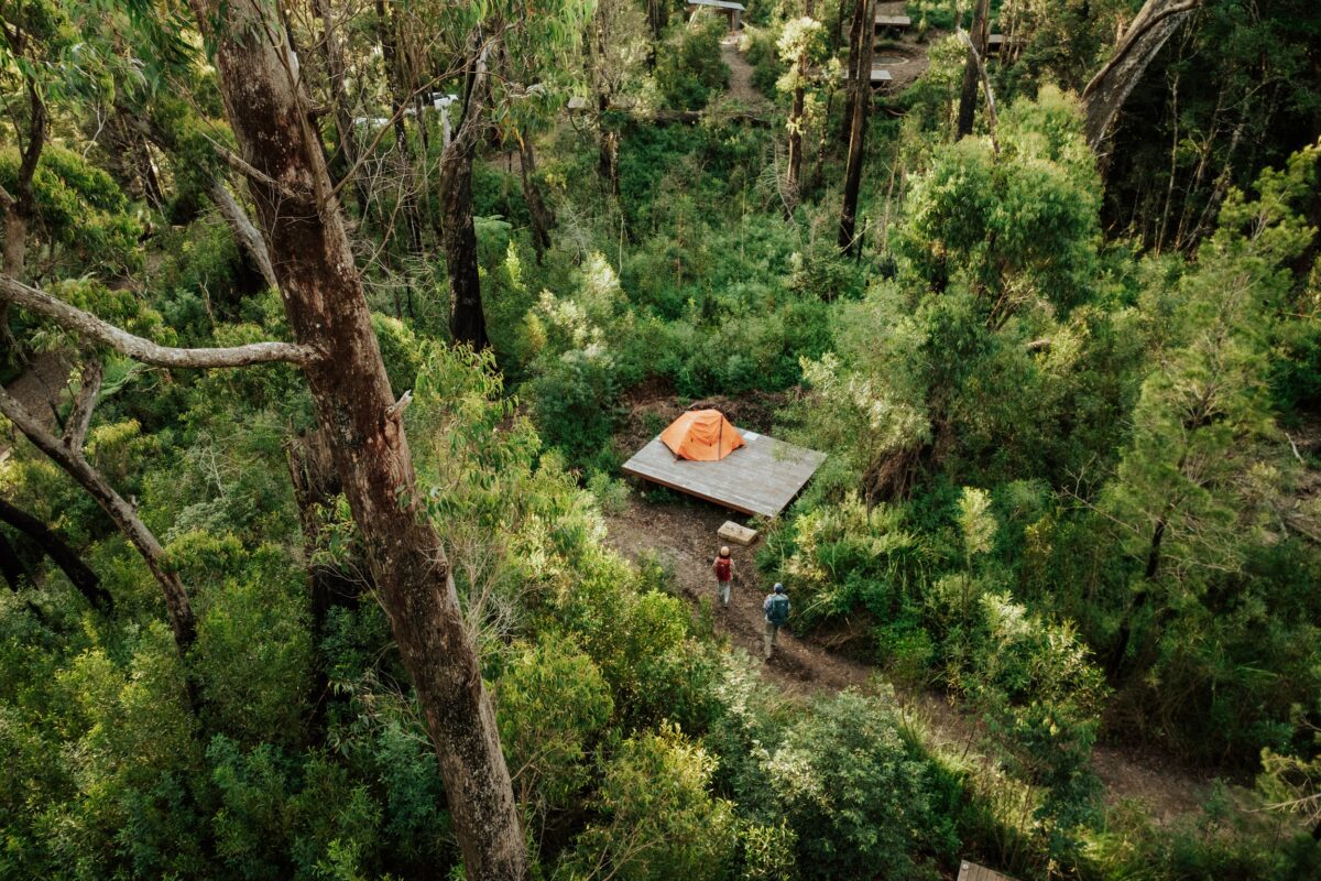 Photo Information
A home away from home.
Sand Ridge campground, Gidjuum Gulganyi Walk
Mount Jerusalem National Park
Daniel Parsons/DCCEEW (2024)
Distance: 8.5km | Time suggested: 3-4 hours | Grade: 4 | Toilets: Manns Road track head, Sand Ridge campground
Sunscreen on, hiking pack adjusted and carrying enough clean drinking water to get you through the day? Great, you’re ready to go.
Before you leave home: We want you and your companions to have an enjoyable and safe time in our national parks. It’s a good idea to fill in a trip intention form to make sure your emergency contact has all the important details about your trip. Also remember to double-check the weather and NSW Parks alerts for up-to-date info on closed parks and safety alerts. Be prepared, read our bushwalking safety tips and download our NSW National Parks app.
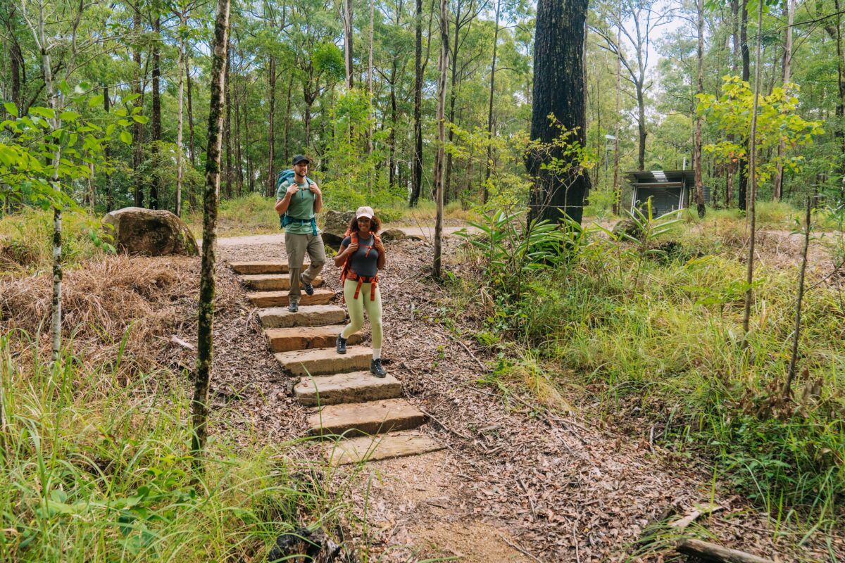 Photo Information
Your epic journey starts here.
Manns Road trackhead, Gidjuum Gulganyi Walk
Mount Jerusalem National Park
Remy Brand/DCCEEW (2024)
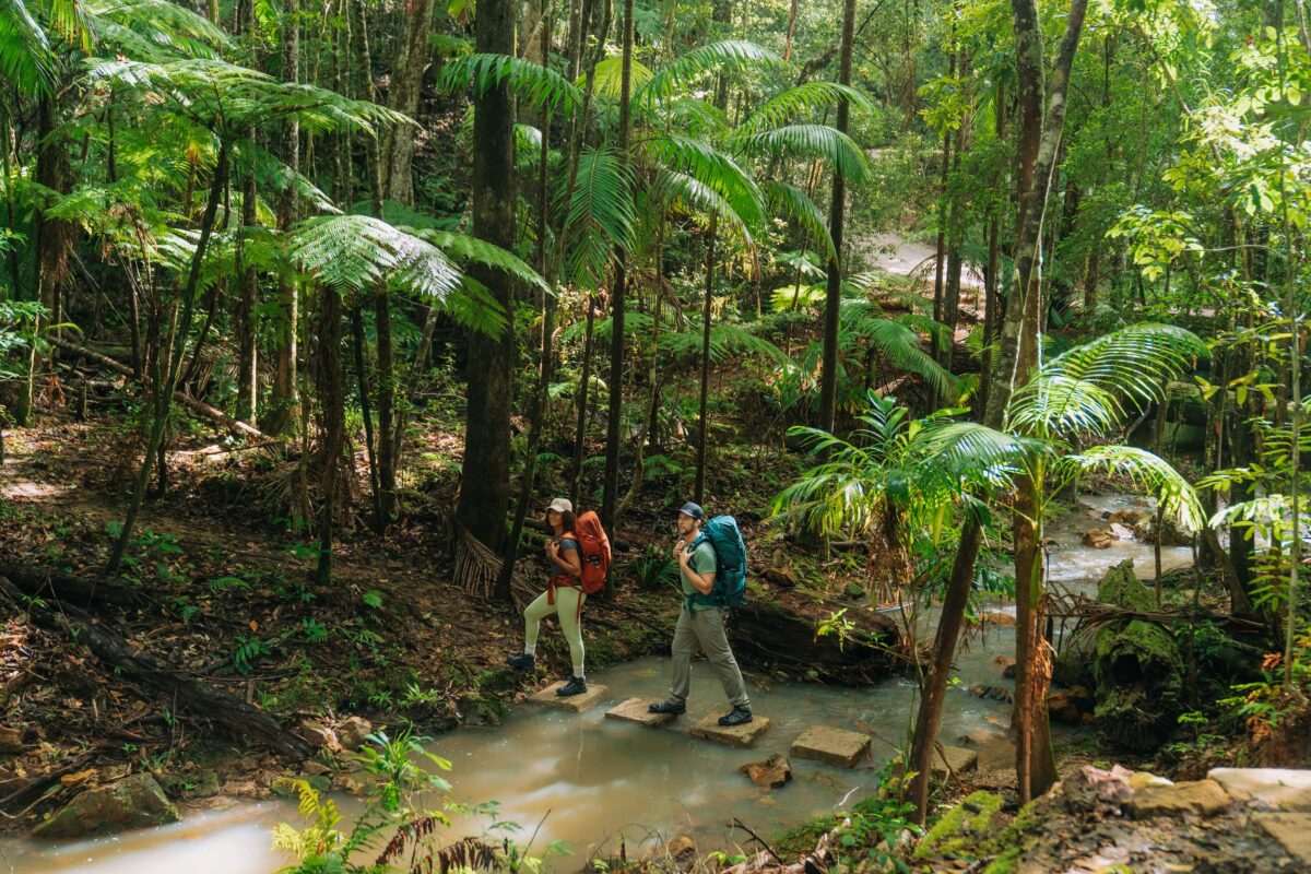 Photo Information
Gidjuum Gulganyi Walk
Mount Jerusalem National Park
Remy Brand/DCCEEW (2024)
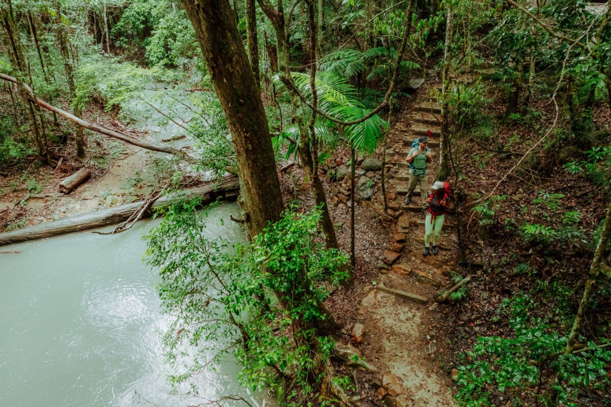 Photo Information
The pale blue water of Unicorn Falls, an oasis in the forest.
Unicorn Falls, Gidjuum Gulganyi Walk
Mount Jerusalem National Park
Daniel Parsons/DCCEEW (2024)
Ease into the trail from the Manns Road track head with a stroll through eucalypt forest dominated by ironbark, tallowwood and grey gum, before descending into sub-tropical rainforest containing outcrops of Bangalow palms along Whiskey Creek. With the tinkling flow of water as your companion, you’ll follow the creek line – crossing the creek at times – until you reach the next section, an old logging trail that takes you through to Middle Ridge trail.
On Day 1, there’s also the option to take a short side trip to the picture-perfect Unicorn Falls.
You know you’re close to the end of the day when you cross Sand Ridge Road bridge. Just after the bridge, the track takes you on a short leisurely journey down to a rainforest creek, before you give your legs one last little workout on the ascent to your destination for the night.
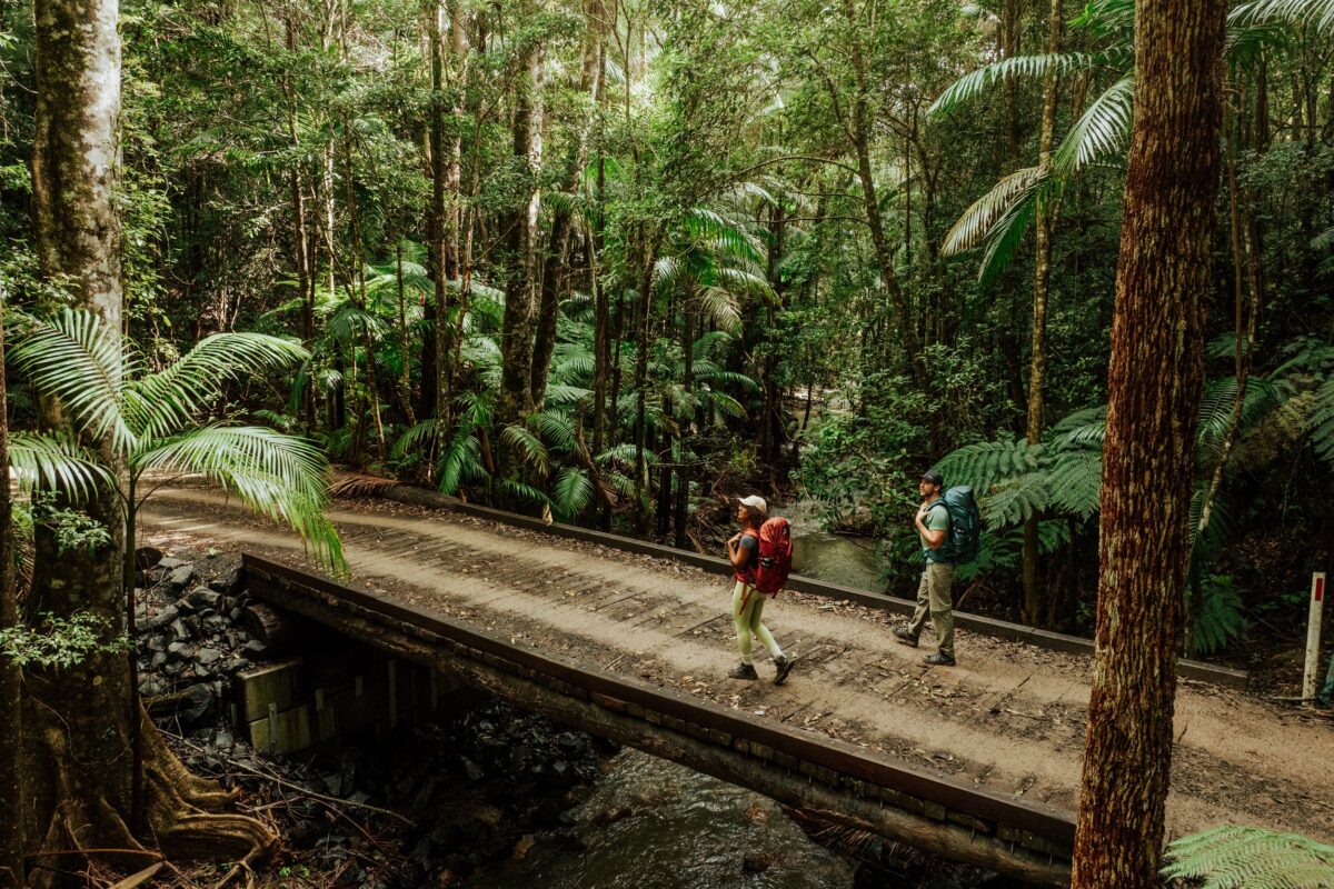 Photo Information
Where the dinosaurs walked.
Gidjuum Gulganyi Walk
Mount Jerusalem National Park
Daniel Parsons/DCCEEW (2024)
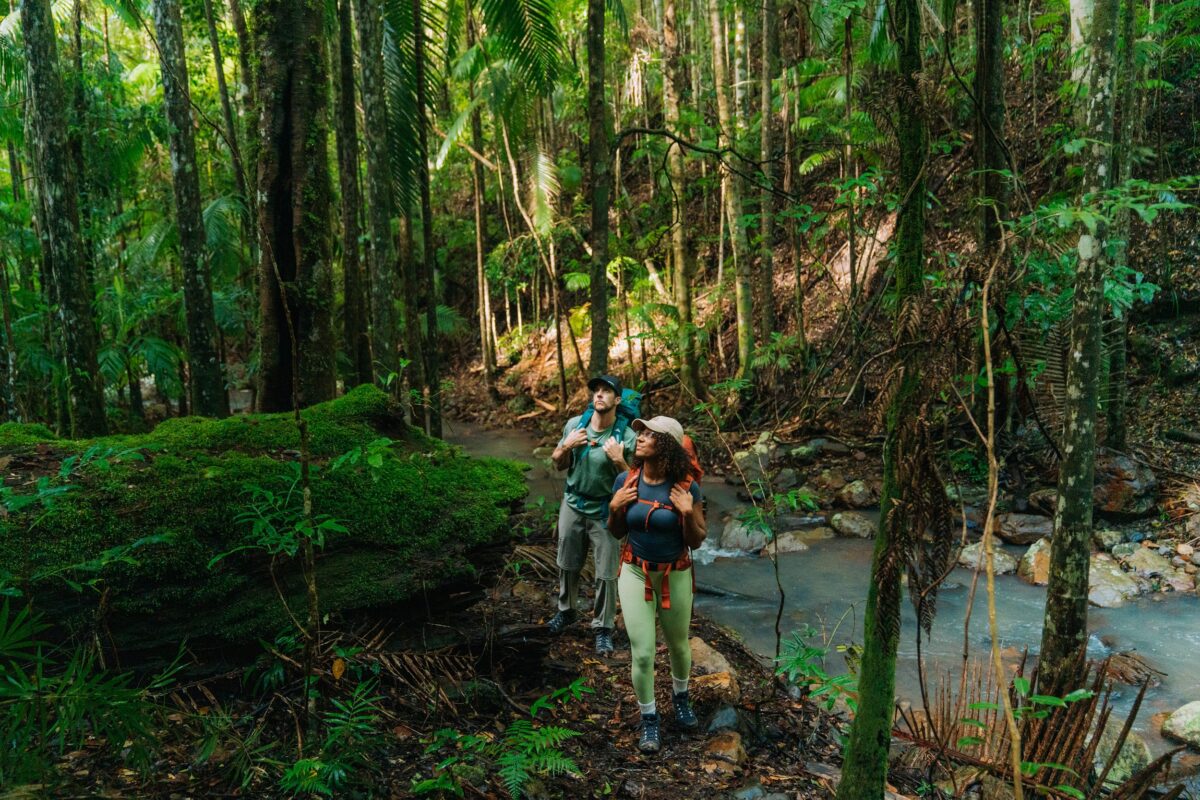 Photo Information
Gidjuum Gulganyi Walk
Mount Jerusalem National Park
Remy Brand/DCCEEW (2024)
Sand Ridge campground
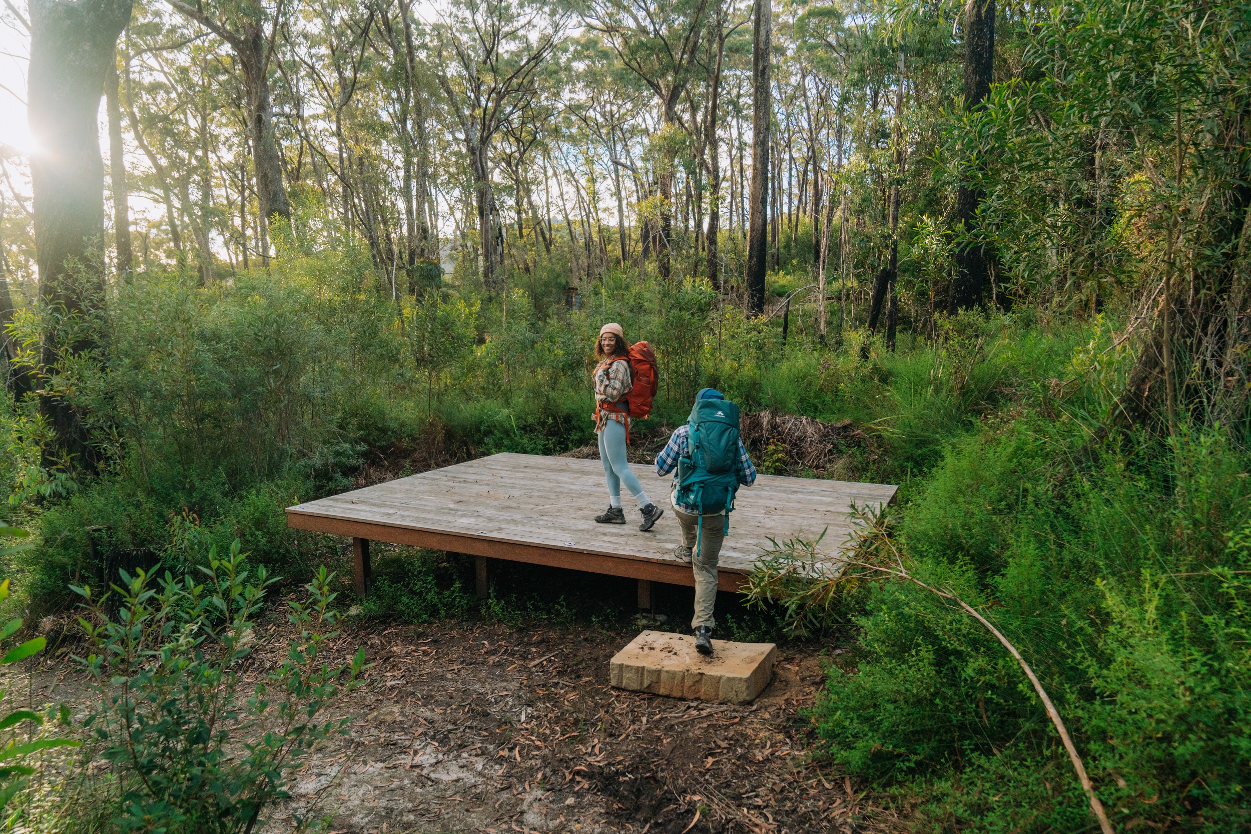 Photo Information
Tonight’s accomodation.
Sand Ridge campground, Gidjuum Gulganyi Walk
Mount Jerusalem National Park
Remy Brand/DCCEEW (2024)
Nestled into private nooks within the rainforest landscape, you’ll find a series of comfortable sleeping platforms at Sand Ridge, each equipped with hooks and chains to make setting up your tent for the night a breeze. It’s exactly what you’ll need after a long day getting reacquainted with your hiking boots and pack.
Cook up a feast and take in the towering trees around you at one of the communal areas, before retreating to the sleeping bag and being lulled to sleep by the sounds of the rainforest.
Drinking water is available from tanks at all campgrounds, but you’ll need to treat it by boiling and/or using purification tablets.
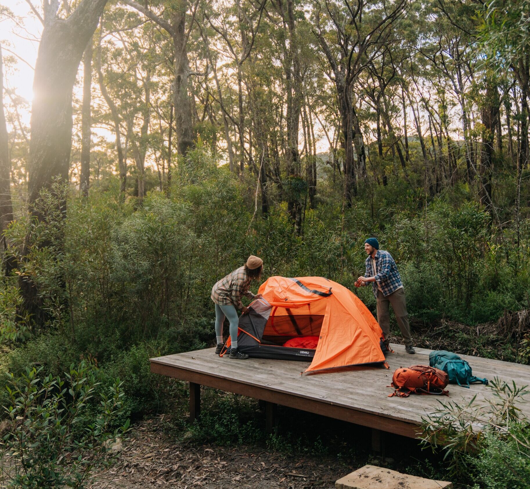 Photo Information
Setting up camp.
Sand Ridge campground, Gidjuum Gulganyi Walk
Mount Jerusalem National Park
Remy Brand/DCCEEW (2024)
Ranger’s tip: Depending on the size and shape of your tent, pack some extra lightweight rope and some fishbone pegs to ensure you can reach all the right spots on the camping platforms.
-
Day 2 – Sand Ridge campground to Yelgun Kyoomgun campground
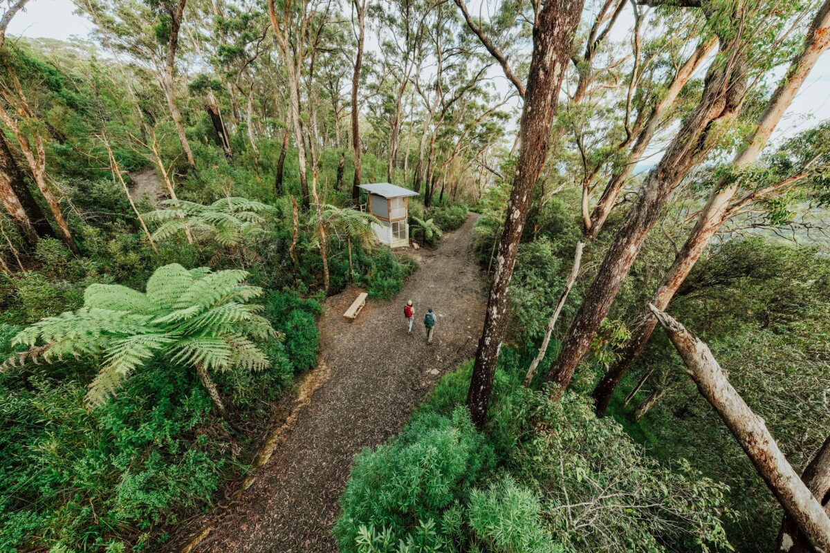 Photo Information
Heading into camp.
Yelgun Kyoomgun campground, Gidjuum Gulganyi Walk
Nightcap National Park
Daniel Parsons/DCCEEW (2024)
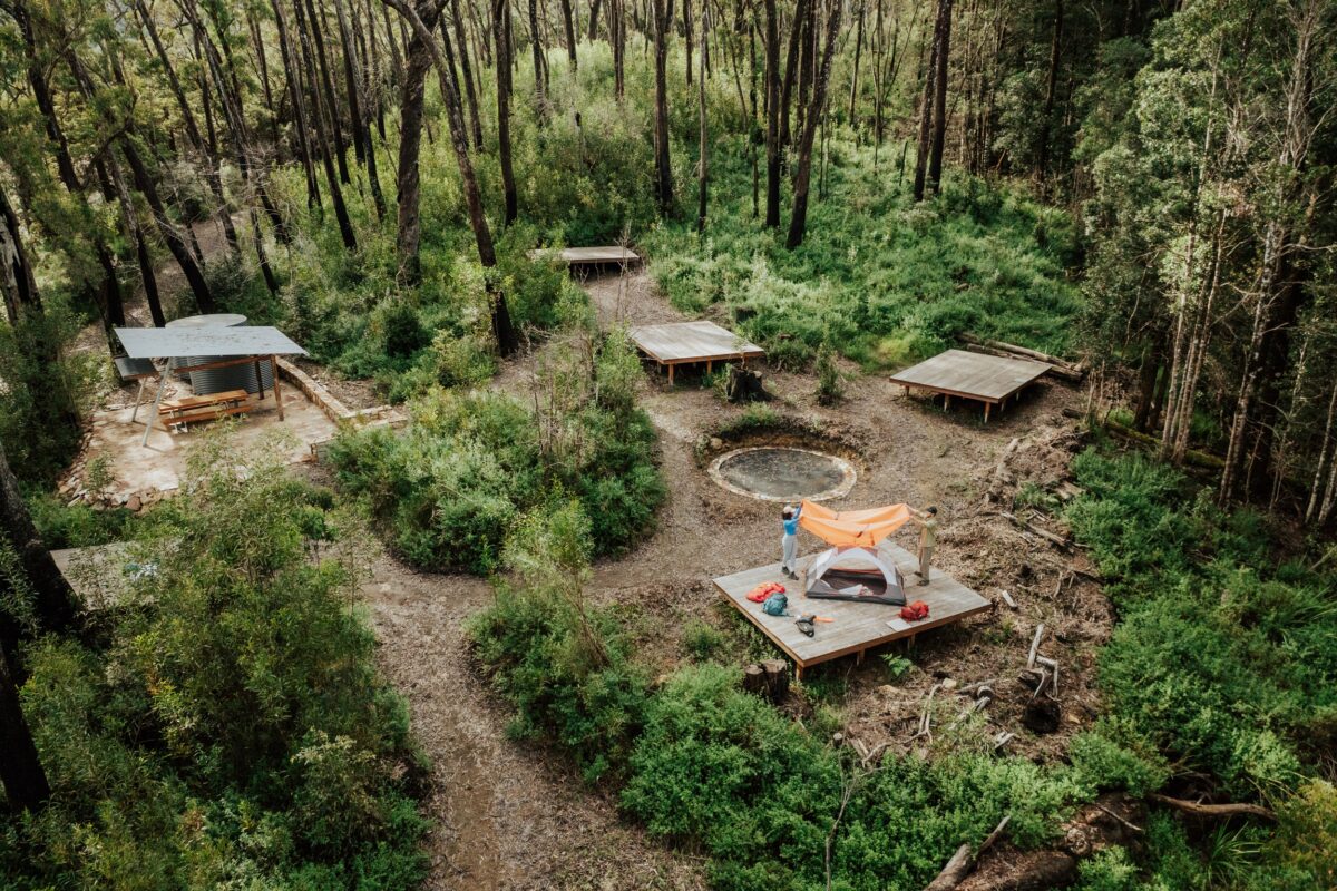 Photo Information
Pitch a tent in paradise.
Yelgun Kyoomgun campground, Gidjuum Gulganyi Walk
Nightcap National Park
Daniel Parsons/DCCEEW (2024)
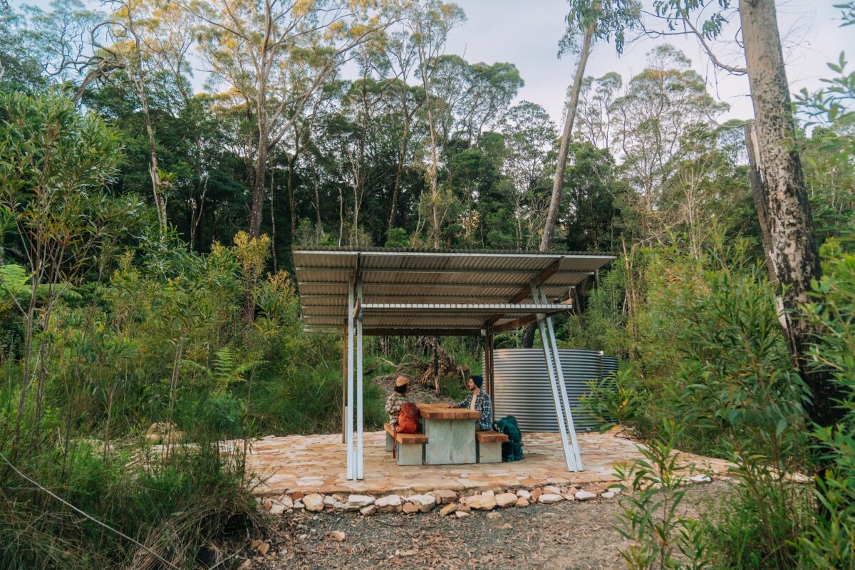 Photo Information
Yelgun Kyoomgun campground, Gidjuum Gulganyi Walk
Nightcap National Park
Remy Brand/DCCEEW (2024)
Distance: 16km | Time suggested: 7-9 hours | Grade: 4 | Toilets: Sand Ridge campground, Yelgun Kyoomgun campground
I like to refer to this day as the ‘Stairmaster 5000’. The saying ‘the best view comes after the hardest climb’ could not be better suited to this section of Gidjuum Gulganyi Walk. This is the longest day of your walk, so make sure you get an early start.
Again, ensure you have enough drinking water to last the day before you set out, and prepare yourself for the possibility of encountering a leech or two.
Ranger’s tip: To deter leeches and ticks , wear long-sleeved shirts and long pants. It can also help to wear gaiters, or tuck your pants into your socks and use insect repellent.
From Sand Ridge campground, you’ll climb 400m to the western end of Koonyum Range. Stairs and switchbacks make the uphill slog a little easier, and the humming of cicadas through the forest provides a welcome distraction from burning legs. Once you reach Grasstree lookout, all ailments will be forgotten. Framed by its namesake grass trees, this lookout offers incredible views across Mount Jerusalem National Park to Wollumbin. It’s the perfect spot to sit and contemplate how far you’ve already come while you squeeze in an early morning tea.
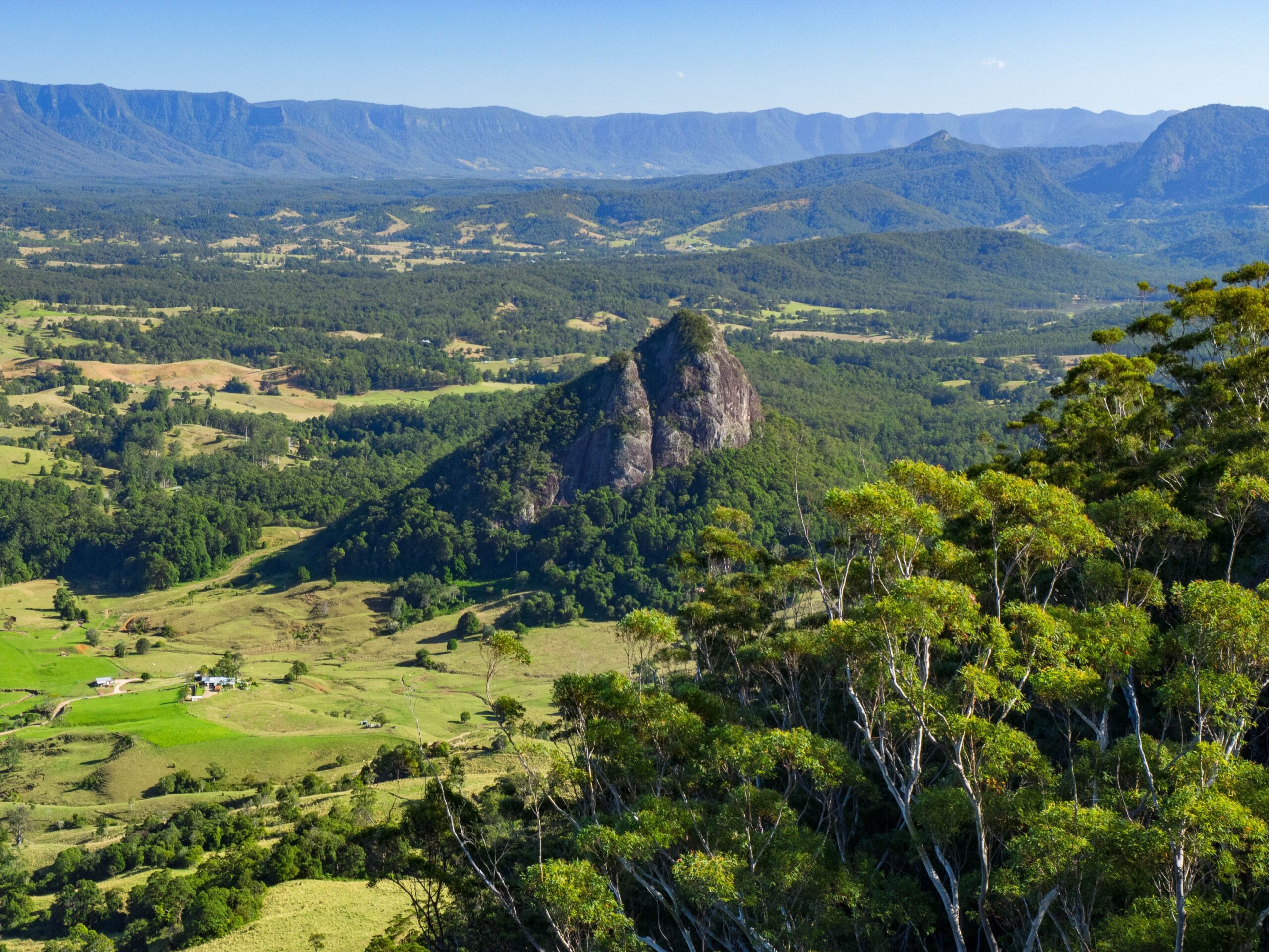 Photo Information
Doughboy Mountain rising from the Tweed Caldera with Wollumbin in the distance.
Doughboy and Wollumbin Caldera, Gidjuum Gulganyi Walk
Mount Jerusalem National Park
Dean Trezise/DCCEEW
Did you know? Wollumbin (formerly Mount Warning) is the central plug of the Tweed Volcano, a massive volcano that stopped erupting about 20 million years ago. Today, it has eroded, leaving behind the Tweed caldera with Wollumbin at its centre. Wollumbin is highly significant to Aboriginal people, as a sacred ceremonial and cultural site that is linked to traditional law and custom.
From Grasstree lookout, you’ll continue the ascent, skirting around the eastern side of Mount Jerusalem. Then, south of the mountain, you’ll descend through warm temperate rainforest and re-emerge into the eucalypts before reaching Tweed Valley lookout, revealing panoramic views across Commissioners Creek Valley with the ever-present Wollumbin in the distance.
Be prepared to marvel at more spectacular scenery and sweeping views of the coast from the Jerusalem Cliffs, taking in the surrounding mountains and peaks of the caldera as you walk the ridgeline. Just south of here is the point where Mount Jerusalem National Park ends and – just across the Doon Doon saddle – your journey into Nightcap National Park begins.
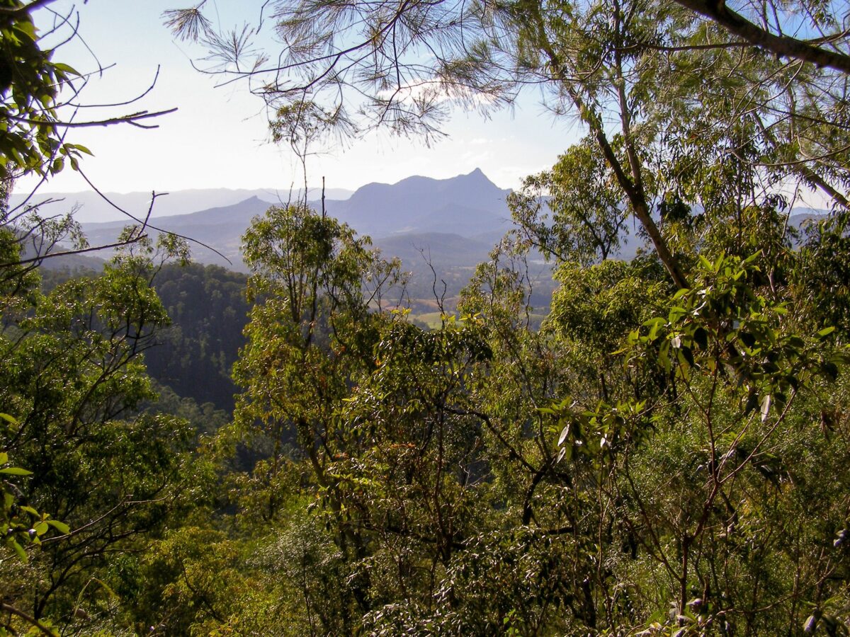 Photo Information
Views of Wollumbin through the trees.
Historic Nightcap walking track, Gidjuum Gulganyi Walk
Nightcap National Park
Brian McLachlan/DCCEEW
Ranger’s tip: As you’re following the Nightcap Bluff ridgeline, keep an eye out for the Postman’s Tree, a huge burnt-out tree that’s said to have provided a resting place for travelling posties who used this route in the 1800s and 1900s.
There are four more lookouts before you reach your camp for the night, including one with spectacular views to the north over Mount Tarrawyra. After climbing up to the exposed, elevated open rocky outcrops and tea-tree scrubs around Nightcap Bluff, you’ll wind your way along the Historic Nightcap walking track through World Heritage-listed rainforest. This rainforest is part of the Gondwana Rainforests of Australia, which make up the most extensive areas of subtropical rainforest in the world. They provide a refuge for many unique plant and animal species, some of which are relatively unchanged from their fossil ancestors, and are an outstanding example of major stages in Earth’s evolution.
Yelgun Kyoomgun campground
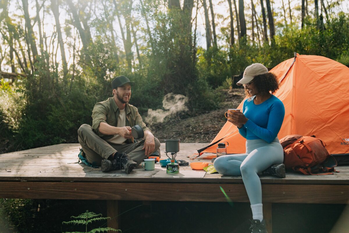 Photo Information
Nothing like a hot beverage after a hard day’s walk.
Yelgun Kyoomgun campground, Gidjuum Gulganyi Walk
Nightcap National Park
Remy Brand/DCCEEW (2024)
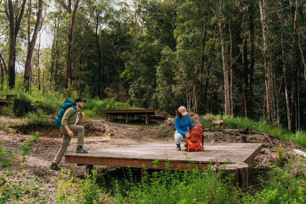 Photo Information
Spread out on spacious and comfortable camping platforms.
Yelgun Kyoomgun campground, Gidjuum Gulganyi Walk
Nightcap National Park
Remy Brand/DCCEEW (2024)
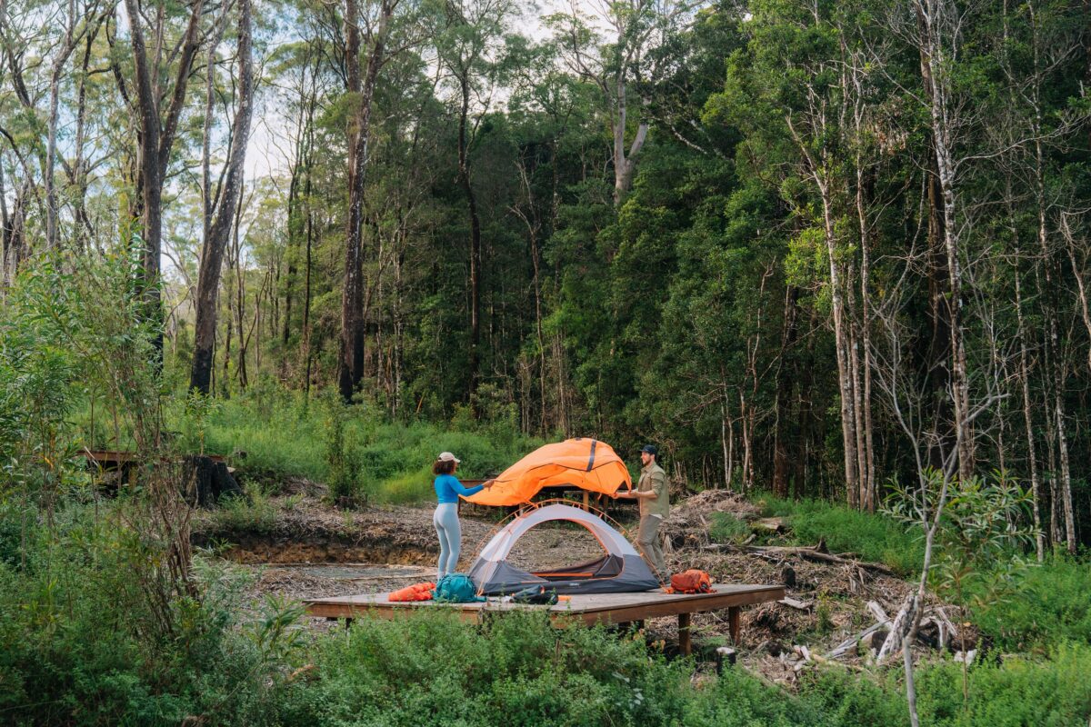 Photo Information
Set-ups a breeze.
Yelgun Kyoomgun campground, Gidjuum Gulganyi Walk
Nightcap National Park
Remy Brand/DCCEEW (2024)
Surrounded by bushland, Day 2’s camp has a very different feel to the first. Perched up high amongst towering New England blackbutt trees, you’ll feel on top of the world as you take in the sunset towards Lismore.
During the construction of this campground, a population of the endangered pink-flowered peach myrtle (Uromyrtus australis) was discovered. To help us protect it, please stick to the paths around the camp.
-
Day 3 – Yelgun Kyoomgun campground to Weeun Weeun campground
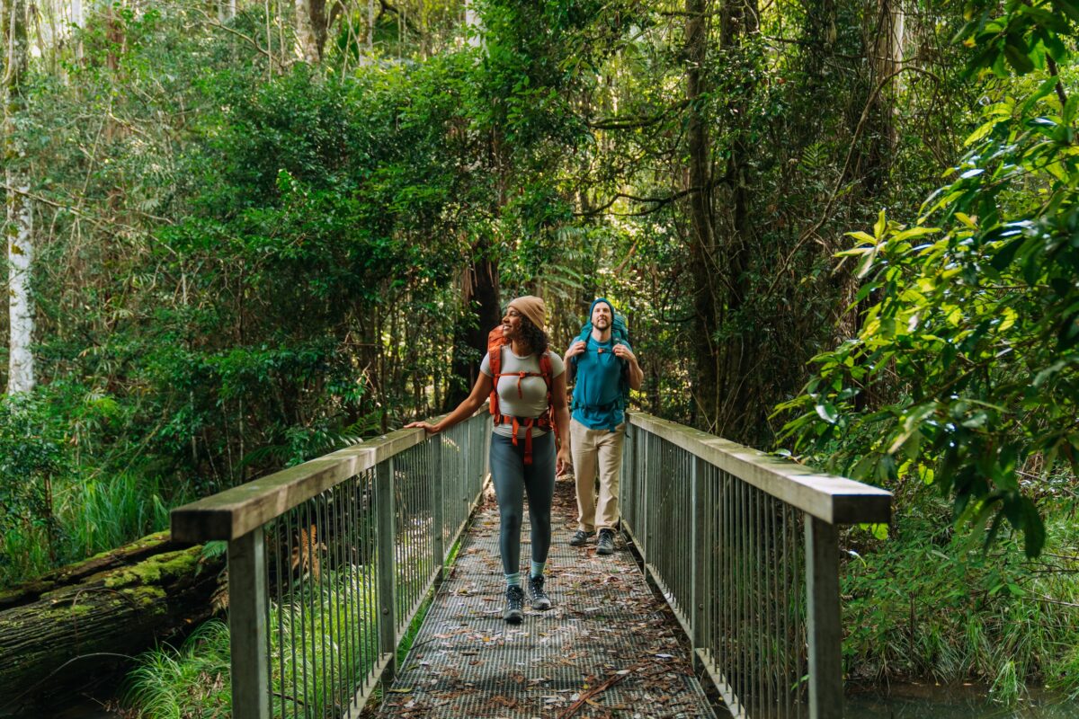 Photo Information
Surrounded by forest.
Peates Mountain track, Gidjuum Gulganyi Walk
Whian Whian State Conservation Area
Remy Brand/DCCEEW (2024)
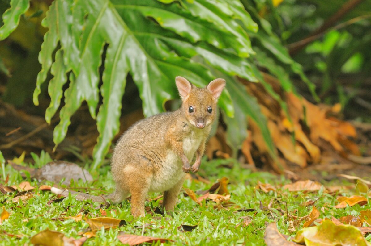 Photo Information
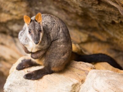
Spot this cutie: Red-legged Pademelon.
Gidjuum Gulganyi Walk
Dave Watts/DCCEEW
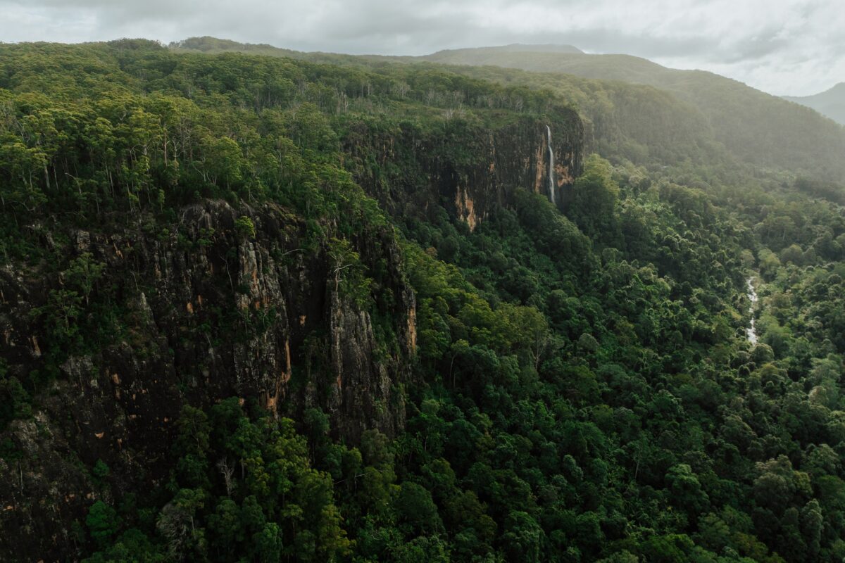 Photo Information
Feel the scale of the landscape from lookouts along the track.
Wanganui Gorge lookout, Gidjuum Gulganyi Walk
Nightcap National Park
Daniel Parsons/DCCEEW (2024)
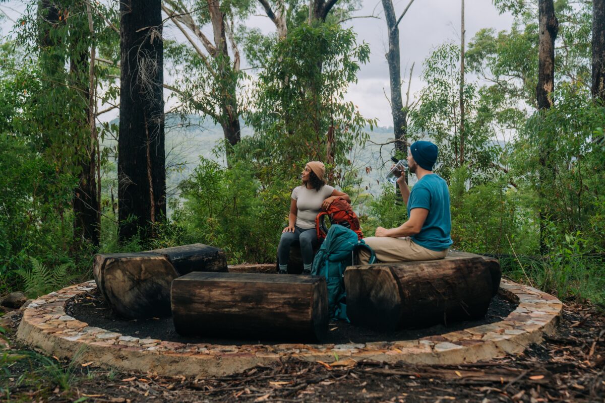 Photo Information
Stop for a chat in the yarning circle at Weeun Weeun campground.
Weeun Weeun campground, Gidjuum Gulganyi Walk
Nightcap National Park
Remy Brand/DCCEEW (2024)
Distance: 11.5km | Time suggested: 4-5 hours | Grade: 4 | Toilets: Yelgun Kyoomgun campground, Weeun Weeun campground
If you’re keen to spot some wildlife, today might be your day. Keep an ear and an eye out for red-legged pademelons, and the tree-dwelling lace monitor, or tree goanna, as you wind your way through the forest.
Leave Yelgun Kyoomgun campground and descend down the spacious Gibbergunyah trail until you come to the Four Ways intersection. From here, the path becomes a single track, winding through dense eucalypt forest which eventually joins Peates Mountain track on the western side of Peates Mountain Road.
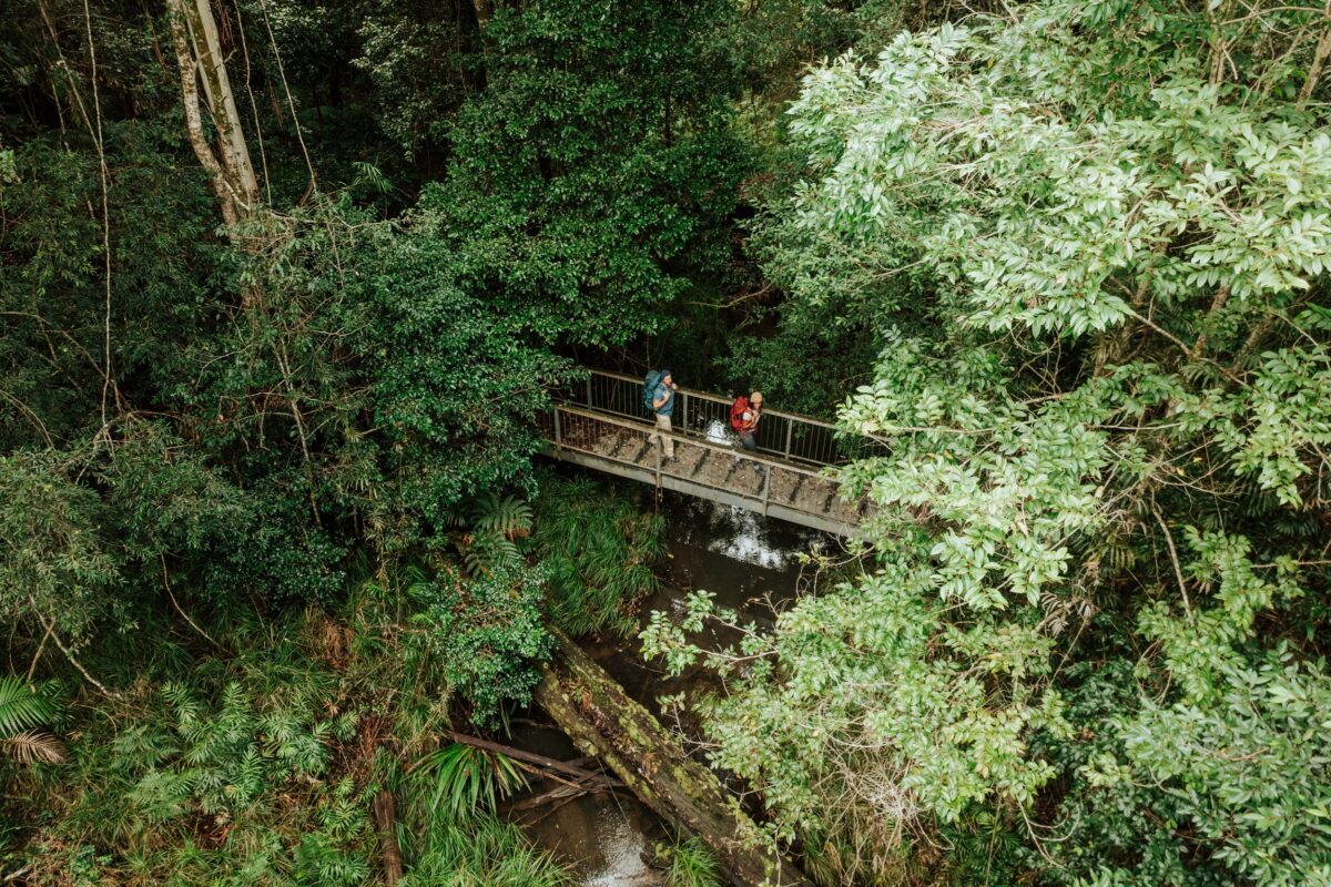 Photo Information
Explore dense forest.
Peates Mountain track, Gidjuum Gulganyi Walk
Whian Whian State Conservation Area
Daniel Parsons/DCCEEW (2024)
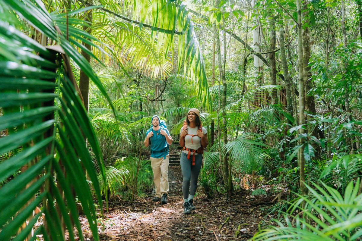 Photo Information
There’s no shortage of palms.
Peates Mountain track, Gidjuum Gulganyi Walk
Whian Whian State Conservation Area
Remy Brand/DCCEEW (2024)
Continue along the track until you reach the Eastern Fire Break where you’ll turn right and head towards Weeun Weeun campground. Just before Weeun Weeun, you’ll encounter a beautiful cascading creek, the perfect spot to stop and freshen up before the final uphill stretch to the campground. On the way, make sure you stop to check out Wanganui Gorge lookout, which offers uninterrupted views across the Coopers Creek catchment to Goonengerry National Park.
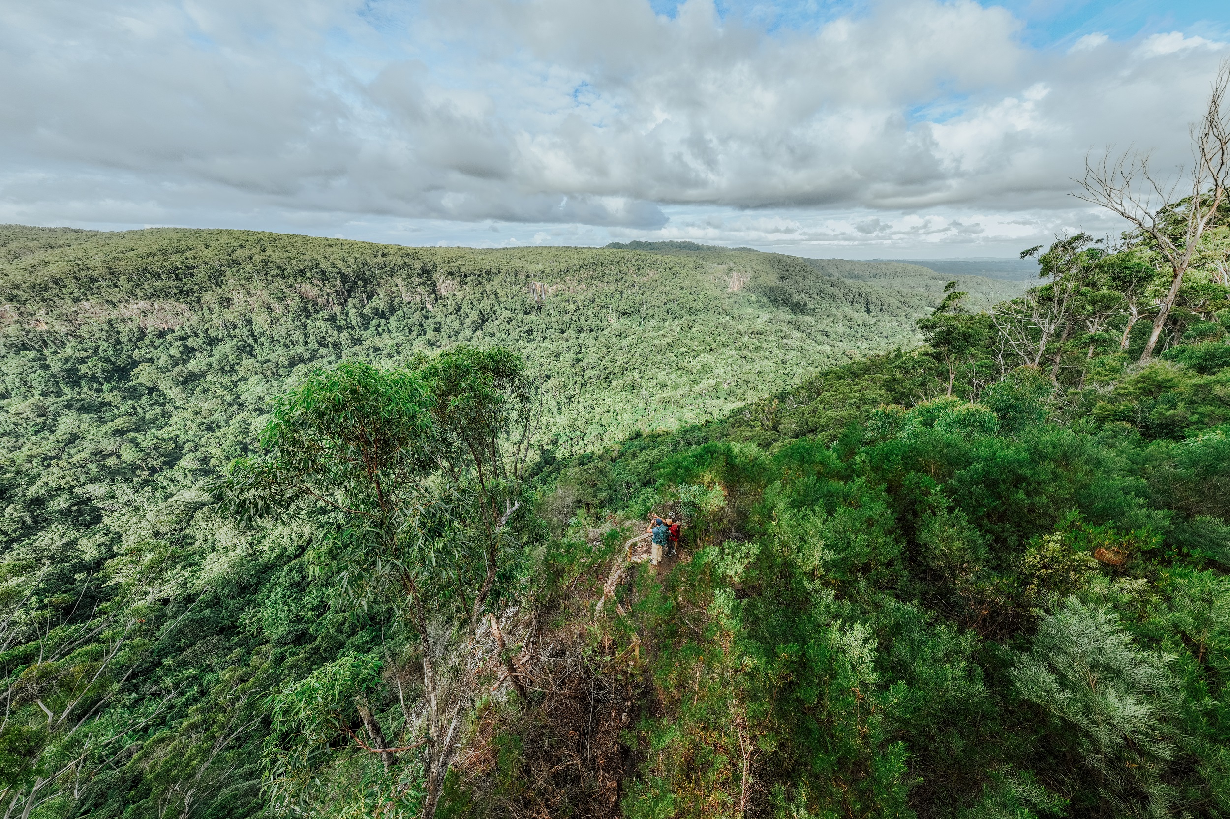 Photo Information
Expansive valley views.
Wanganui Gorge lookout, Gidjuum Gulganyi Walk
Nightcap National Park
Daniel Parsons/DCCEEW (2024)
Help keep our national parks clean: learn how to leave no trace.
Weeun Weeun campground
 Photo Information
Campers enjoy a well-earned snack.
Weeun Weeun campground, Gidjuum Gulganyi Walk
Nightcap National Park
Remy Brand/DCCEEW (2024)
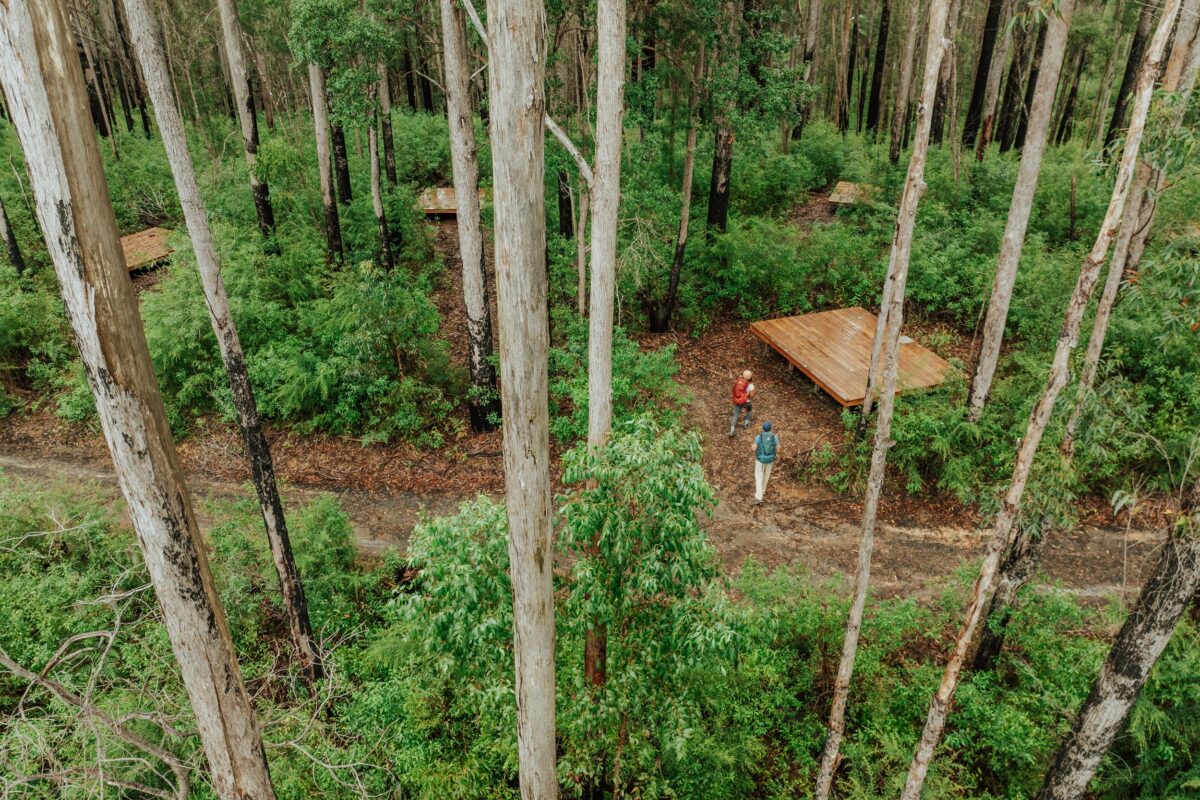 Photo Information
Another night in your peaceful nature accomodation.
Weeun Weeun campground, Gidjuum Gulganyi Walk
Nightcap National Park
Daniel Parsons/DCCEEW (2024)
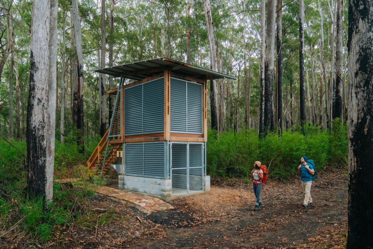 Photo Information
Amenities at the campground.
Weeun Weeun campground, Gidjuum Gulganyi Walk
Nightcap National Park
Remy Brand/DCCEEW (2024)
Set on the edge of Wanganui Gorge, with views of the vast valley below and steep cliffs dotted with waterfalls beyond that, Weeun Weeun is truly a breathtaking place to spend a night.
Here, you’ll find beautiful open shelters, yarning circles and lookouts dotted along the gorge. The views from the camping platforms are just as spectacular, and make it easy to emerge from your cosy tent in the morning.
-
Day 4 – Weeun Weeun campground to Minyon Falls lookout
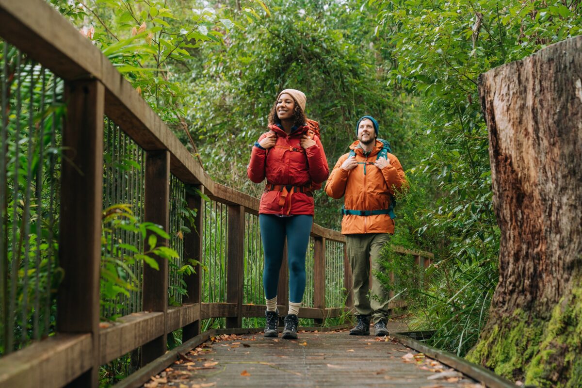 Photo Information
The final leg of your adventure.
Minyon Falls, Gidjuum Gulganyi Walk
Nightcap National Park
Remy Brand/DCCEEW (2024)
 Photo Information
Follow signs to your destination.
Minyon Falls, Gidjuum Gulganyi Walk
Nightcap National Park
Remy Brand/DCCEEW (2024)
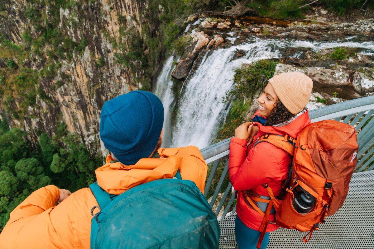 Photo Information
Feel the power of Minyon Falls from the lookout.
Minyon Falls, Gidjuum Gulganyi Walk
Nightcap National Park
Remy Brand/DCCEEW (2024)
Distance: 6km | Time suggested: 2-3 hours | Grade: 4 | Toilets: Rummery Park campground, Minyon Falls lookout
There’s something special about the final day of a multi-day hike. Your pack is lighter, your legs have found their rhythm and your routine is running like a well-oiled machine.
If you wake up for one sunrise this trip, make it this morning. Watch the morning’s golden glow creep through the peaceful valley, spilling across the waterfalls in the distance, while sulphur-crested cockatoos careen in and out of the light and the laughter of kookaburras heralds a new day. It’s pure magic, we promise.
Soon after you set off, you’ll pass over a stream that leads to the edge of a waterfall. A quick splash of fresh water will cool you off just enough to revive you for the walk ahead, just be sure not to swim here and stay well back from the cliff edge.
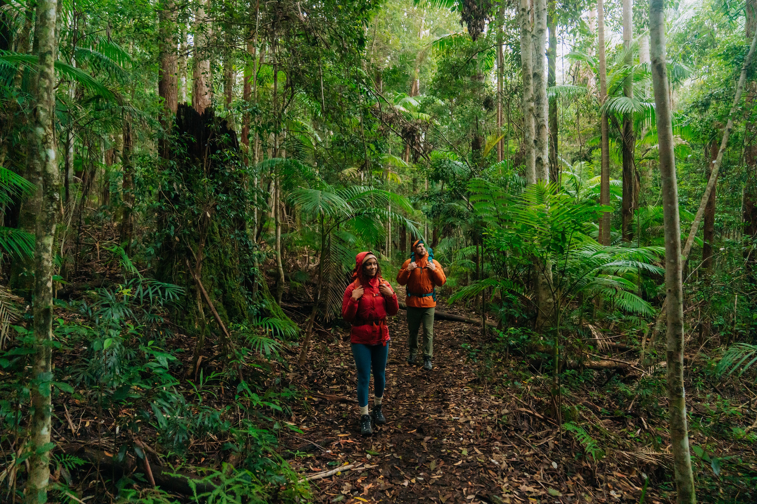 Photo Information
Enjoy your last moments in the rainforest.
Boggy Creek walk, Gidjuum Gulganyi Walk
Whian Whian State Conservation Area
Remy Brand/DCCEEW (2024)
The main path then closely follows the clifftop above Wanganui Gorge and Coopers Creek along Eastern Fire Break, before looping around the head of Snows Gully Nature Reserve to Rummery Park campground. You can’t miss the otherworldly stands of giant spear lilies along the track, but also keep an eye out for the small, delicate purple-fringed lilies that line the edges.
Stop at Rummery Park for a toilet and snack break before embarking on the final leg of the journey – a leisurely 2km stroll along Boggy Creek walk towards Minyon Falls. Take in the large water gums and brushbox that line the creek, and enjoy these final moments.
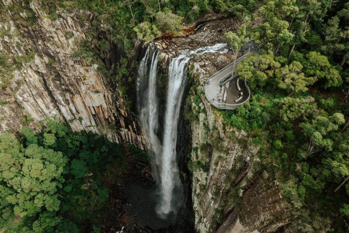 Photo Information
The rewarding final view of your walk.
Minyon Falls, Gidjuum Gulganyi Walk
Nightcap National Park
Daniel Parsons/DCCEEW (2024)
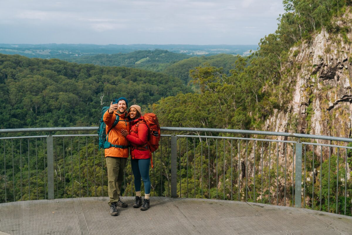 Photo Information
Selfie time!
Minyon Falls, Gidjuum Gulganyi Walk
Nightcap National Park
Remy Brand/DCCEEW (2024)
Your walk ends at the magnificent Minyon Falls lookout, where you’ll be rewarded for your efforts with epic views of the waterfall plunging into the palm-shaded gorge below. The best way to finish a truly memorable multi-day hike.
-
Safety checklist
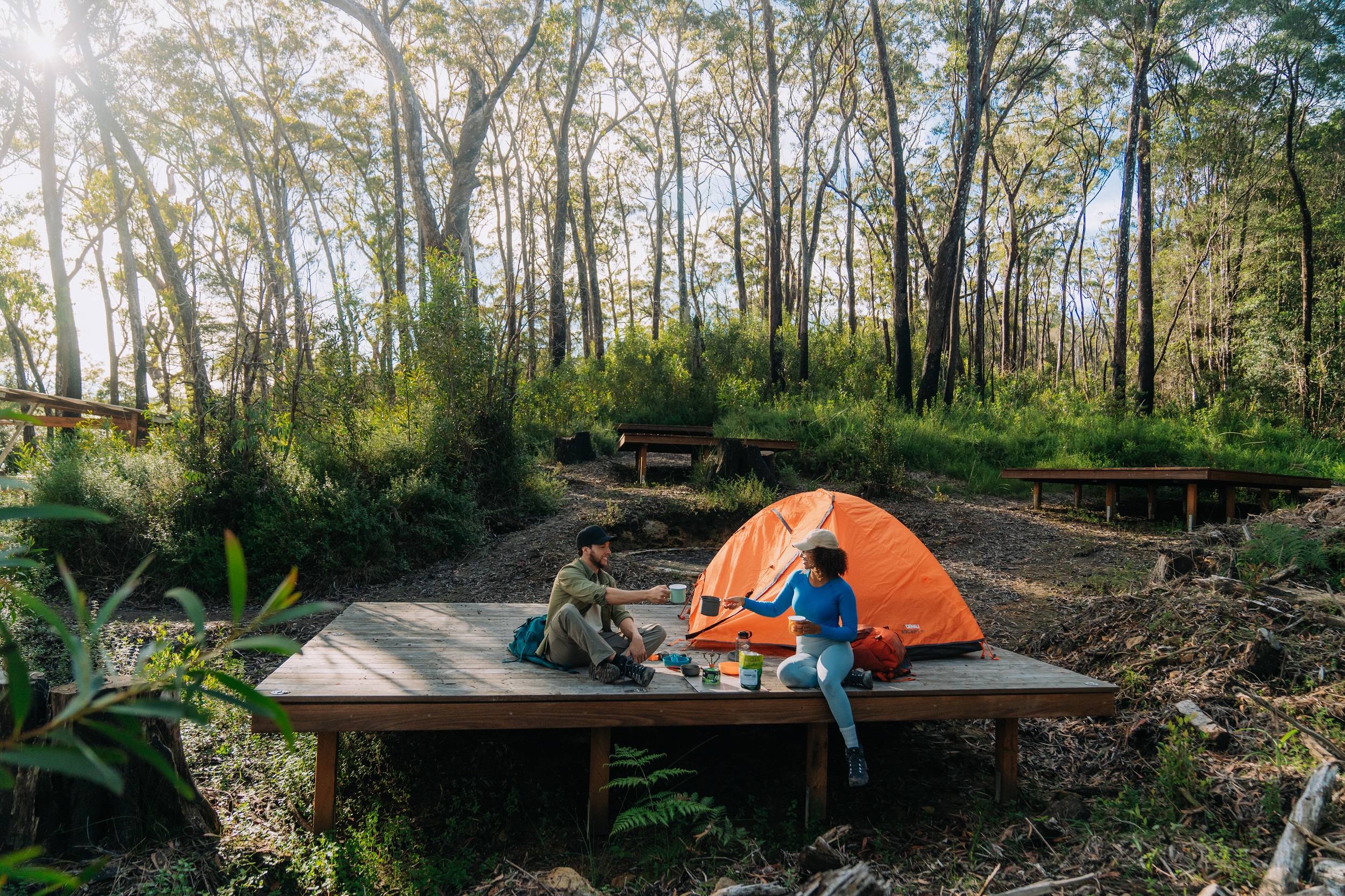 Photo Information
Yelgun Kyoomgun campground, Gidjuum Gulganyi Walk
Nightcap National Park
Remy Brand/DCCEEW (2024)
- Pack and carry a first aid kit – include tick freeze-off spray and insect repellent.
- Download the EmergencyPlus app and the NSW National Parks app.
- Carry a Personal Locator Beacon (PLB).
- Always check the NSW National Parks alerts page for up-to-date information on closed parks and safety alerts.
- Ensure you have adequate food to last all 4 days of the walk.
- Maintain sun protection – wear a hat and sunscreen (even on overcast days).
- Stay hydrated. Each camp has water tanks, but ensure you have water purification tablets, or means to boil water.
- Consider carrying a power pack to recharge your phone.
-
Plan your visit
Gidjuum Gulganyi Walk takes you through Mount Jerusalem National Park, Nightcap National Park and Whian Whian State Conservation Area. For more detailed maps and to plan your walk, check out the NPWS website.