There’s a place on the New South Wales South Coast where spotted gums and Burrawang trees meet the ocean. Where eastern grey kangaroos hop along the sand and endless headlands give way to secluded beaches with water that shines bright blue. Welcome to Murramarang National Park, the home of the latest NSW Great Walk.
The 34km, Grade 4, Murramarang South Coast Walk is a brilliant way to fully immerse yourself in the South Coast’s best-kept secret. There are a range of flexible ways to tackle the trail, making it a great option for all kinds of hikers and bushwalkers. My partner and I walked the trail over the recommended four days camping only experience, and weeks later I’m catching myself still daydreaming of salty air and the rhythmic pounding of waves on the sand.
-
Highlights
 Photo Information
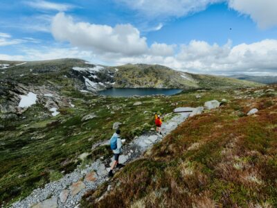
Murramarrang South Coast Walk
Murramarang National Park
Remy Brand / DPE (2023)
- Visiting quiet bays most people don’t see.
- Traversing striking rock platforms.
- Hiking through rare coastal spotted gum forest.
- Having a dip at Calm Corner.
- The tent platforms at Oaky Beach.
- Clifftop views of the ocean.
- Spotting native wildlife including kangaroos, whales, white-breasted sea eagles, echidnas, and lace monitors.
The Murramarang South Coast Walk (or MSCW for short) runs from Pretty Beach at the northern end to Maloneys Beach in the south. It’s been created using new and existing trails, some of which have been significantly refreshed with new signage, sandstone steps, and small sections of boardwalk.

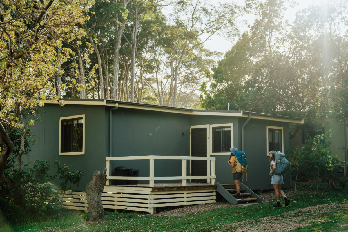 Photo Information
Depot Beach Cabins
Murramarang National Park
Remy Brand / DPE (2023)
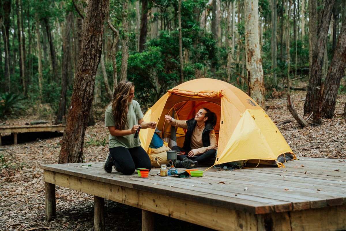 Photo Information
Oaky Beach Campground
Murramarang National Park
Remy Brand / DPE (2023)
There are also brand new tent platforms at Oaky Beach, nestled among some of the tallest trees on the walk, as well as existing national park shack and cabin accommodation at Pretty Beach, Pebbly Beach, and Depot Beach.
The walk itself is free, so how you hike it is up to you! There are camping or cabin packages available on the NSW National Parks website with different costs and inclusions depending on when and how you hike.
If you’d like to book other accommodation or even walk it in sections that’s totally fine, just remember that you’ll have to sort out your own transport options. You’re never more than 50 kilometres from Bateman’s Bay, so you can likely get a taxi or similar.
Get back to your car: The other main ways to get back to your car are a ‘car shuffle’ – using multiple cars so you can drive yourself back to the start – local shuttle services (contact Rixons Bus Service or Region X to pre-book), Uber, or a local taxi, which costs around $200.
-
Itinerary
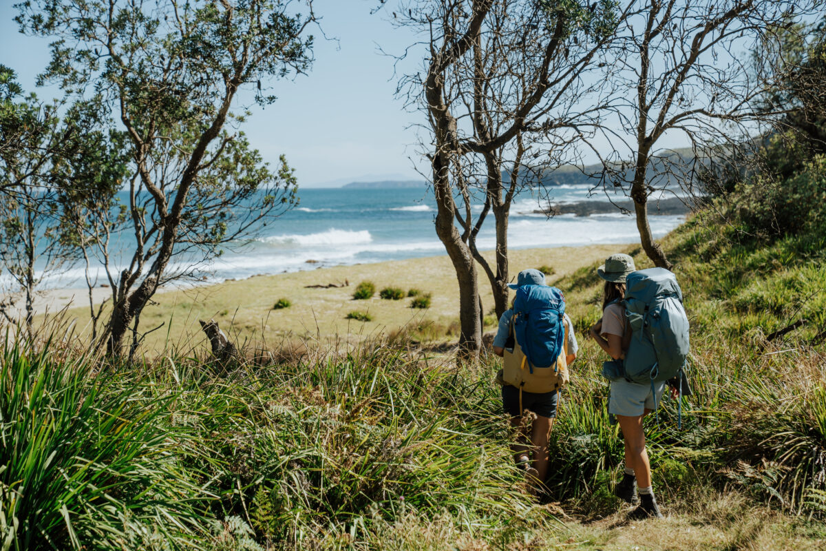 Photo Information
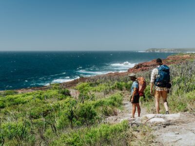
Murramarang South Coast Walk
Murramarang National Park
Remy Brand / DPE (2023)
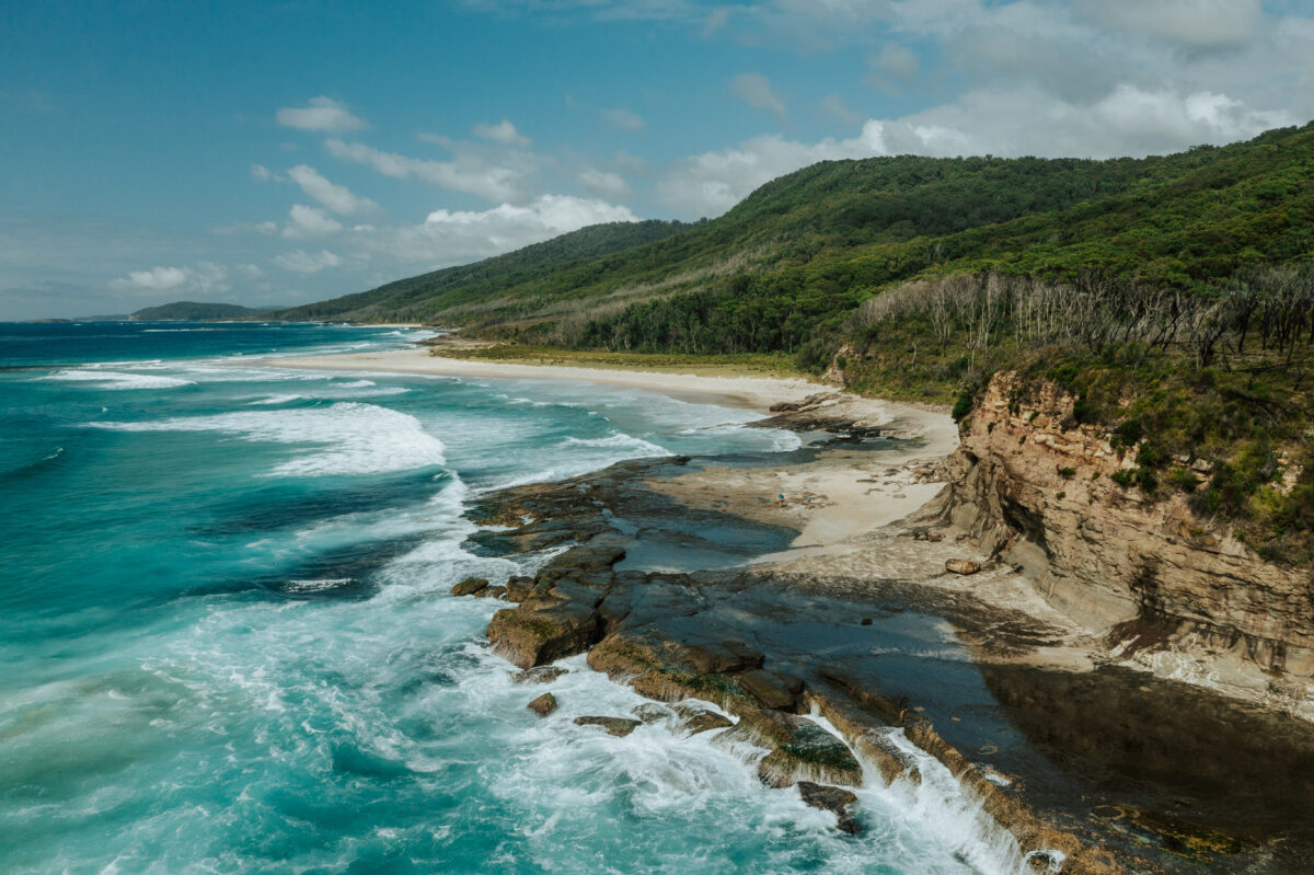 Photo Information
Murramarrang South Coast Walk
Murramarang National Park
Remy Brand / DPE (2023)
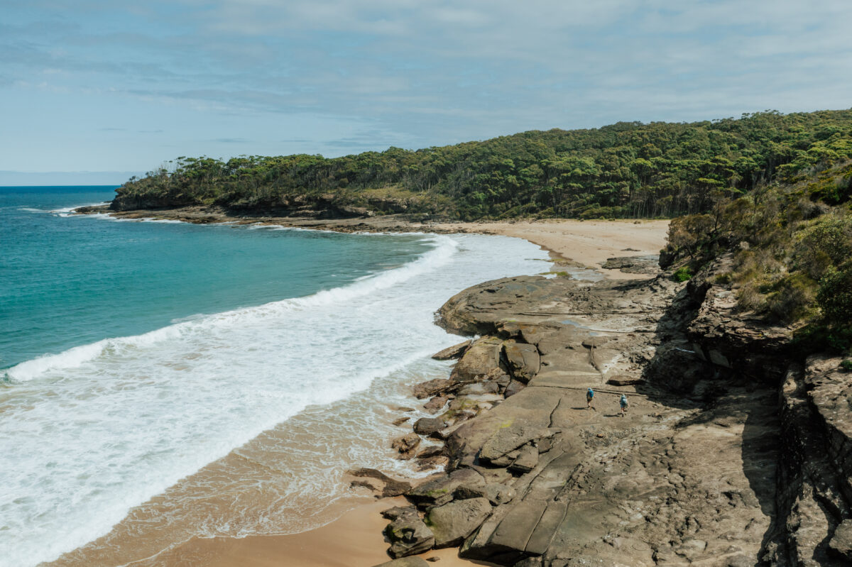 Photo Information
Emily Miller Beach
Murramarang National Park
Remy Brand / DPE (2023)
What’s hiking and camping along the Murramarang South Coast Walk actually like? I’m going to have to pull out all stops for this one to try and capture the majesty of one of the best multi-day walks I’ve ever done. Let’s go.
Safety first: Before you leave, tell someone when and where you’re going (and when you expect to be back) and fill out a Trip Intention Form so all of your details are on record in case of an emergency.
-
Day 1: Arrival
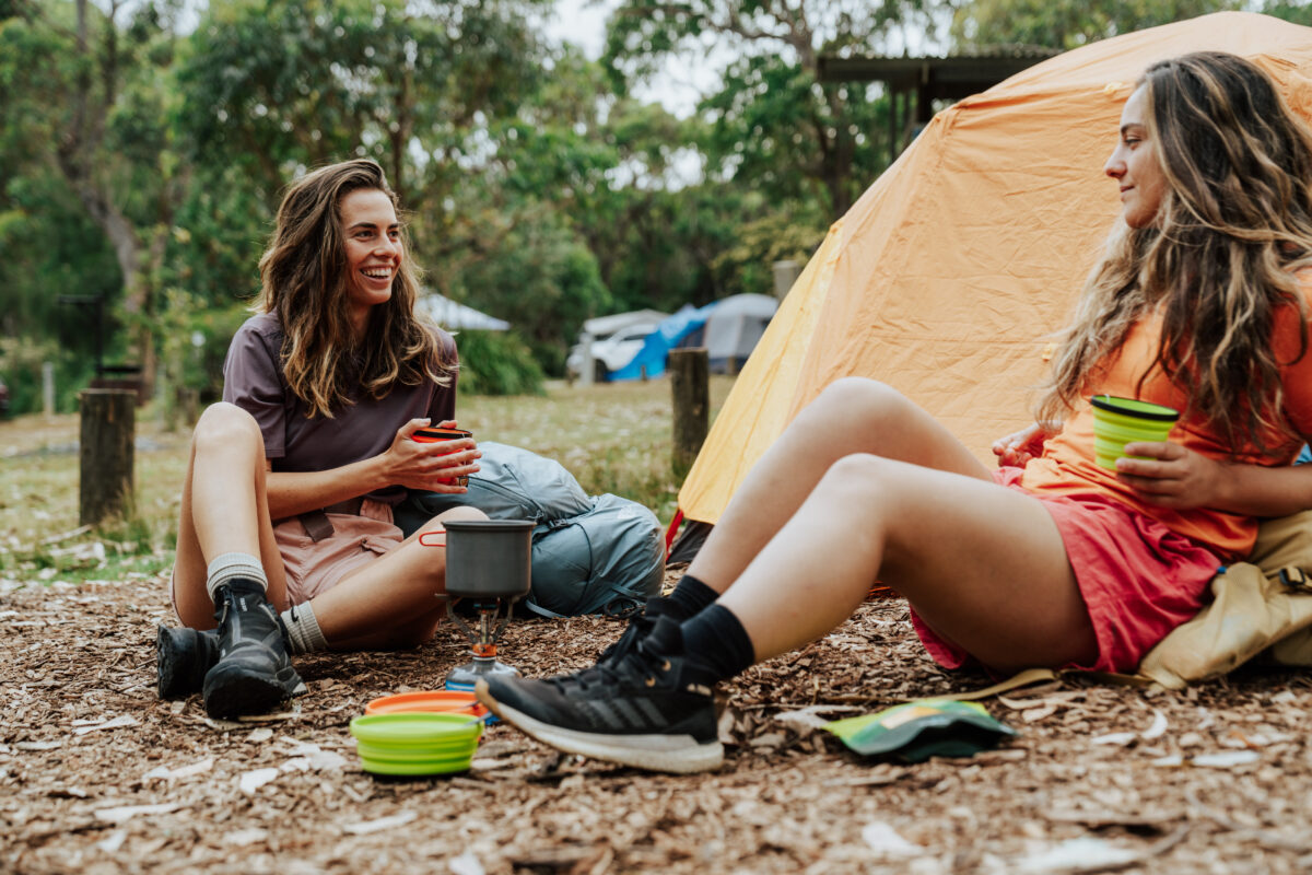 Photo Information
Pretty Beach Campground
Murramarang National Park
Remy Brand / DPE (2023)
Camping out before your hike begins is underrated. Whether it gives you time to soak up the vibes at the campground or drive down after work, it really takes the stress out of things so you can start your walk on the right… foot. Pretty Beach campground is a particularly gorgeous place to begin. You’ll catch views of the ocean from camp unless a kangaroo or lyrebird blocks the view. There’s also a shower block and a BBQ area to cook up a big pre-hike dinner!
Be sure to drop in and introduce yourself at the campground office, the National Parks staff will have the most up-to-date information on the trail, weather, and tides for your next few days on the Murramarang South Coast Walk. If you arrive after hours there will be details on the notice board, so make sure you visit before you start walking. It’s best to start your walk at low tide, you can check the Bureau of Meteorology website for detailed information on tides.
Comfort tip: Pretty Beach has bookable national park cabins that sleep up to four people.
-
Day 2: Pretty Beach to Depot Beach
Distance: 10km | Time suggested: 3 to 6 hrs | Toilets: Pretty Beach, Pebbly Beach and Depot Beach
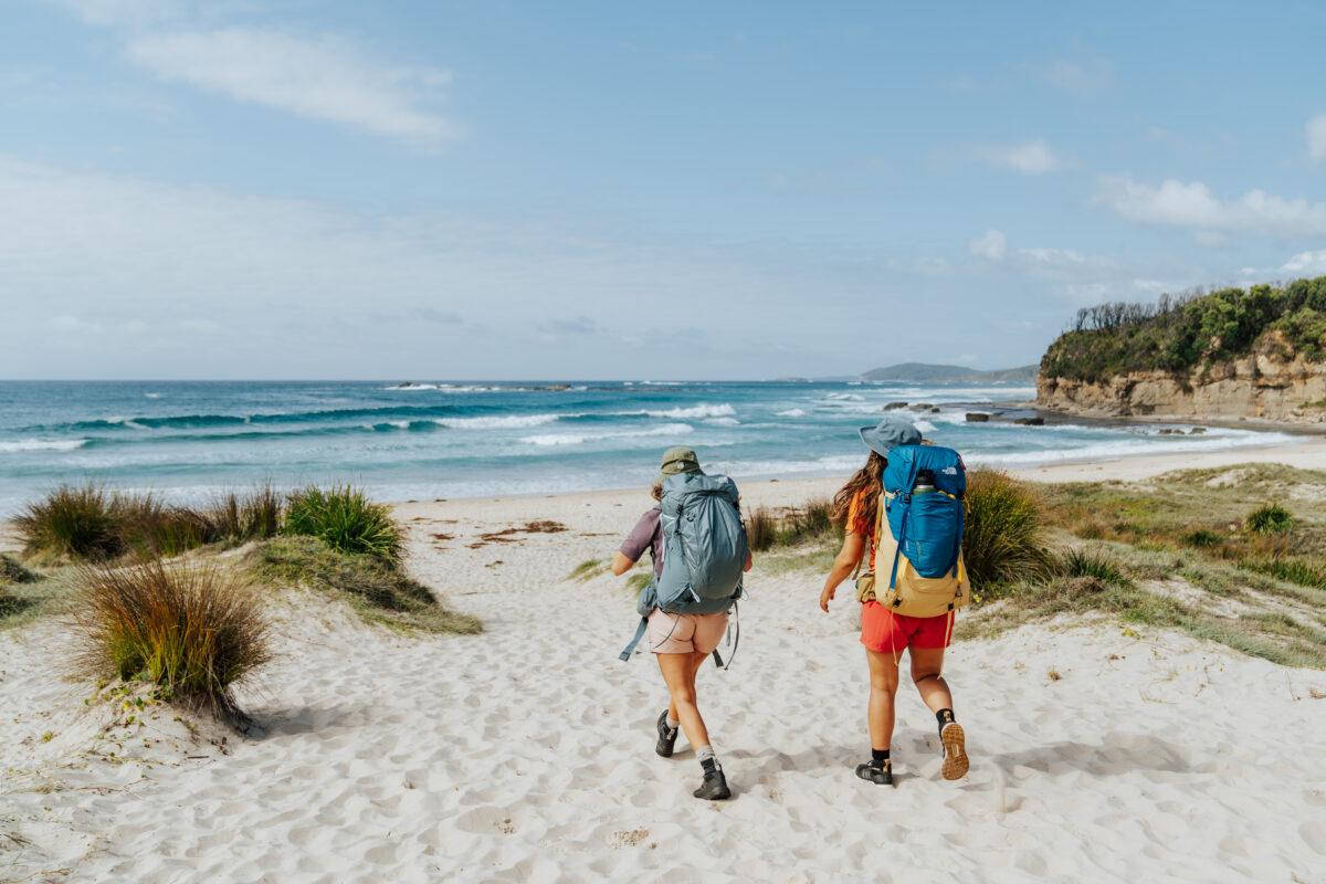 Photo Information
"To the left, to the left" - on the MSCW the ocean will always be on your left.
Pretty Beach
Murramarang National Park
Remy Brand / DPE (2023)
Take your first steps on the Murramarang South Coast Walk by walking down to the sand of Pretty Beach and heading south. If navigation isn’t your strongest skill, just remember that the ocean will always be on your left.
You’ll quickly encounter a rough rock platform with eye-catching honeycomb formations. Just make sure you watch your step and keep an eye on the waves, especially if the tide is high or there’s a large swell. If the waves look too large to safely cross, you can take an alternate route via Mount Durras track near the start of the walk. Next, stroll across Island Beach (look for the island!) before heading onto the cliffs.
Safety tip: Take extra caution when crossing coastal platforms. Never have your back to the ocean as large waves can appear without warning, and tread carefully as they can be very slippery.
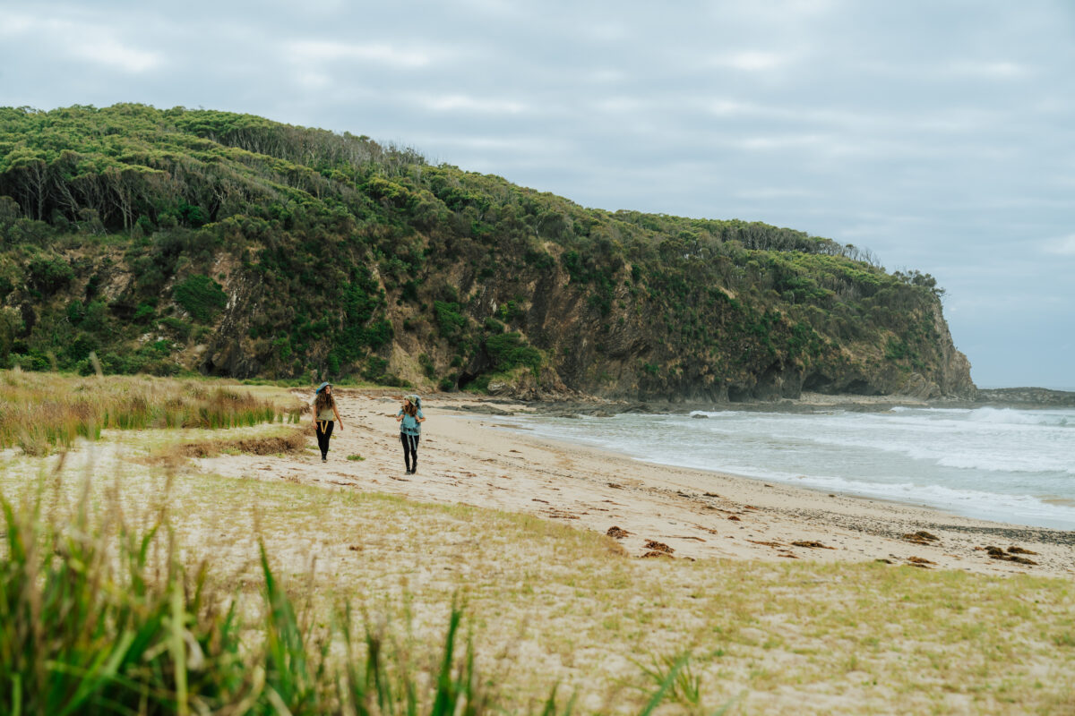
Singing Stones Beach is the next highlight, it’s a tiny inlet filled with large, rounded stones that crackle and pop as waves pummel the shore. From here the walk traces the cliff line whilst a mountain range rises on your right – the highpoint is known as Durras Mountain.
These mountains by the sea create all kinds of microclimates, meaning you’ll alternate between palm-filled gullies with towering gums and exposed heathy clifftops where only shrubs survive. The bays are filled with stones and pebbles that range through reds, oranges, and yellows, particularly Snake Bay, which in addition to being possibly the most beautiful, is well-protected and a safe spot to swim if you’re confident in the water.
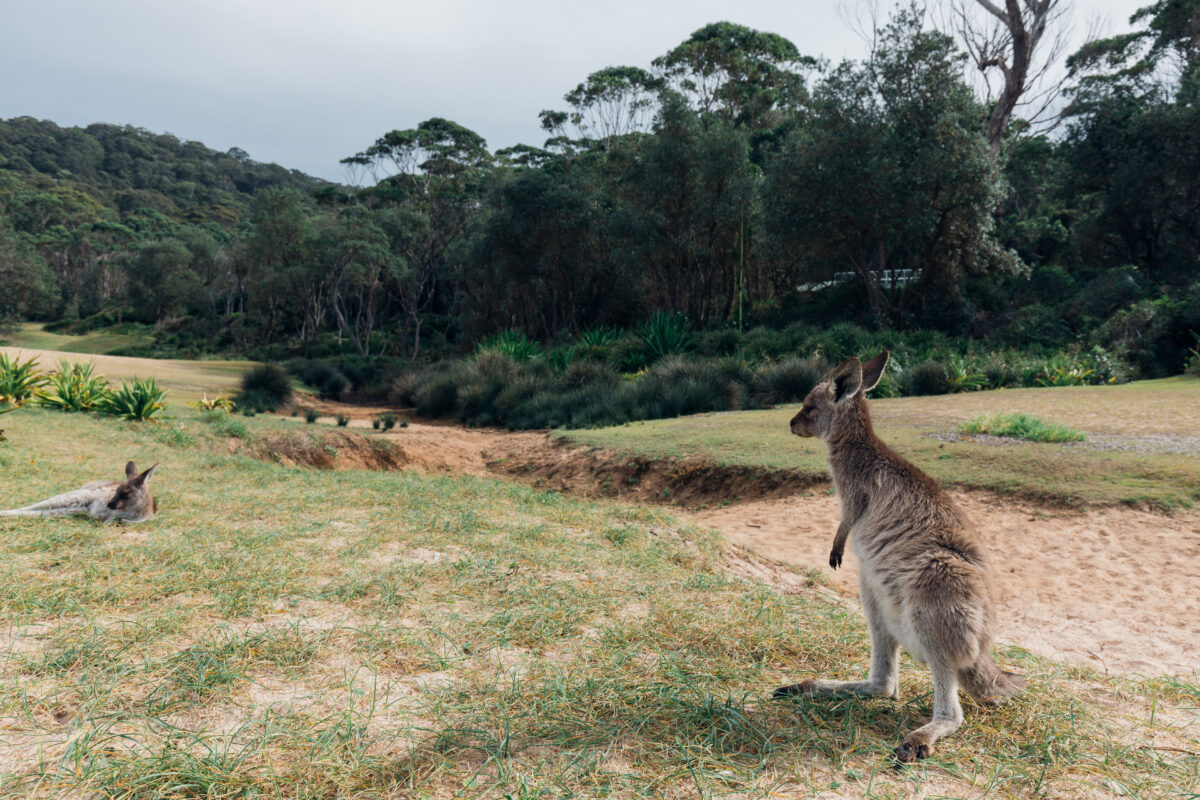 Photo Information
Just some locals hanging out.
Murramarrang South Coast Walk
Murramarang National Park
Melissa Findley/DCCEEW (2023)
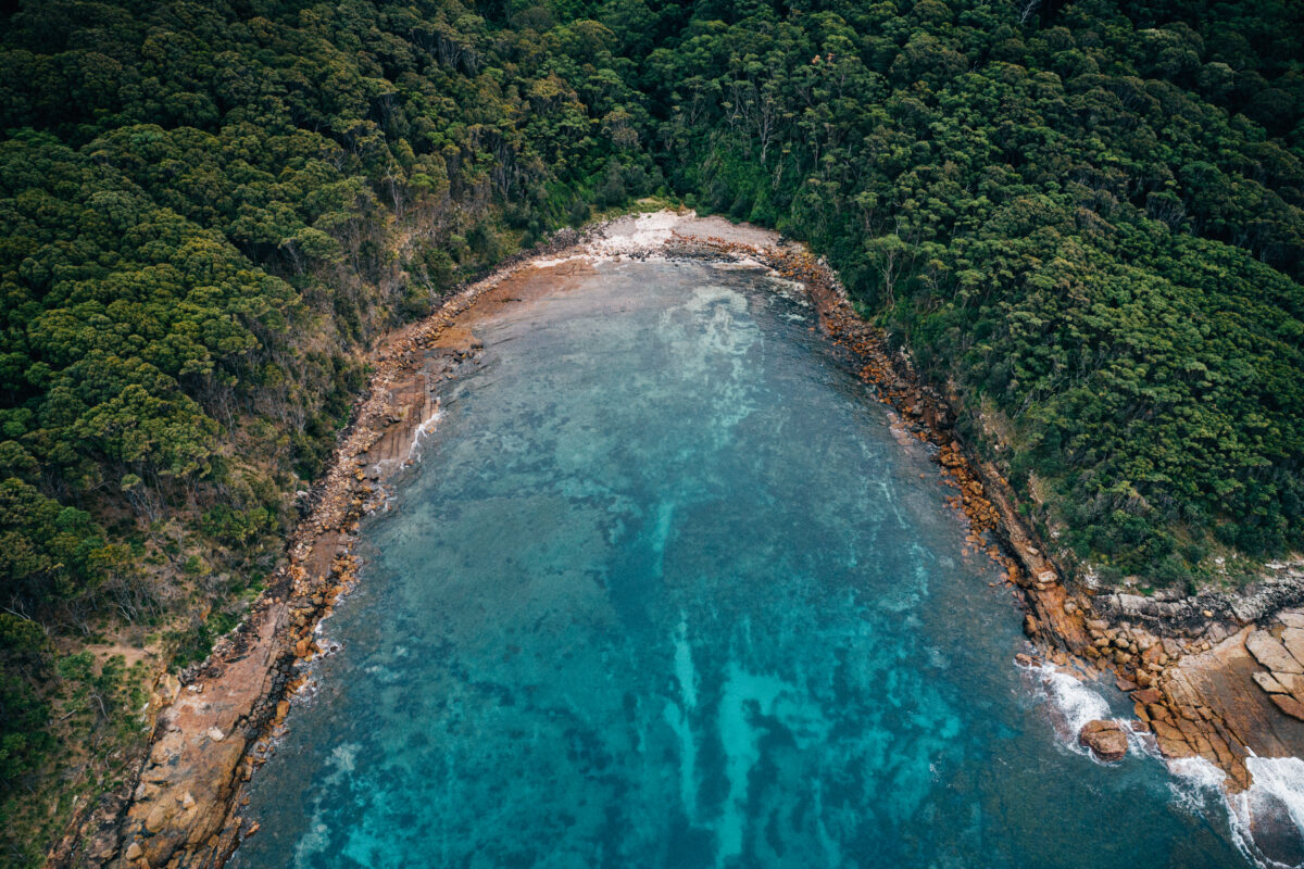 Photo Information
Murramarrang South Coast Walk
Murramarang National Park
Melissa Findley / DPE
You’re nearly at Pebbly Beach. Before you pass through the headland at Clear Point make sure you turn around and look north up the coast to see how far you’ve come. At Pebbly Beach you can use the toilet, refill your water (remember to treat tank water), or go for a swim. Make sure you say g’day to the resident kangaroos and lyrebirds too, from a distance of course.
We used the BBQs to toast our cheese and salami wraps here. It’s a great place to recharge before the final stint, the 1hr walk across the rock platform to Depot Beach.
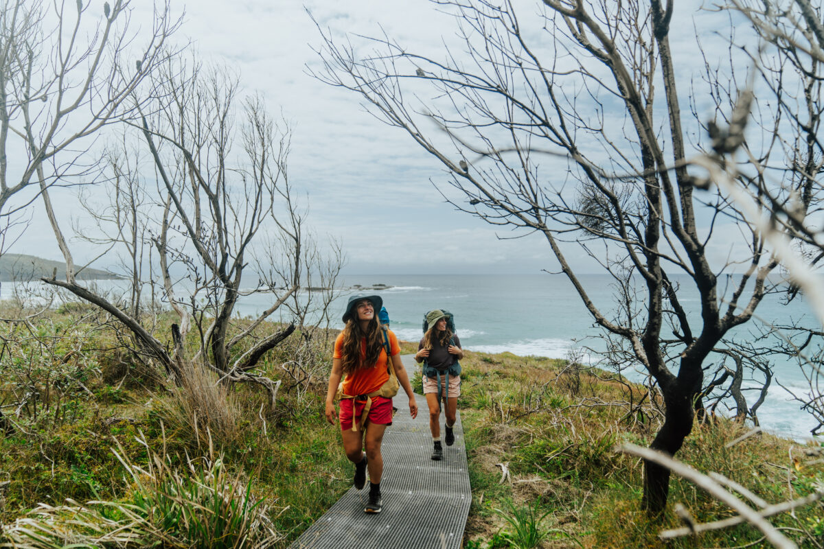 Photo Information
Murramarrang South Coast Walk
Murramarang National Park
Remy Brand / DPE (2023)
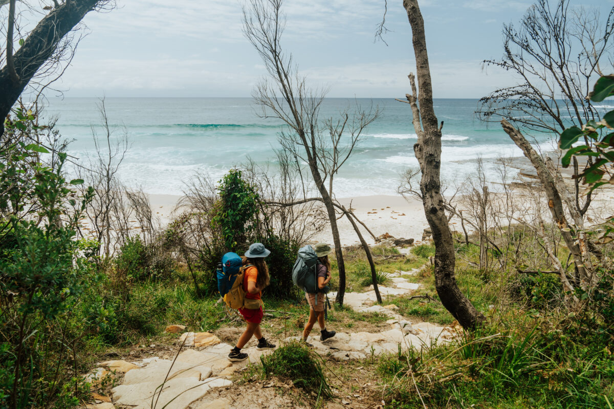 Photo Information
Murramarrang South Coast Walk
Murramarang National Park
Remy Brand / DPE (2023)
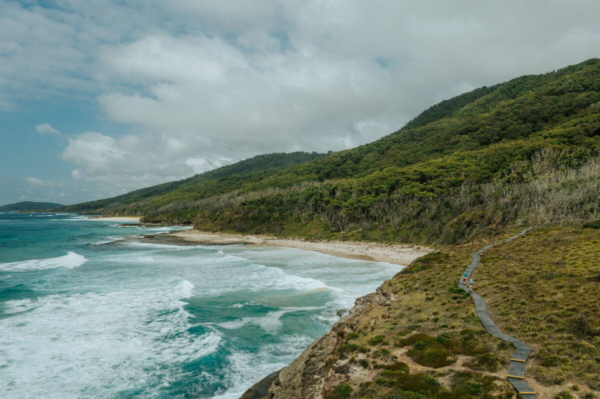 Photo Information
Pretty beach
Murramarang National Park
Remy Brand / DPE (2023)
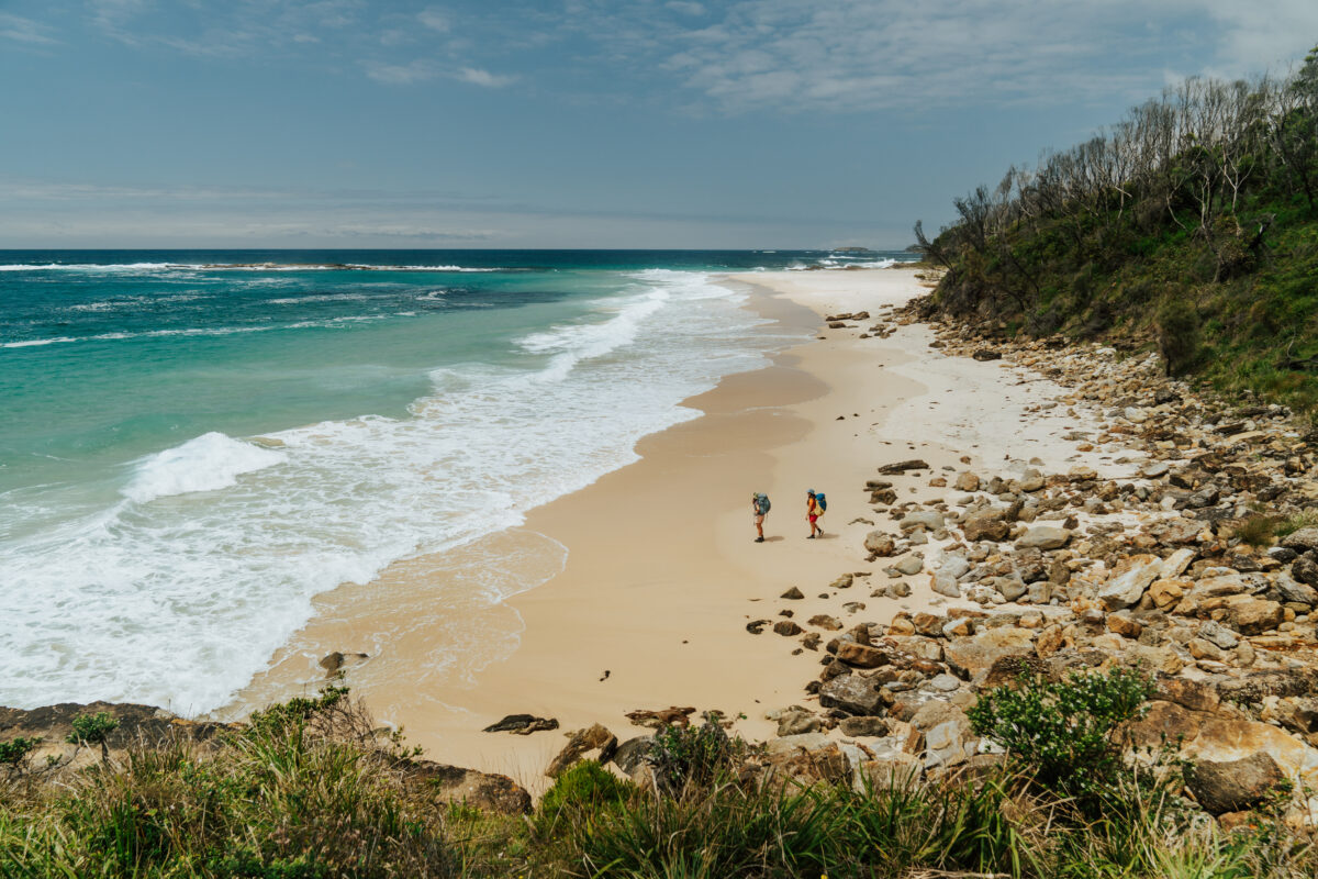 Photo Information
Murramarang South Coast Walk
Murramarang National Park
Remy Brand/DCCEEW (2023)
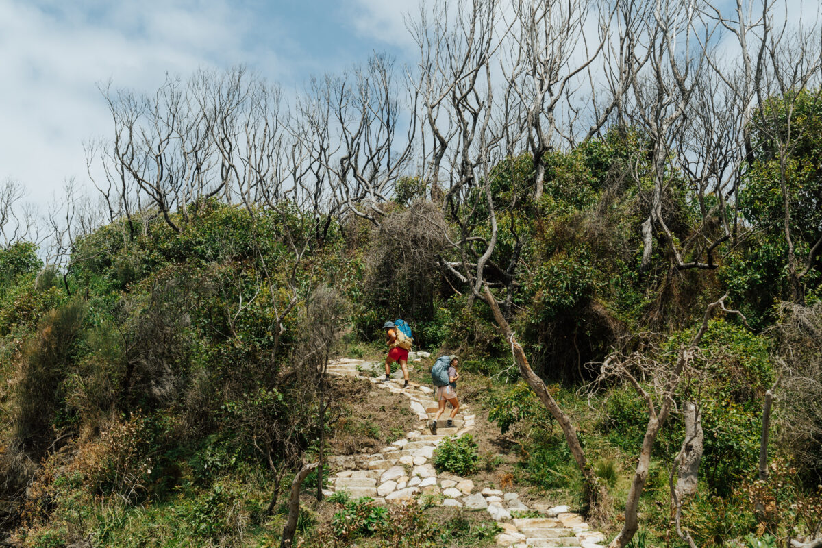 Photo Information
Murramarrang South Coast Walk
Murramarang National Park
Remy Brand/DCCEEW (2023)
This is probably the most challenging part of the day as your tired legs will have to negotiate beaches filled with large pebbles and a rock platform with smooth surfaces that can become incredibly slippery. Take your time and use walking poles if you have them. You’ll be rewarded with a walk alongside a bright red layered cliff line and across a very flat rock platform with exciting swirls and dead straight cracks in the volcanic surface.
Alternate route: If the Pebbly Beach to Depot Beach walk along the coast isn’t possible due to conditions there is an alternate route over the headland. National Parks staff will be able to advise you at the Pretty Beach office.
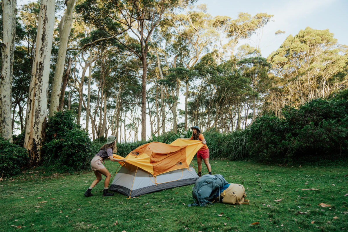 Photo Information
Depot Beach campground
Murramarang National Park
Remy Brand/DCCEEW (2023)
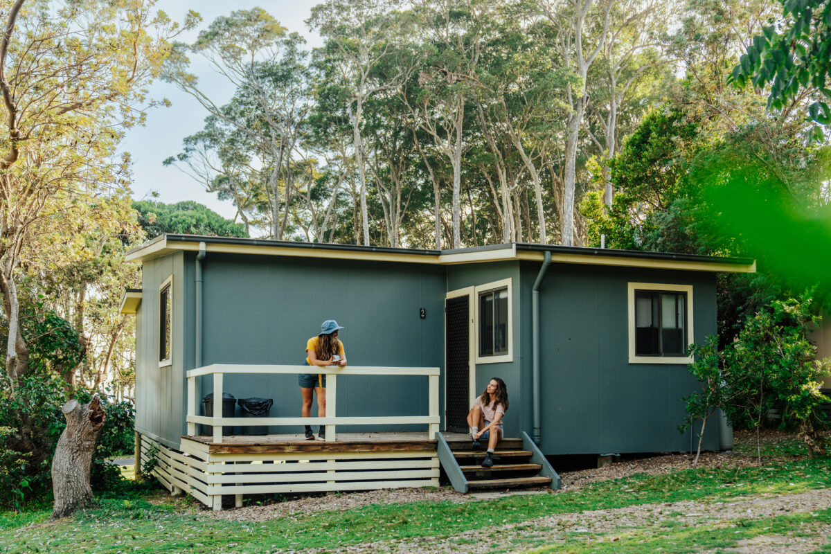 Photo Information
Time to unwind.
Depot Beach Cabins
Murramarang National Park
Remy Brand/DCCEEW (2023)
Walk across Depot Beach and up the stairs to Depot Beach campground to finish your first day on the MSCW. Like Pretty Beach campground there are hot showers, BBQs, and even cabins here, so put your feet up or get a campfire going!
Leave no trace: Follow these tips to leave the bush exactly as you found it. Take only photos, leave only footprints.
-
Day 3: Depot Beach to Oaky Beach
Distance: 16km | Time suggested: 6 to 8 hrs | Toilets: South Durras, NRMA Murramarang Beachfront Holiday Resort and Oaky Beach
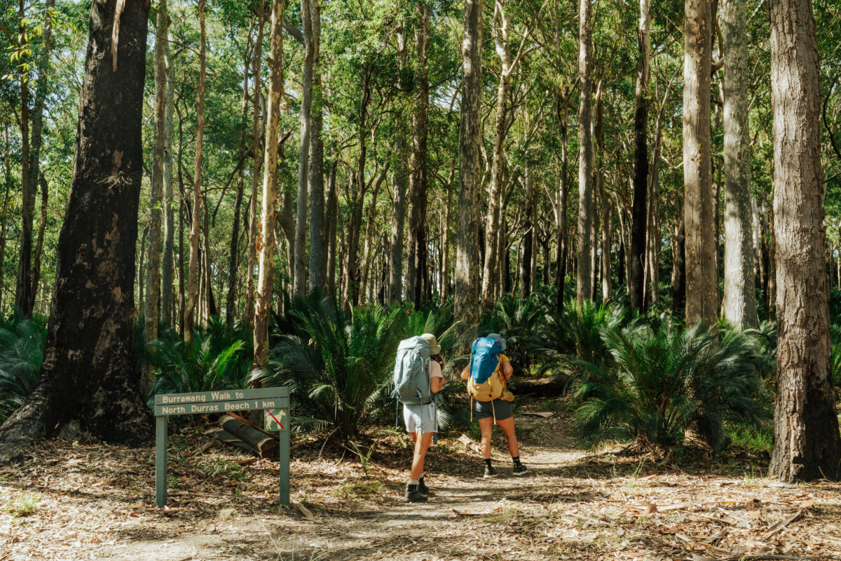 Photo Information
Burrawang Walk – Murramarrang South Coast Walk
Murramarang National Park
Remy Brand / DPE (2023)
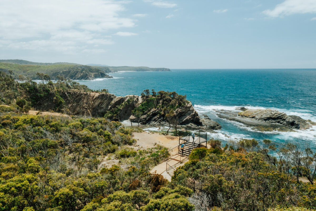 Photo Information
North Head Lookout
Murramarang National Park
Remy Brand / DPE (2023)
Today starts by climbing through some of the most exquisite coastal forest I’ve ever seen. The spotted gums are mottled with creams and greys that contrast with the burrawangs, dark green palm-like cycad trees that arch over the trail. It’s the largest forest of its kind in NSW and it’s particularly special to walk through as the sun rises.
Take a moment to detour out to Point Upright lookout to gaze down the coast all the way to South Durras, you’ve got a few kilometres of beach walking ahead of you today! This is also a great vantage point to view Durras Lake, which you’ll cross later.
Ranger tip: The safest way to cross the lake when the water level is high is by pre-booking a kayak transfer with Bay and Beyond Sea Kayak Tours. If you plan to cross on foot, pick a shallow area away from the shoreline and use walking sticks or link arms with your walking buddies for extra stability. National Parks staff at Pretty Beach campground and Depot Beach campground offices will be able to advise you ahead of time about the current best way to cross the lake.
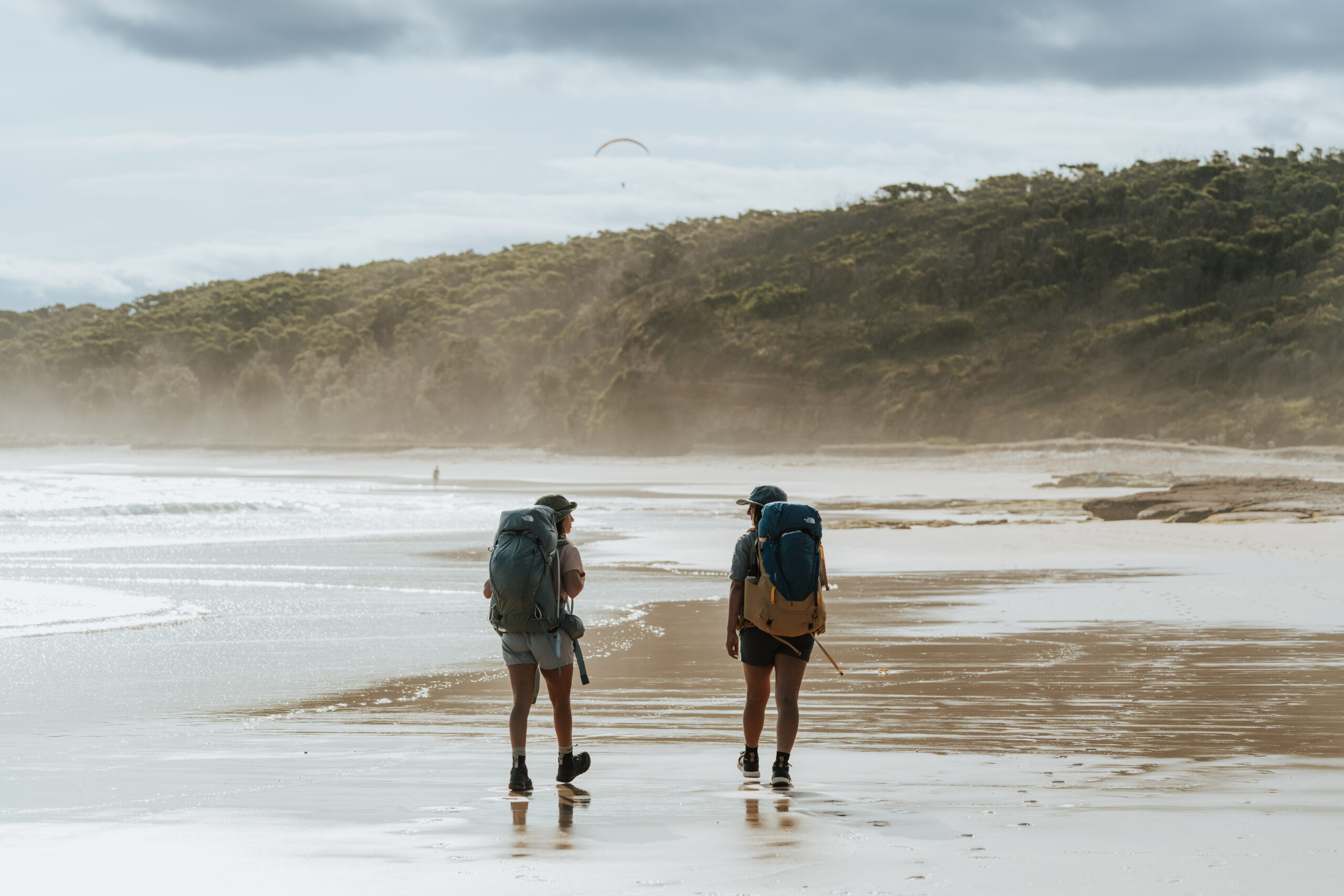 Photo Information
‘Calm Corner’ – the name says it all.
Calm Corner, North Durras Beach
Murramarang National Park
Remy Brand / DPE (2023)
When you arrive at the beach you’ll be at Calm Corner, the safest and most gorgeous place to swim until you reach the far southern end of the beach, so choose wisely. Otherwise, you’ll follow the firm sand near the water, cross the lake, and continue to the headland. You’ll likely see ocean fishers and surfers as you walk along this stunning stretch of beach.
 Photo Information
Slip, slop, slap!
NRMA Murramarang Beachfront Resort
Murramarang National Park
Remy Brand / DPE (2023)
Before you farewell civilisation, you’ll enter NRMA Murramarang Beachfront Holiday Resort, where you’ll fill your water bottles with enough water for the afternoon, cooking tonight, and the rest of the hike tomorrow (about 5 litres per person). Remember to treat all water in Murramarang National Park. You can also buy fish and chips, a latte, or a pack of chippies if you feel like you deserve it (you do). Just make sure you leave before 2pm in the winter months so you arrive at Oaky Beach campground before dark.
Reminder: Oaky Beach campground is a remote campground and has no available water. Make sure you come prepared.
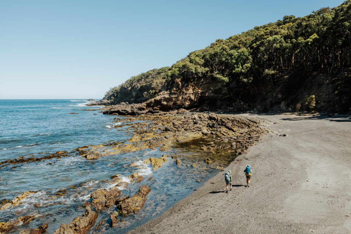
Photo InformationEmily Miller Beach
Murramarang National Park
Remy Brand / DPE (2023)
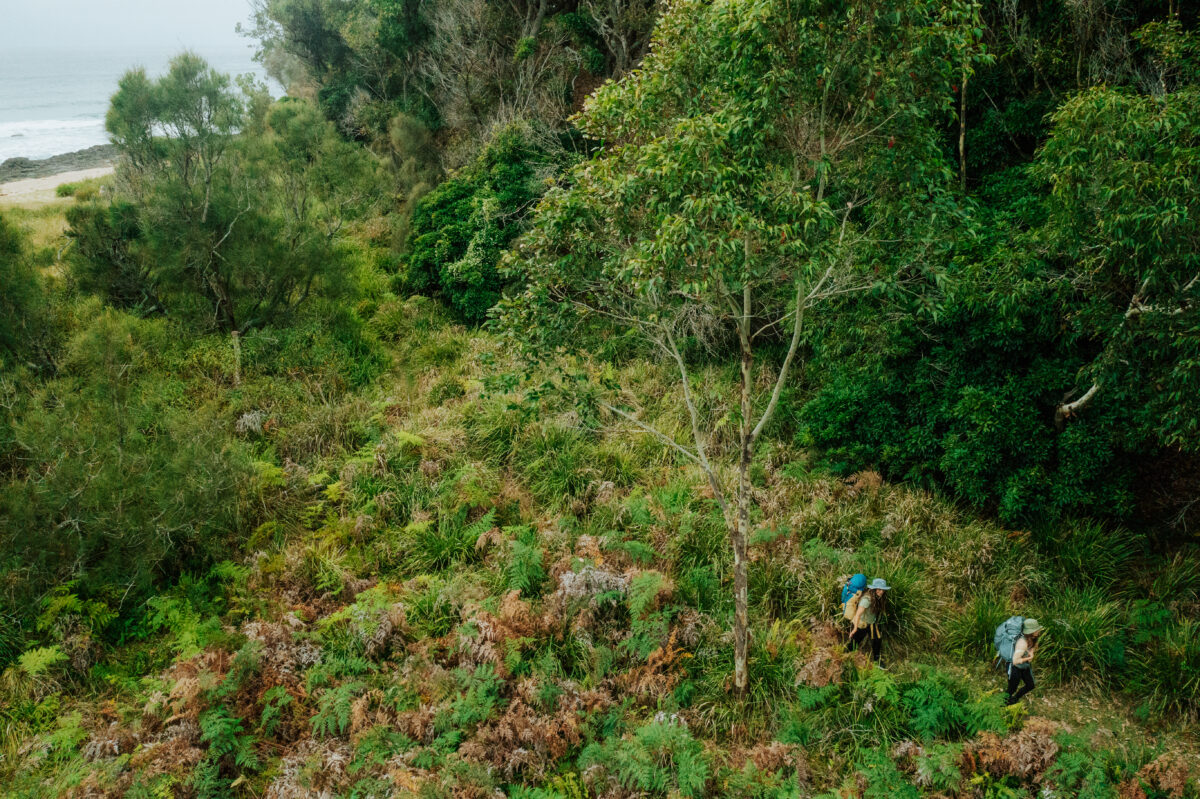 Photo Information
Murramarrang South Coast Walk
Murramarang National Park
Remy Brand / DPE (2023)
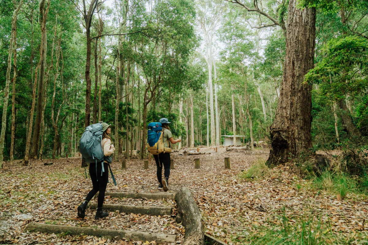 Photo Information
Oaky Beach Campground
Murramarang National Park
Remy Brand / DPE (2023)
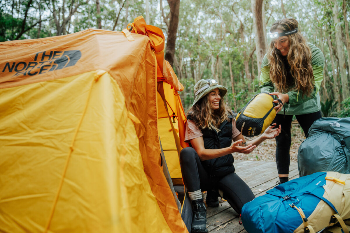 Photo Information
Oaky Beach Campground
Murramarang National Park
Remy Brand/DCCEEW (2023)
The walk to Oaky Beach campground winds along the cliffs and ducks down to small beaches, each different to the last. Dark Beach with its charcoal grey sand, Emily Miller Beach with its sea eagles soaring over volcanic stone, Myrtle Beach with its ‘enchanted forest’. The headlands are linked by more spotted gum forest and well-crafted trails that let you focus on the ocean views.
Ranger tip: These beaches are unpatrolled and unpredictable so it’s best to avoid swimming at them.
Oaky Beach campground is set beneath towering gums, easily the tallest of the walk, which offer protection from coastal winds and weather. The tent platforms and campsites are dotted amongst the trees, tastefully spread out to give you a sense of privacy. This isn’t your typical patch of grass – it feels like you’re floating in the understory of the forest. But we could see the ocean from our tent. Keep an eye out for possums, sugar gliders, and pademelons (we saw one watching the sunset) then fall asleep to the crash of the ocean.
-
Day 4: Oaky Beach to Maloneys Beach
Distance: 8km | Time suggested: 2.5 to 3.5 hrs | Toilets: North Head campground and Yellow Rock Beach
Wake up and smell the salt air! Your final day on the Murramarang South Coast Walk is a cruisy one so take your time to enjoy sunrise filtering through the trees to your tent platform or campsite. Or stroll along the beach and feel the sand between your toes, or sleep in – I’m not your boss!
Once you’ve packed up, checked for rubbish, and made use of the toilets it’s time to wander. The scenery begins similar to the end of Day 3 but with a distinctly clifflike flavour as you wind toward Honeysuckle Beach. The cliffs here are steep and angular, they’re noticeably different because, around the time you walked past Myrtle Beach, you began to leave a geological region known as the ‘Sydney Basin’ and its familiar sandstone cliffs.
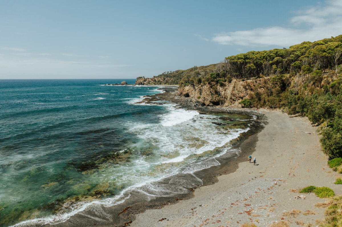 Photo Information
Honeysuckle Beach
Murramarang National Park
Remy Brand / DPE (2023)
Photo InformationNorth Head Lookout
Murramarang National Park
Remy Brand / DPE (2023)
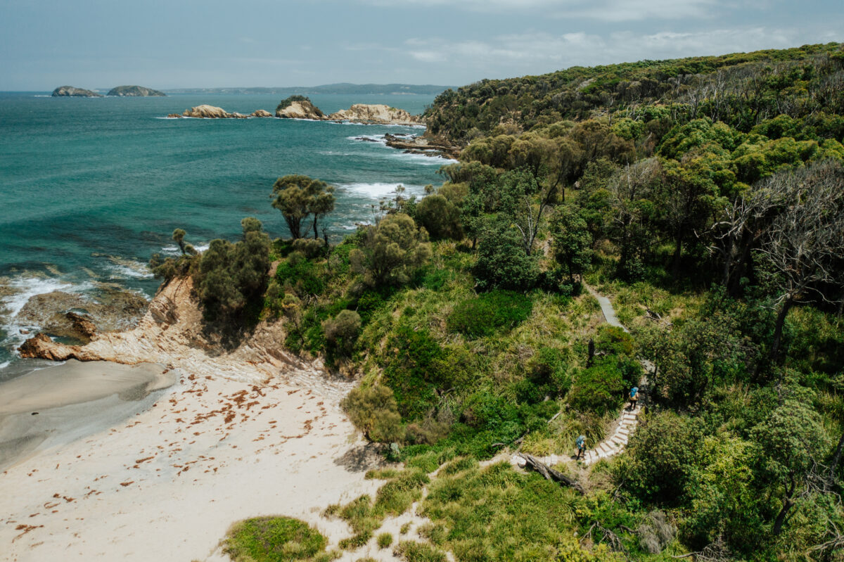 Photo Information
North head Beach, Murramarang South Coast Walk
Murramarang National Park
Remy Brand / DPE (2023)
Check out the dark pebbles on the beach before you begin your climb up to North Head lookout for a sprawling coastal view to the north. It’s time to begin your stroll west into Batemans Bay.
Stay in view of the ocean as you walk around North Head to avoid ending up in the campground (unless you need the toilet, of course) and soon you’ll be walking along the deep yellow sands of North Head Beach, which is covered in shells.
Your next stop is Yellow Rock Beach where NSW National Parks has two bookable accommodations, Judges House and Yellow Rock Beach House. Trip finale anyone? Seriously though you can use the public bathrooms here and you’re absolutely going to want to rip your shoes and socks off for another swim. We persevered, crossing one more small headland to swim at the northern end of the beach. The water was so clear I reckon I could see underwater.
The final kilometre is a real last hurrah for the Murramarang South Coast Walk. The winding spotted gum forest and burrawangs are your friends now and if you look closely, they’ll wave. This is also the place where we saw an echidna snacking away on some tasty ants, so keep your eyes peeled.
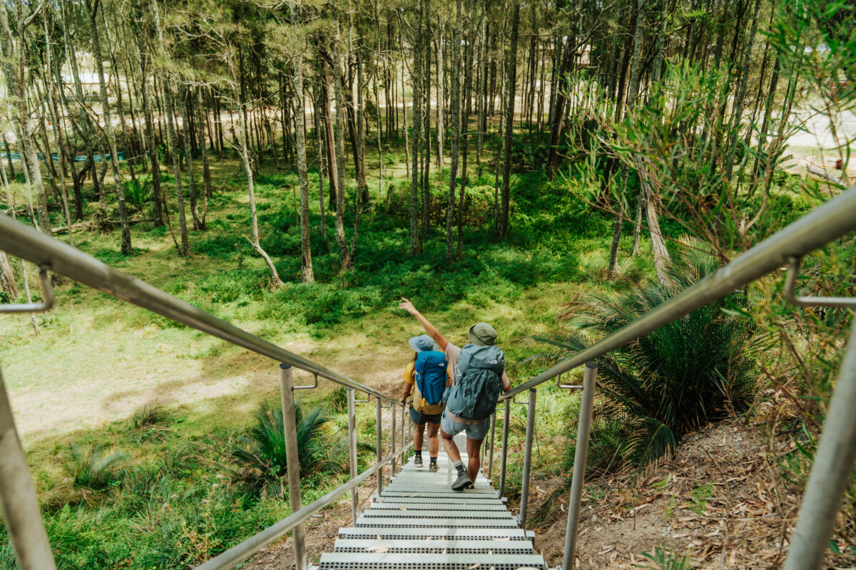 Photo Information
Maloneys Beach Staircase, Maloneys Beach
Murramarang National Park
Remy Brand / DPE (2023)
Finally, walk down the large staircase to Maloneys Beach, give your mates a crisp high five, and call your transport option of choice, in that order. You’ve done it! Hiking some of the best and most unique coastline in New South Wales, not bad for a few days’ work.
Too much to organise and carry? Take all the heavy lifting out on a Murramarang South Coast Walk guided experience.
How hard is the Murramarang South Coast Walk?
The Murramarang South Coast Walk is considered a Grade 4 walk using the Australian Walking Track Grading System, but what’s this look like? In reality, most of the walk is well-graded, the climbs are never particularly steep or long, and with newly-installed signage, navigation shouldn’t be that difficult. If you’re reasonably fit it shouldn’t be too challenging.
The ratings are given to the hardest aspects of the walk, which are the distance (16km on day 2 with an overnight pack will take 6-8 hours), crossing Durras Lake, and coastal rock platforms and rocky beaches, which can be slippery and exposed to large ocean swells.
What to bring
The Murramarang South Coast Walk is a self-guided multi-day walk, meaning you have to carry most of your own food, water, equipment, and clothing, but it does pass through some populated areas. At Pebbly Beach and Depot Beach, you can refill with tank water, while at NRMA Murramarang Beachfront Holiday Resort on day 2 you can buy lunch and bottled water, as well as refill with tank water (you’ll have to treat all water in the national park before drinking).
Not sure what to pack? For the Murramarang South Coast Walk, I’d recommend these essentials:
- Broad brim hat or bucket hat
- Sunscreen
- Sunglasses
- Swimwear
- Lightweight hiking towel (good for cleaning sandy feet before they go back into boots)
- Fleece or insulated jacket (it can get cold at night)
- Waterproof rain jacket
- Beanie or warm hat
- Twine or string to attach to the tent platform
- A freestanding hiking tent
- Water purification tablets
- Hand sanitiser (which doubles as a leech remover)
- First aid kit
- NSW Parks app
- Tide chart (can be saved on your phone)