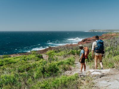
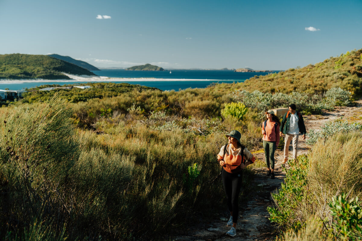
Salty breezes, aqua-coloured water, twisted gums, big skies, rugged headlands. Walking the Tomaree Coastal Walk on Worimi Country will awaken your senses, blow away the cobwebs and make you fall head-over-hiking-boots for this magical corner of NSW.
Winding through ancient volcanic landscapes, beneath shaded canopies of gum and she-oaks, around sheltered rocky coves, and along soft white sand. This epic 27km walk begins at the foot of Tomaree Mountain, a few minutes’ drive from the popular coastal town of Shoal Bay, and just 2.5hr drive from Sydney.
Highlights
- Stunning coastal scenery, ocean views, and secluded coves and beaches.
- Prime whale-watching vantage points.
- Retrace ancient routes used by the Worimi People, the region’s traditional owners.
- Panoramas of Port Stephens from Tomaree Head Summit.
- The chance to spot and walk amongst incredible Aussie wildlife – koalas, sea eagles, dolphins and sea turtles.
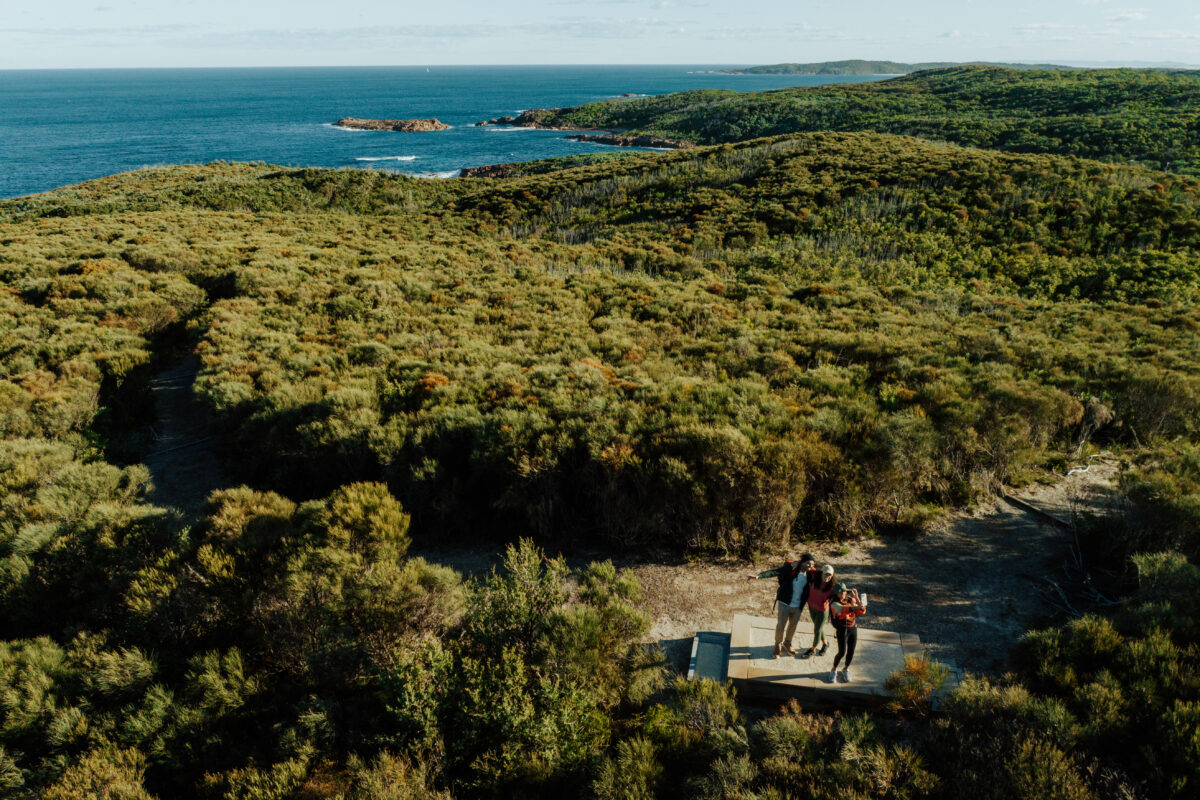
- Pass through diverse ecosystems and landscapes as you walk, from rainforests to rugged rocky outcrops.
- Awe-inspiring 65 million-year-old volcanic landscapes.
-
Where to stay

 Photo Information
Port Stephens Koala Sanctuary
Tomaree National Park
Remy Brand/DCCEEW (2023)
 Photo Information
Port Stephens Koala Sanctuary
Tomaree National Park
Remy Brand / DPE (2023)
There’s plenty of accommodation available in the Port Stephens area, so if you aren’t a super keen camper and like a hot shower, gourmet meal and comfy bed at the end of a big day in the great outdoors (no judgement!) – this trail might just be the unicorn of multi-day hikes. We stayed in One Mile Beach and took a short taxi ride back to our car at the end of each day.
-
Itinerary
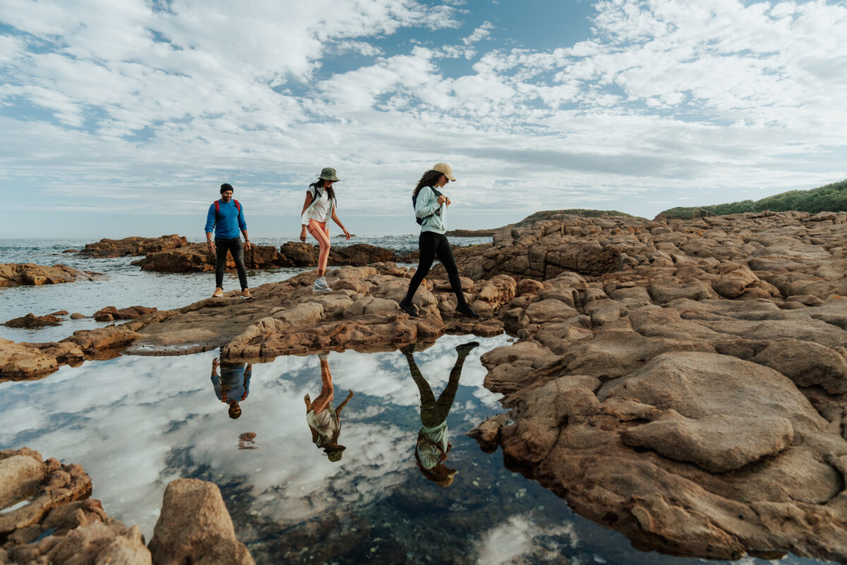 Photo Information
Tomaree Coastal Walk
Iris Moore Reserve
Tomaree National Park
Remy Brand / DPE (2023)
There’s no right or wrong way to hike Tomaree Coastal Walk. You can enjoy it however you like, making it a great option for everyone, including less-experienced hikers and families with kids. There is a three-day walk for those wanting a more leisurely pace. You can also do shorter sections of the 27 km track, with options ranging from 2 hours to a half day.
But if you want the full two-day itinerary, grab your backpack and we’ll show you how to make the most of every second.
-
Day 1: Tomaree Head Summit, then Zenith Beach to One Mile Beach
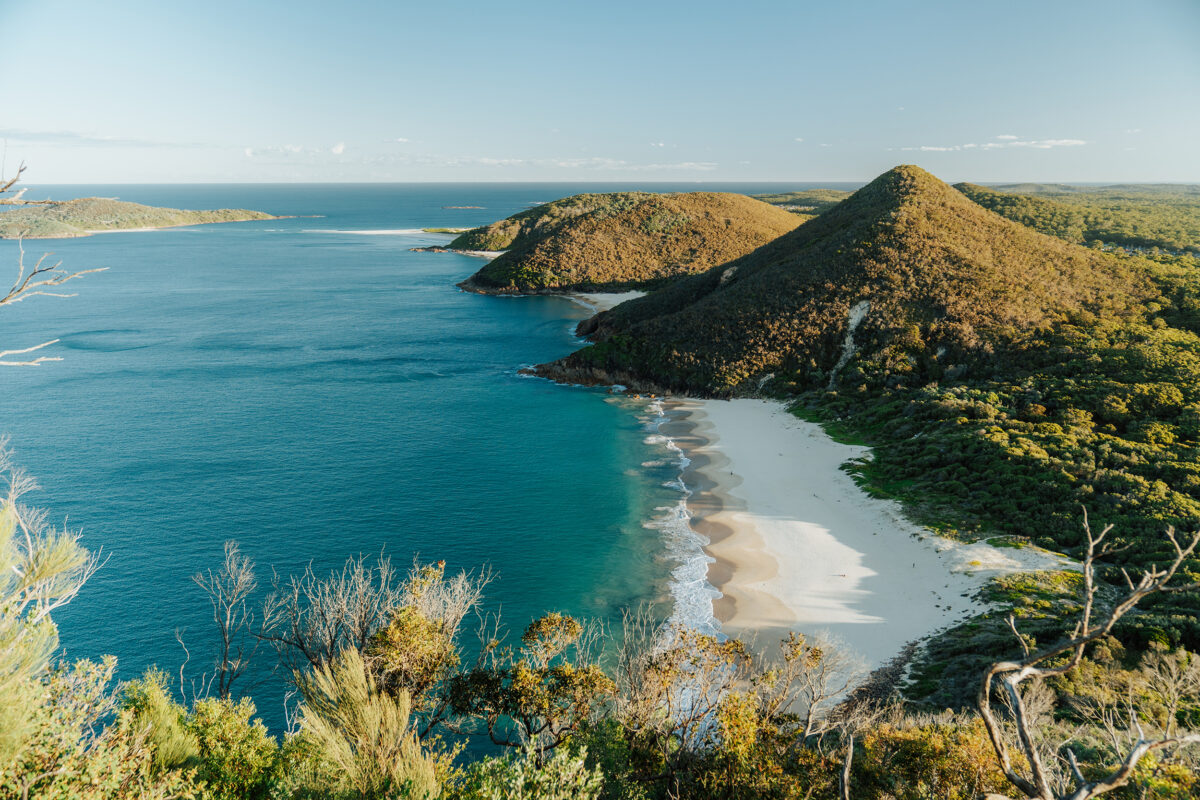 Photo Information
The view from the top of Tomaree Head 👌
Tomaree Head Summit
Tomaree National Park
Remy Brand / DPE (2023)
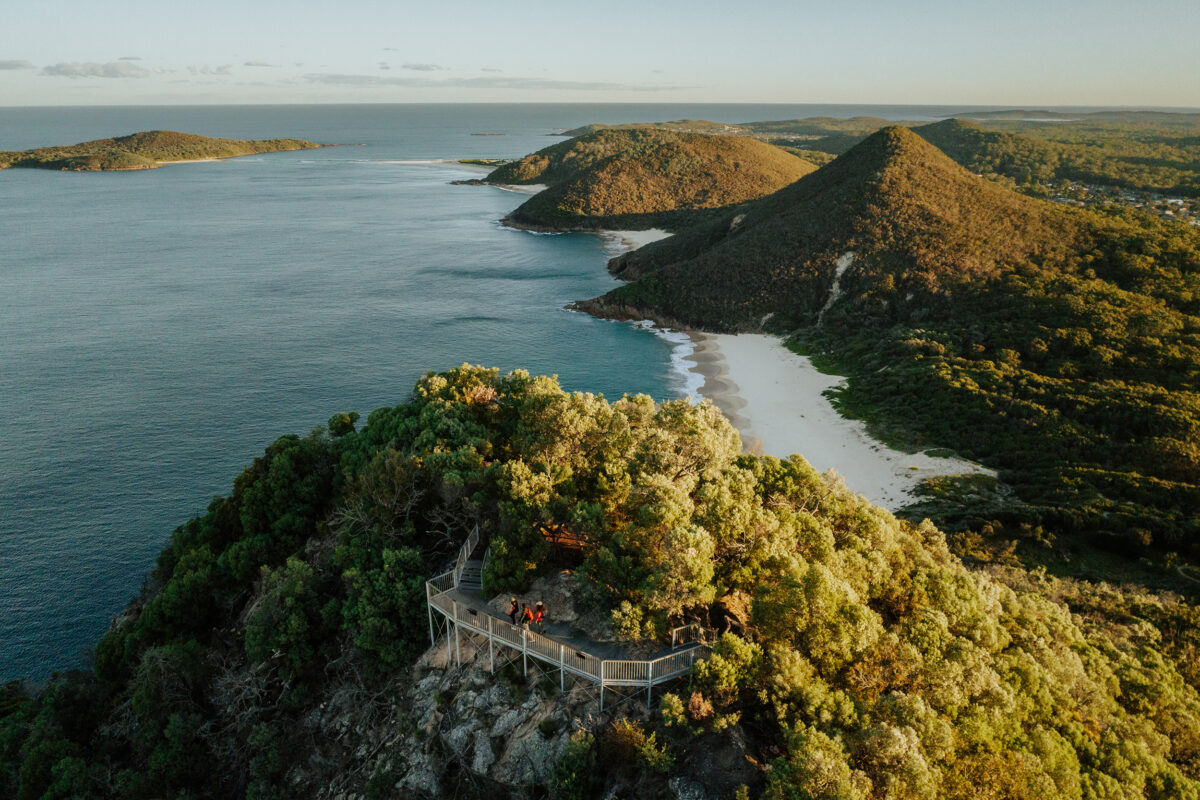 Photo Information
Tomaree Head Summit
Tomaree National Park
Remy Brand / DPE (2023)
Distance: 18km | Time suggested: 7 to 8 hours | Toilets: Shoal Bay foreshore, Fingal Bay, Barry Park, One Mile Beach
After filling your tums in one of the many nearby cafés, your day will start at the foot of Tomaree Mountain, at the signposted Tomaree Head Summit Walk.
 Photo Information
Tomaree Head Summit
Tomaree National Park
Remy Brand / DPE (2023)
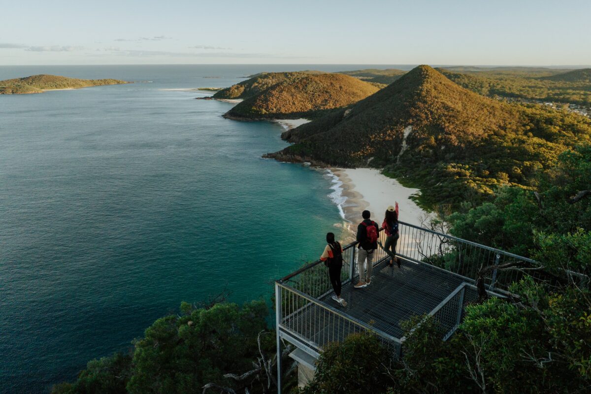 Photo Information
Epic views from Tomaree Head Summit.
Tomaree Head Summit
Tomaree National Park
Remy Brand/DCCEEW (2023)
 Photo Information
Sunrise and worth getting up for
Tomaree coastal walk
Tomaree National Park
Remy Brand / DPE (2023)
 Photo Information
Tomaree Head Summit
Tomaree National Park
Remy Brand / DPE (2021)
It’s not long before your heart starts racing, but you’ll be rewarded with glimpses of a view that slowly reveals itself the further you climb. Follow the shaded path to the summit, and soak up the panoramas of Shoal Bay to your west and Mount Yacaaba – part of Myall Lakes National Park – to the north. And see that lush coastline to the south? You’ll be walking that way pretty soon. Right now, you’re a cool 161m above the Port Stephens entrance – this is the highest point the trail will take you over the next two days.
Did you know: The endangered Gould’s petrel breeds on the islands you’ll see from the summit of Tomaree Head. You can learn more about the fascinating story of the petrel’s lifecycle and discover how conservation efforts led by NPWS are helping to secure a future for this bird in an immersive story via NSW National Parks App.
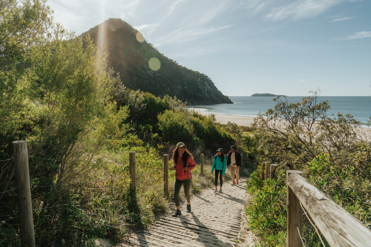 Photo Information
Zenith beach
Tomaree coastal walk
Tomaree National Park
Remy Brand/DCCEEW (2023)
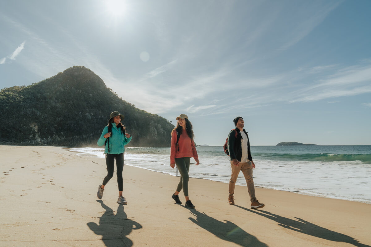 Photo Information
Stroll along Zenith beach
Tomaree coastal walk
Tomaree National Park
Remy Brand / DPE (2023)
Make your way back down the mountain, taking the track to check out the historic World War II Gun Emplacements at Fort Tomaree on the way. Then, instead of heading back towards the car park, turn left to walk onto Zenith Beach, where you’ll get your first taste of the stunning beaches this walk has to offer.
We walked on a day with gale-force winds, but the views across the sparkling blue waters of Zenith Beach made us feel like we’d stepped into a guided meditation. Don’t get too comfy, though – you’ve got a 16km walk ahead of you!
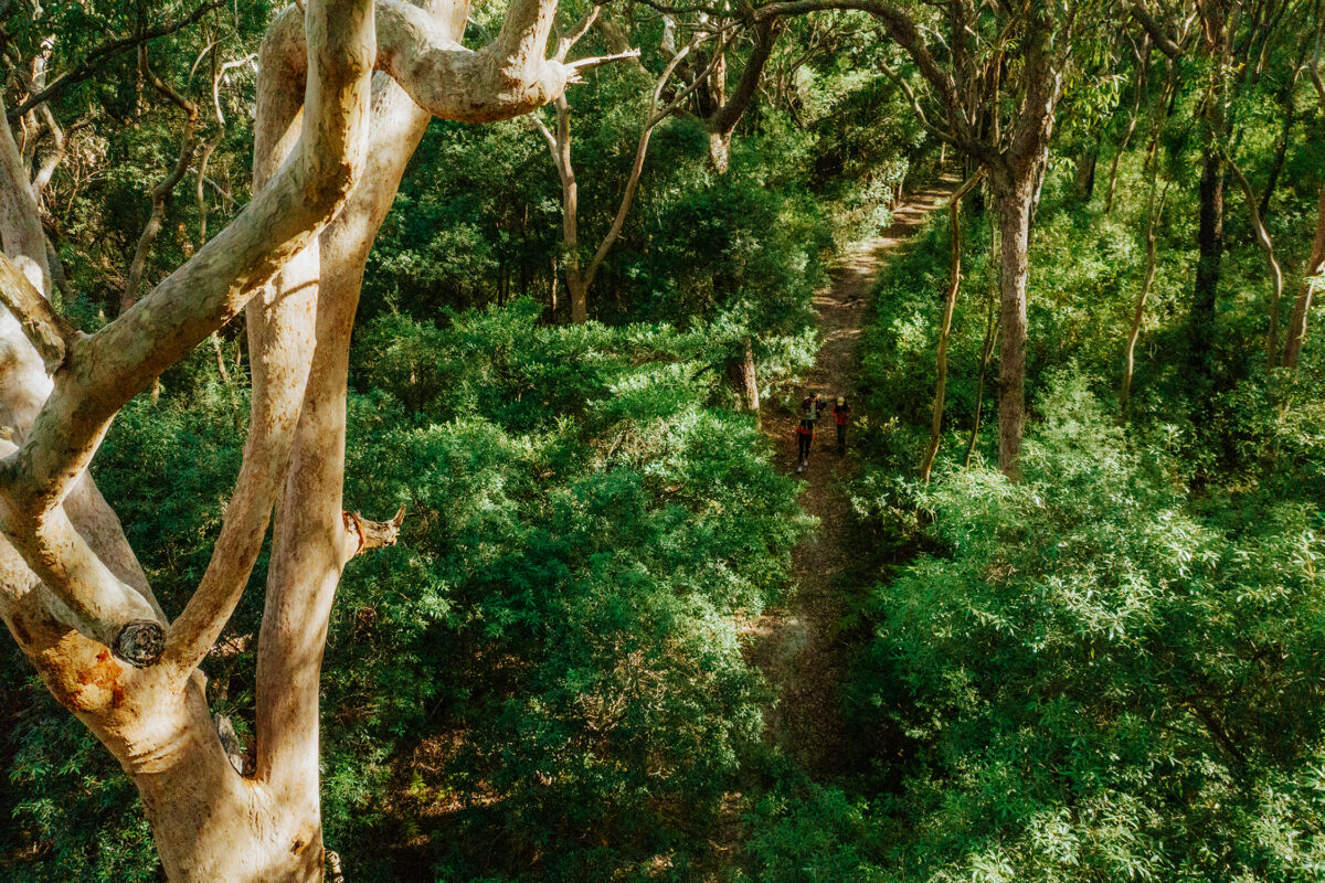 Photo Information
Tomaree Coastal Walk
Tomaree National Park
Remy Brand / DPE (2023)
 Photo Information
Tomaree Coastal Walk
Tomaree National Park
Remy Brand / DPE (2023)
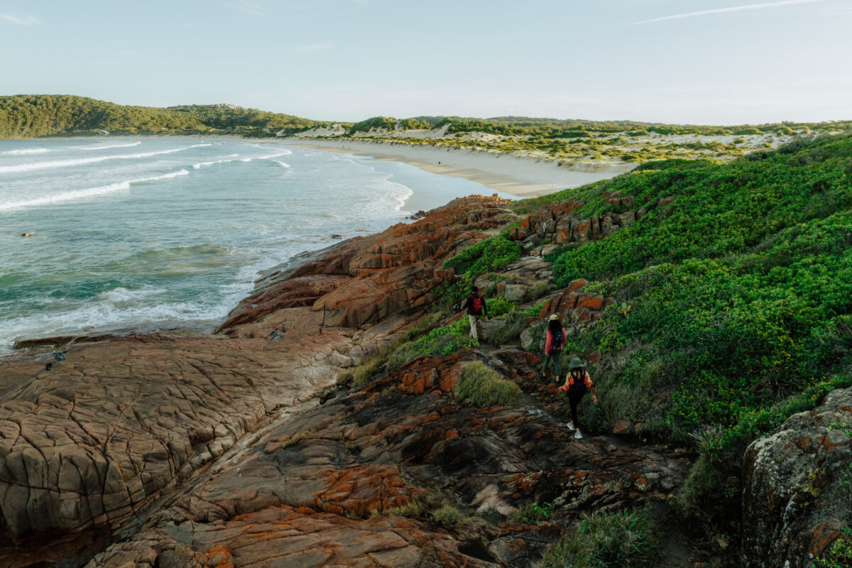
Take the trail from the end of the beach and walk up the hill, always keeping the ocean to your left, with Tomaree Head behind you. It’s not long before the trail meets a shaded track, and Shoal Bay peeks through the twisted arms of gum trees to the west. Continue towards and then around Quarry Hill, enjoying banksia, wattle, and Gymea lilies in bloom.

You’ll meet up with the main road and follow this down to Longboat Café in Fingal Bay. Continue along the soft sand and watch the black cockatoos noisily feed in the she-oaks lining the beach, before heading up the hill towards Barry Park.
Depending on the time of year, you might run into some whale watchers hoping to catch a glimpse of these majestic beauties with their long-lens cameras. If you don’t spot one here, don’t worry – there are plenty more whale-watching opportunities to come.
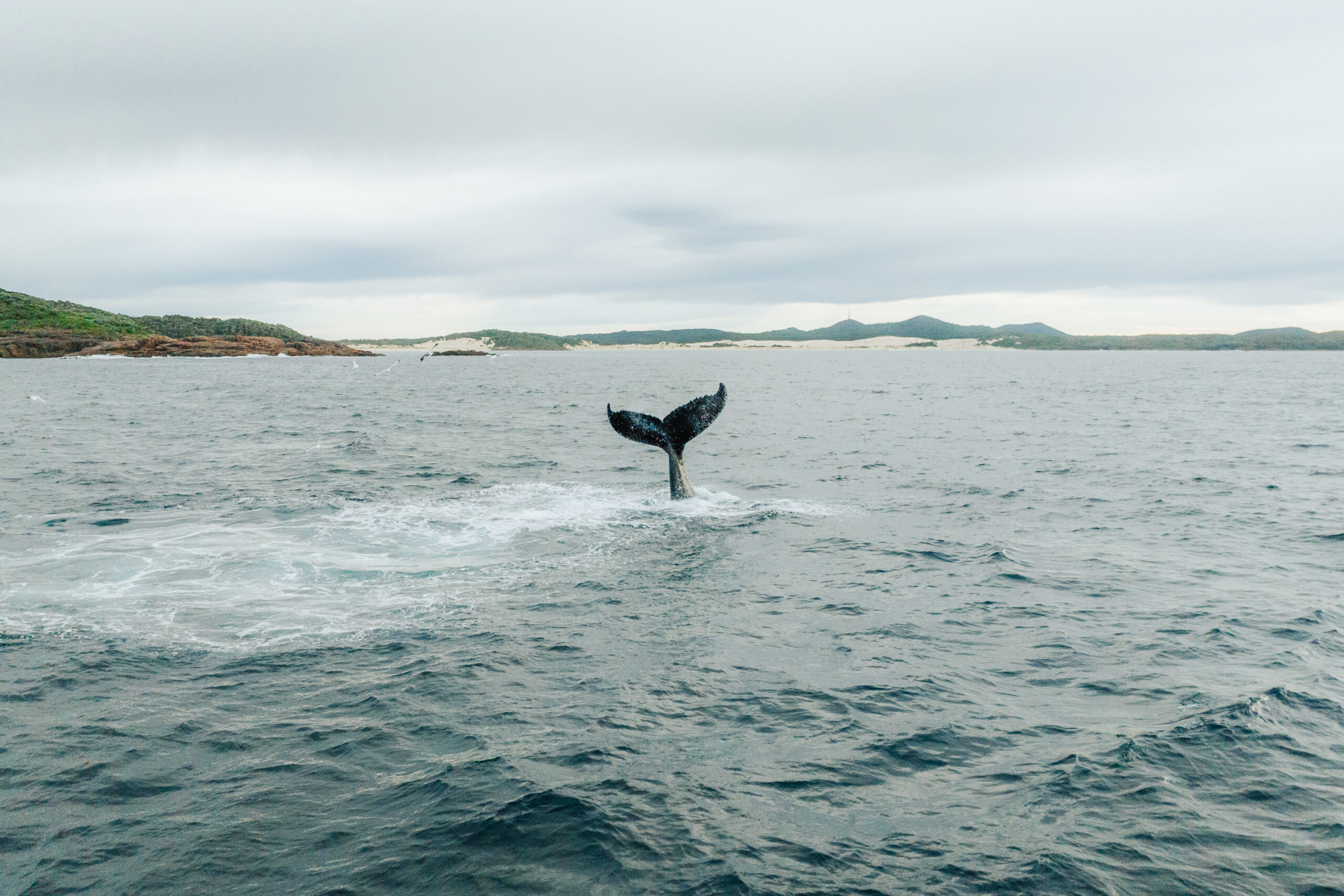 Photo Information
Whale sighting
Tomaree coastal walk
Tomaree National Park
Remy Brand / DPE (2023)
Did you know: Twice a year, humpback and southern right whales migrate north or south, passing through waters off the NSW coastline – sometimes close enough that we can catch a glimpse of them from land. Lucky us! They start their swim north around May and June and then make their southbound journey from around August to November. The peak of the season is the around end of June and throughout July, when the highest numbers of whales can be seen from the NSW coastline. More facts on whale migration here.

The track takes you across Boulder Bay Road and into a quiet canopy of angophora rainforest with ferns and flannel flowers covering the ground, insulating you from the sounds of the ocean. A little further up the hill, there’s a sandstone bench with panoramic ocean views, overlooking Little Rocky – a rocky outcrop submerged in the sea – directly in front of you. Here’s a great place to stop for a packed lunch or to catch your breath.
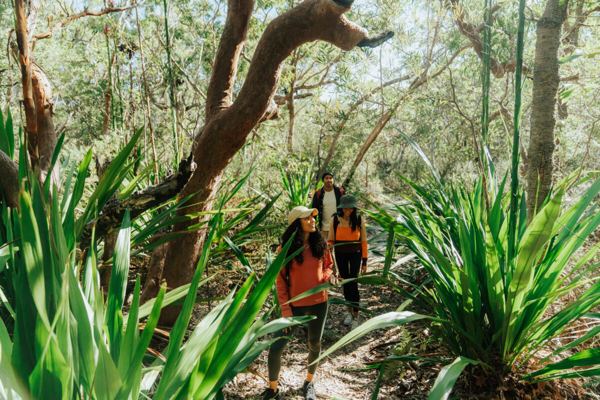 Photo Information
Little Rocky trail
Tomaree National Park
Remy Brand/DCCEEW (2023)
If you’re a native plant fan, the next section will really tickle your fancy. As you ascend the hill on your approach to Little Rocky Trail, Gymea lilies immediately catch your eye, poking their big red spikes above the exposed shrubland. The landscape here feels almost pre-historic, as though you’re breathing the same air as dinosaurs.
Did you know: Gymea lilies thrive on fire, with bushfires actually encouraging them to flower. The green foliage of the lillies is around one-metre high, but the plant’s flower spike can grow up to six metres tall, making them pretty easy to spot when walking through our National Parks.
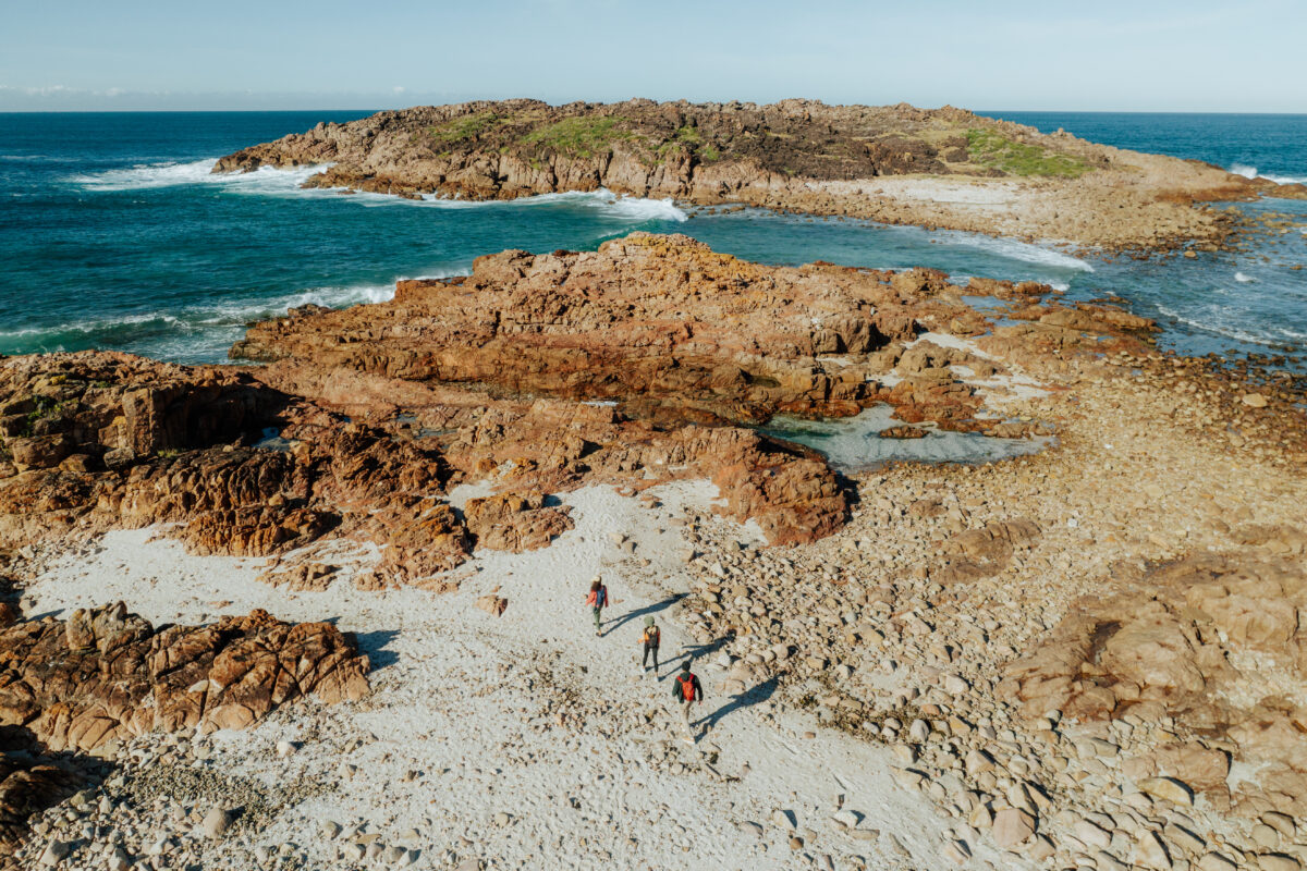 Photo Information
This is not a drill. It’s in fact the coastline of Tomaree Coastal Walk, NSW
Big Rocky
Tomaree National Park
Remy Brand / DPE (2023)
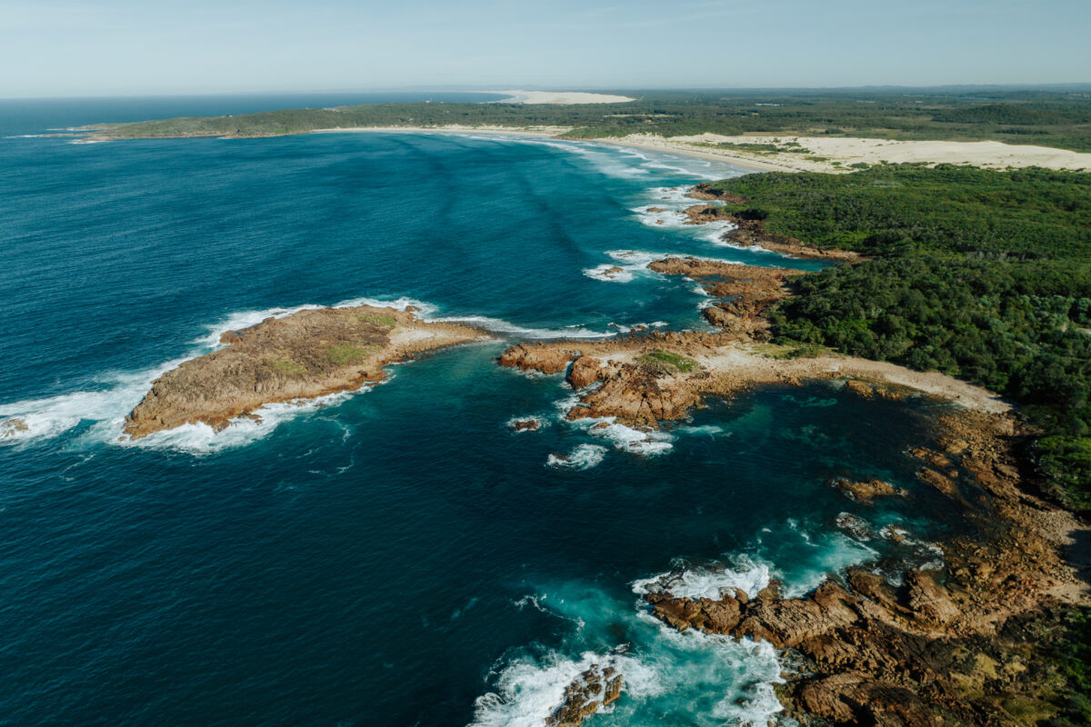 Photo Information
The clear and bright blue water could be mistaken for the Mediterranean
Big Rocky
Tomaree National Park
Remy Brand / DPE (2023)
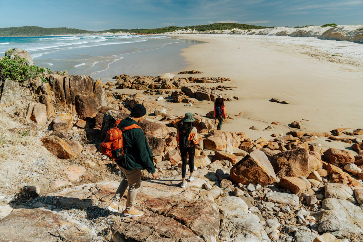
Continue through a more shaded path and you’ll arrive at Big Rocky Beach Carpark. If you’ve been lusting over photos of your friends’ European holidays – this is seriously the next best thing (or better, if you prefer your beaches without sunbeds and oil-covered sunbathers 🙋).
As you walk from the car park towards the lookout point, you could be forgiven for thinking you’d taken a wrong turn and ended up in the Mediterranean. Your feet are probably aching a little now – so take a moment to dip your toe into the clear, bright blue waters of this rocky cove, and admire the sweeping views from north to south.
There’s not too much further to go for Day 1. Leave the Big Rocky Day Visitor Precinct via a new boardwalk up a sandy, shaded track. This’ll take you to another boardwalk down to the wide, open expanse of Samurai Beach – where the sand dunes loom large, and clothing is optional.

Separating Samurai Beach from One Mile Beach is Middle Rock. Look for the sandstone steps leading up onto the rocks and follow the trail away from the ocean to the Port Stephens Koala Sanctuary and Gan Gan Road. From here, you can organise a taxi or make your way back to your accommodation on foot, like we did.
Now’s the time to slip into something more comfortable, scroll through the many photos you took today, and enjoy a well-earned break before you tackle Day 2 tomorrow.
-
Day 2 : One Mile to Birubi Beach
Distance: 9km | Time suggested: 3.5 to 4.5 hours | Toilets: One Mile Beach, Boat Harbour, Fishermans Bay, Birubi Beach
Feeling rested? Great! You’ll start Day 2 right where you finished Day 1 – at Middle Rock, on the northern end of One Mile Beach.
This idyllic, white-sand beach is patrolled all year round (please check the seasonal patrol timetable for details), so if you fancy a swim before you get started, we’re all for it. There’s a surf club, café and public toilets at the south end of the beach, if you want to get changed and refuel post-dip.
Beach Safety: If you’re swimming at a patrolled beach, always swim between the flags. Most beaches in NSW national parks are unpatrolled – stay safe on the sand and in the water with these tips.
When you’re ready, look for some sandstone steps from the beach that take you up the cliff. The steep climb gives you the perfect vantage point to look back over One Mile Beach, and Samurai Beach, which you walked across yesterday.
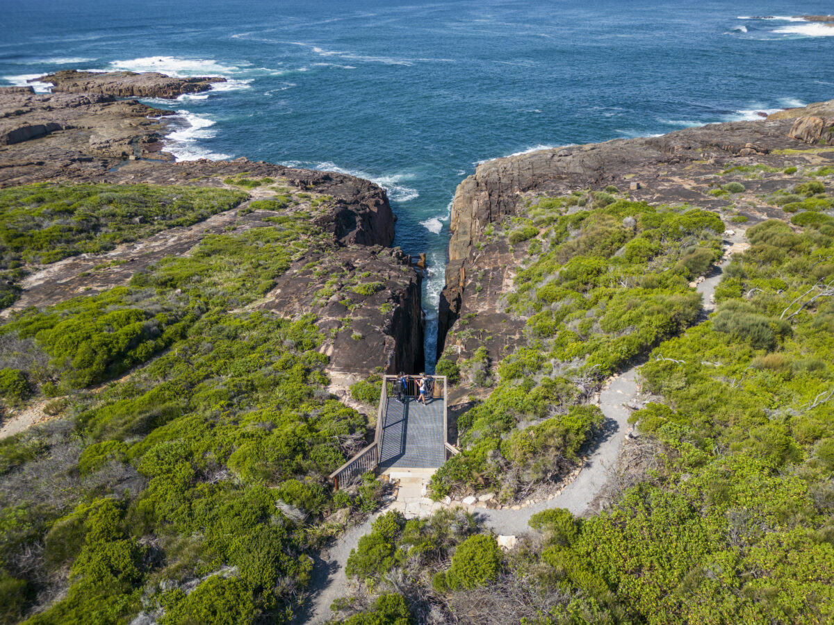 Photo Information
The viewing platform at Slot Canyon
Slot Canyon
Tomaree National Park
John Spencer / DPE (2023)


You’ll soon pass through shaded forest, then open out into a wider sandy path, lined with Gymea lilies and banksia trees. Arriving at a viewing platform overlooking Slot Canyon, take a moment to watch the waves crash into a narrow ‘slot’ in the rocks, against the ancient rugged coastline.
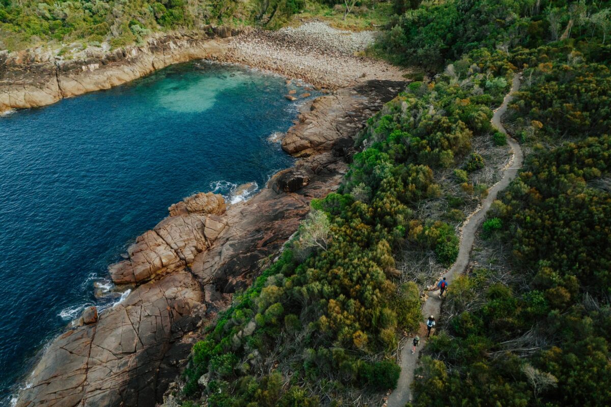 Photo Information
Boat Hrabour, Tomaree Coastal Walk
Tomaree National Park
Remy Brand/DCCEEW (2023)
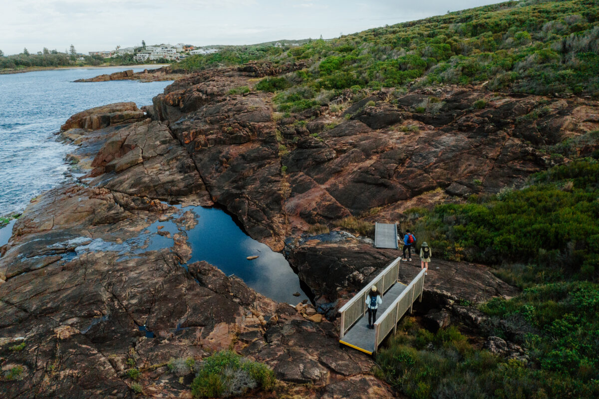 Photo Information
Tomaree Coastal Walk, Boat Harbour
Tomaree National Park
Remy Brand / DPE (2023)
The path then takes you across the rocks, traversing the jagged cliffs, and over new boardwalks and sandstone steps that lead you down to the tranquil shores of Boat Harbour, where you might spot a whale or dolphin in the distance if you’re lucky.
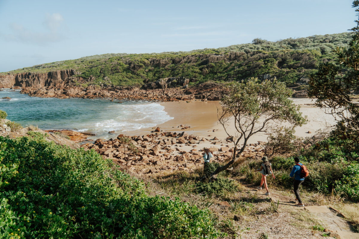 Photo Information
Little Kingsley Beach
Tomaree National Park
Remy Brand / DPE (2023)
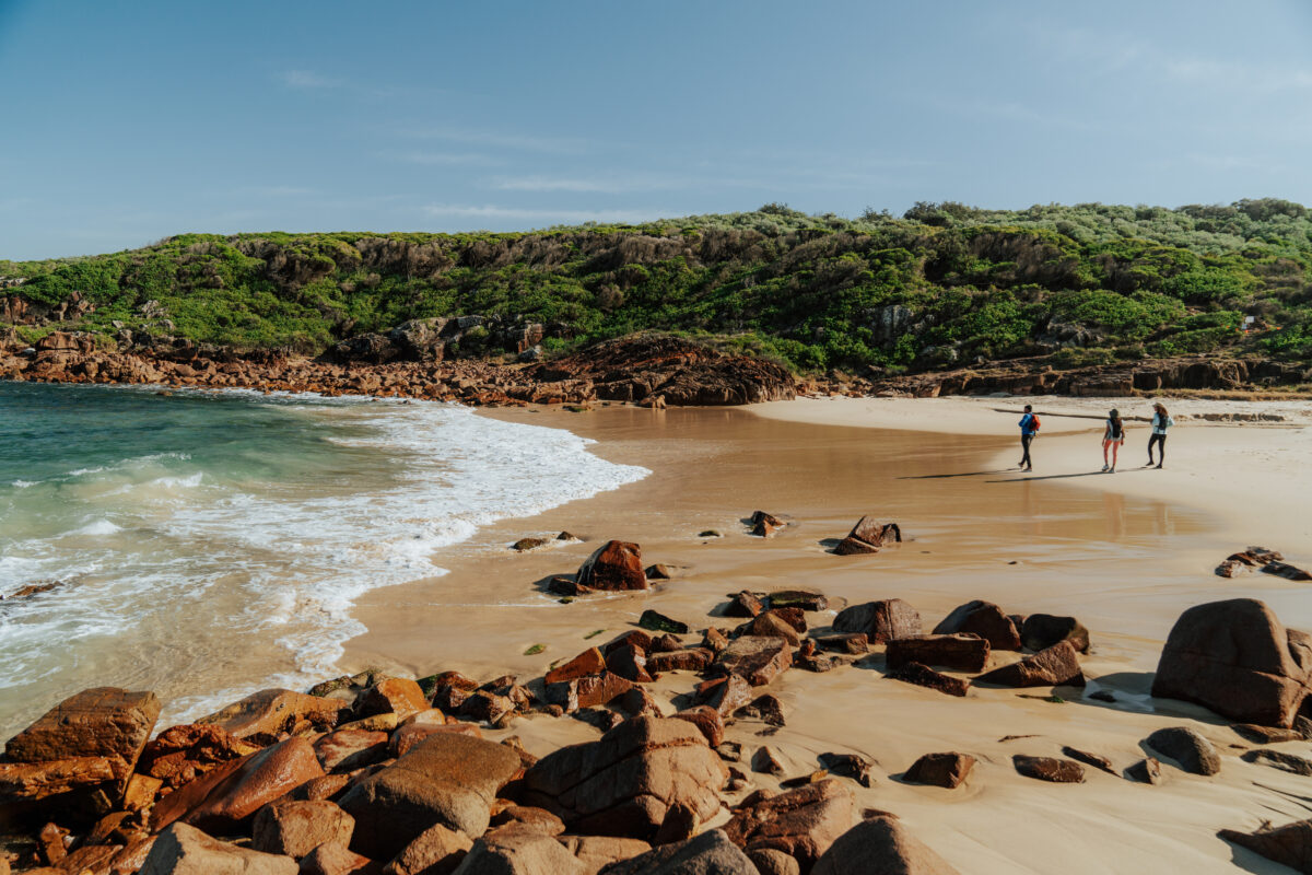 Photo Information
Little Kingsley Beach
Tomaree National Park
Remy Brand/DCCEEW (2023)
The track continues through the ‘burbs of Boat Harbour and then back into the national park, arriving at Kingsley Beach, and Little Kingsley Beach beyond. Along this stretch, you will be delighted by the uniquely Australian sight of bright orange banksia flowers contrasting against the bright blue of the sea.
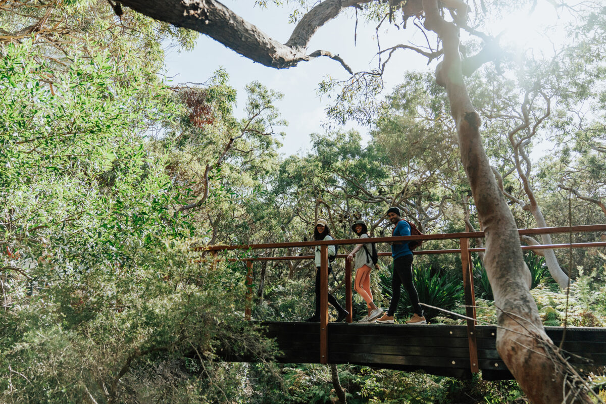 Photo Information
Tomaree Coastal Walk
Tomaree National Park
Remy Brand / DPE (2023)
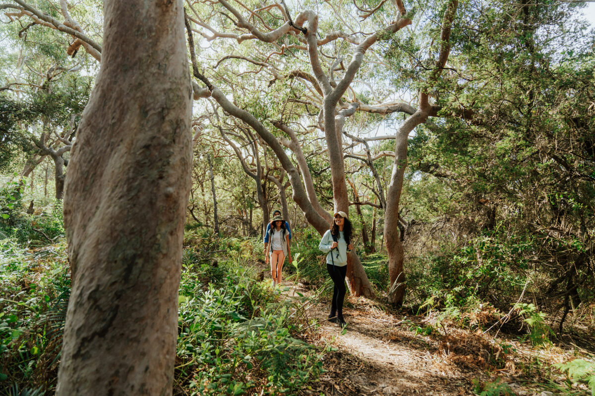 Photo Information
Tomaree Coastal Walk
Tomaree National Park
Remy Brand / DPE (2023)
Leaving Little Kingsley Beach up through the rocky pathway, you quickly say goodbye to the exposed rocky coastline and enter a peaceful patch of lush, angophora rainforest. A new pedestrian bridge takes you over a fern-filled gully, weaving around the gnarled limbs of the decades-old trees.
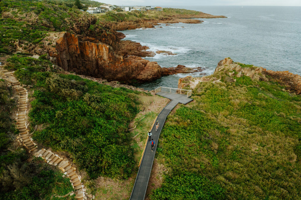 Photo Information
Iris Moore Reserve
Tomaree National Park
Remy Brand / DPE (2023)
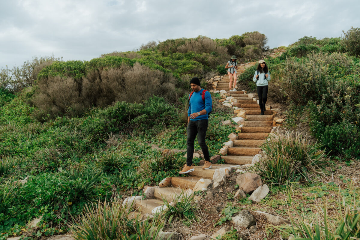 Photo Information
Iris Moore Reserve
Tomaree National Park
Remy Brand / DPE (2023)
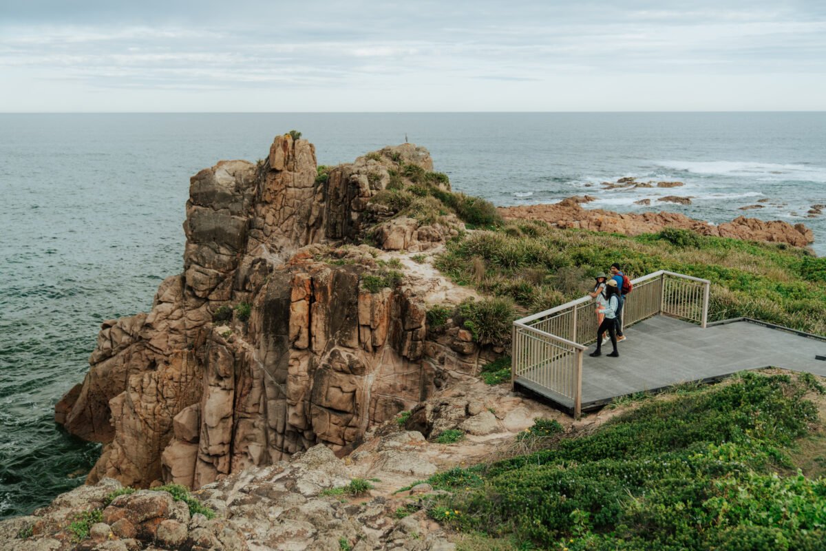 Photo Information
Iris Moore lookout
Tomaree National Park
Remy Brand / DPE (2023)
You’ll soon enter the quiet cove of Fishermans Bay, and follow the rugged coastline to a lookout point (Iris Moore lookout and picnic area) at Iris Moore Reserve. Breathe in the brisk, salty air here, and admire the dramatic jagged rocks that jut out from the coastline.
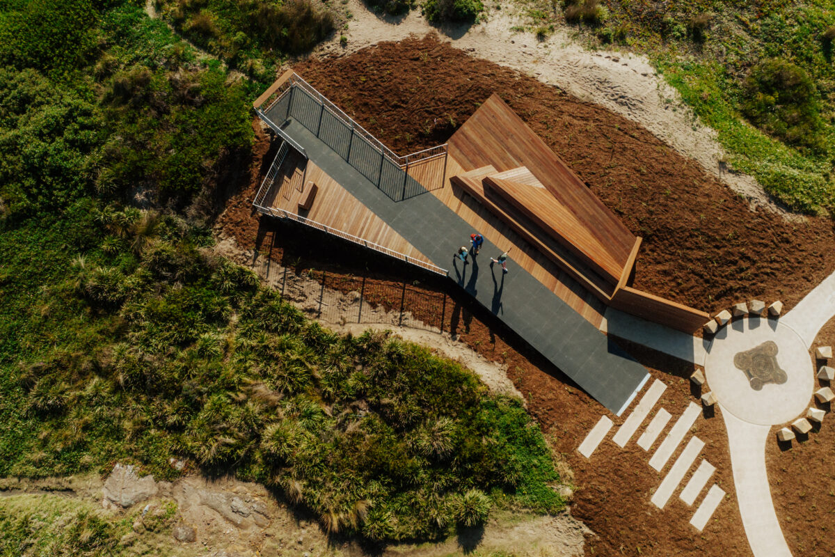 Photo Information
Birubi Point Aboriginal Place – a culturally significant place to the Worimi People
Birubi Point Aboriginal Place
Tomaree National Park
Remy Brand / DPE (2023)
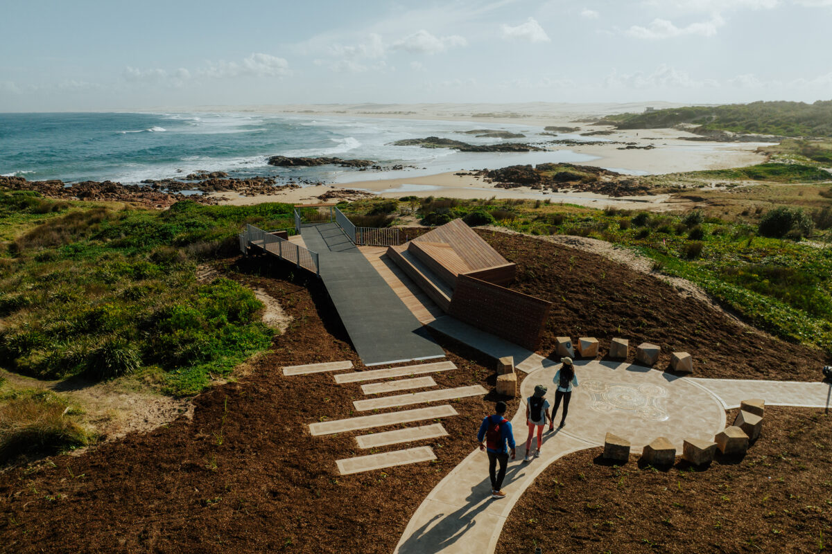 Photo Information
Birubi Point Aboriginal Place
Tomaree National Park
Remy Brand/DCCEEW (2023)
 Photo Information
Birdseye view of the artwork. #Incredible
Birubi Point Aboriginal Place
Tomaree National Park
Remy Brand / DPE
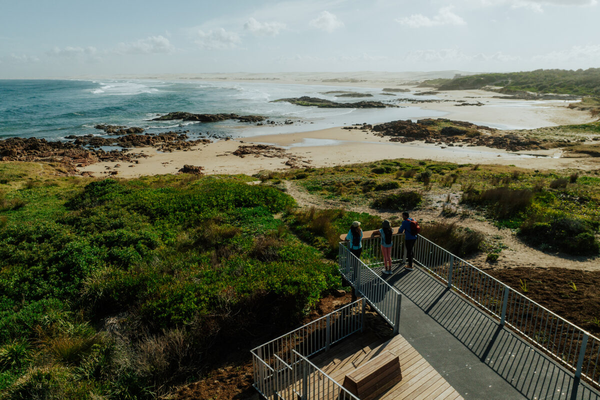 Photo Information
This is a special place. Take a moment to admire the views and reflect on culturally significant landscape to the Worimi People
Birubi Point Aboriginal Place
Tomaree National Park
Remy Brand / DPE (2022)
Day 2 is nearly over – but you’re about to reach a very special section. Birubi Point Aboriginal Place is part of a landscape that’s culturally significant to the Worimi People, the traditional owners of these lands. The Worimi People lived here peacefully for tens of thousands of years before colonisation, expertly caring for the land you’re now standing on.
Birubi Point is home to ancient burials, ceremonial sites, natural resources, and archaeological material that helps us all to learn about Aboriginal culture and traditions.
Did you know: ‘Birubi’ is the Worimi People’s word for the Southern Cross, which lights the night sky above Birubi Point.
This special place has been acknowledged with a viewing platform and artwork installation by Worimi man Gerard Black. Pause here to consider the significance of this land, listen in as a Worimi Elder shares the Worimi dreamtime story, while you drink in the views across NSW’s largest sand dunes at Worimi Conservation Land in the distance.
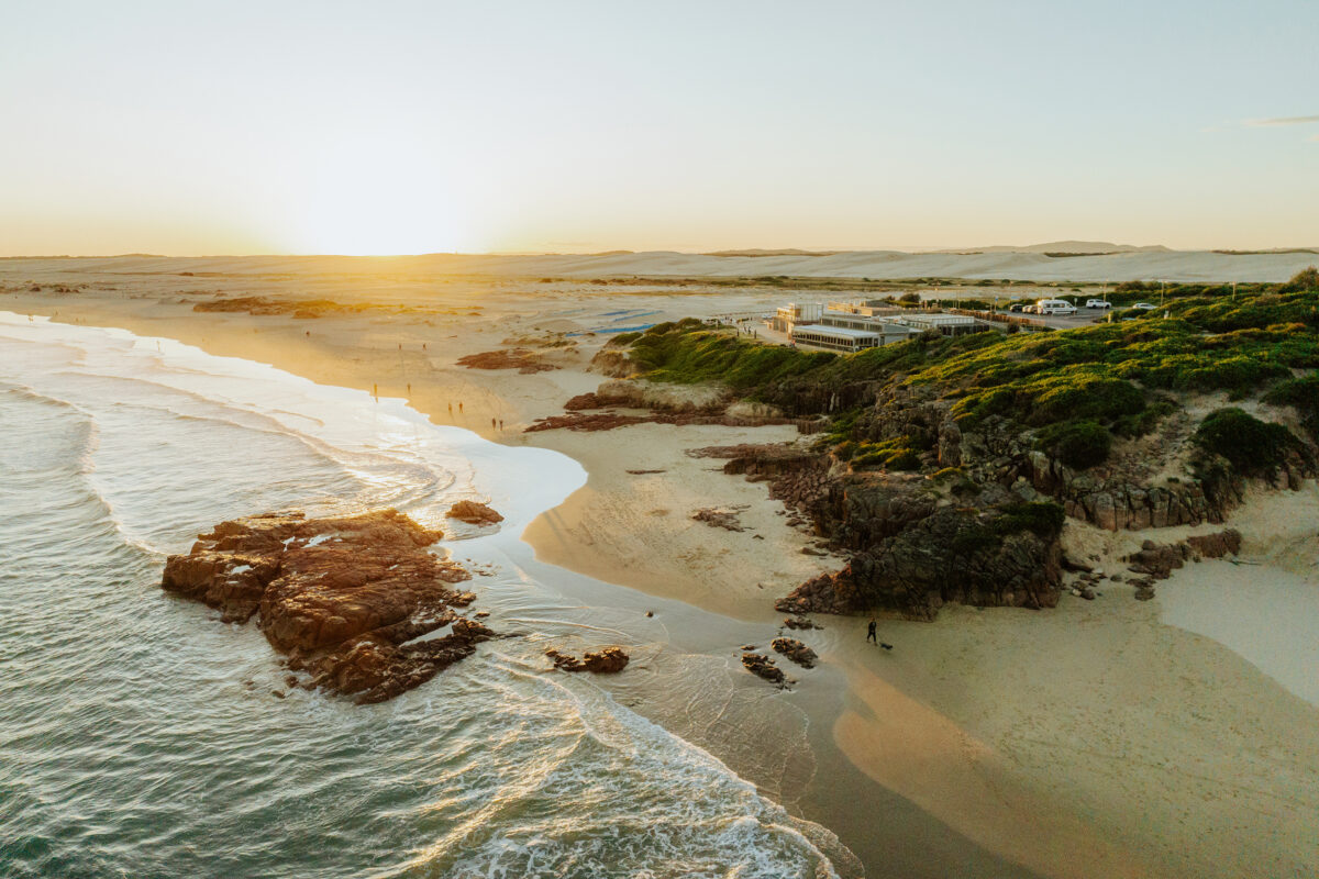 Photo Information
Birubi Beach and views to Stockton Dunes
Birubi Beach
Tomaree National Park
Remy Brand / DPE (2023)
 Photo Information
Cheers! Tomaree Coastal Walk 🥳
Crest Birubi Beach Café.
Tomaree National Park
Remy Brand / DPE (2023)
Then, make your way along the final stretch of the track along the footpath to the Birubi Beach Surf Club, in front of Crest Birubi Beach Café. If you’re hungry, you can stop here for some food at the kiosk while you wait for your chariot of choice to take you back to your car.
And that’s it – you made it! 27km of NSW’s most scenic and spectacular coastline (an unbiased opinion, of course) in two days, walked on your own two feet. Time for a celebratory selfie, a group hug, and a rest, we reckon.
Is the Tomaree Coastal Walk right for me?

Middle rock sandstone steps.
Tomaree coastal walk
Tomaree National Park
Remy Brand / DPE (2023)
If you’re looking for a multi-day hike that doesn’t require too much preparation, equipment, or endurance – this is a great pick. There aren’t too many steep inclines, apart from Tomaree Head Summit. The path is well-graded throughout, so you won’t be scrambling up hills or tripping over tree trunks.
Slip, slop, slap: Remember even on overcast days to wear sunscreen, wear a hat and stay hydrated.
The Tomaree Coastal Walk is also quite unique because it starts and ends in towns, with plenty of facilities nearby. You can grab a coffee or snack on your route, use public toilets along the way and you’re never too far from ‘civilisation’.
Ranger tips: We want you and your companions to have an enjoyable and safe time in our national parks. Before you go tell someone, double-check the weather, and NSW Parks alerts for up-to-date info on closed parks and safety alerts. Be prepared, read our bushwalking safety tips and download our NSW National Parks app.