Famous for their epic, sweeping landscape shots, drones have become filming and photography’s go-to tech toy. But recently this buzzing box in the sky has stepped up to its most important role yet: a vital member of the NSW National Parks and Wildlife Service (NPWS) firefighting team.
The 2019/2020 fire season was the most widespread and extreme that NSW has ever seen, and most of us have memories of orange skies, smoke-filled air and residents trapped alongside summer holiday makers all over NSW. A staggering 5.5 million hectares of land in NSW and 38% of national park land were affected by these fires.
In this emergency, NPWS’ Remotely Piloted team and their drones were called into action.
-
Right tool for the job
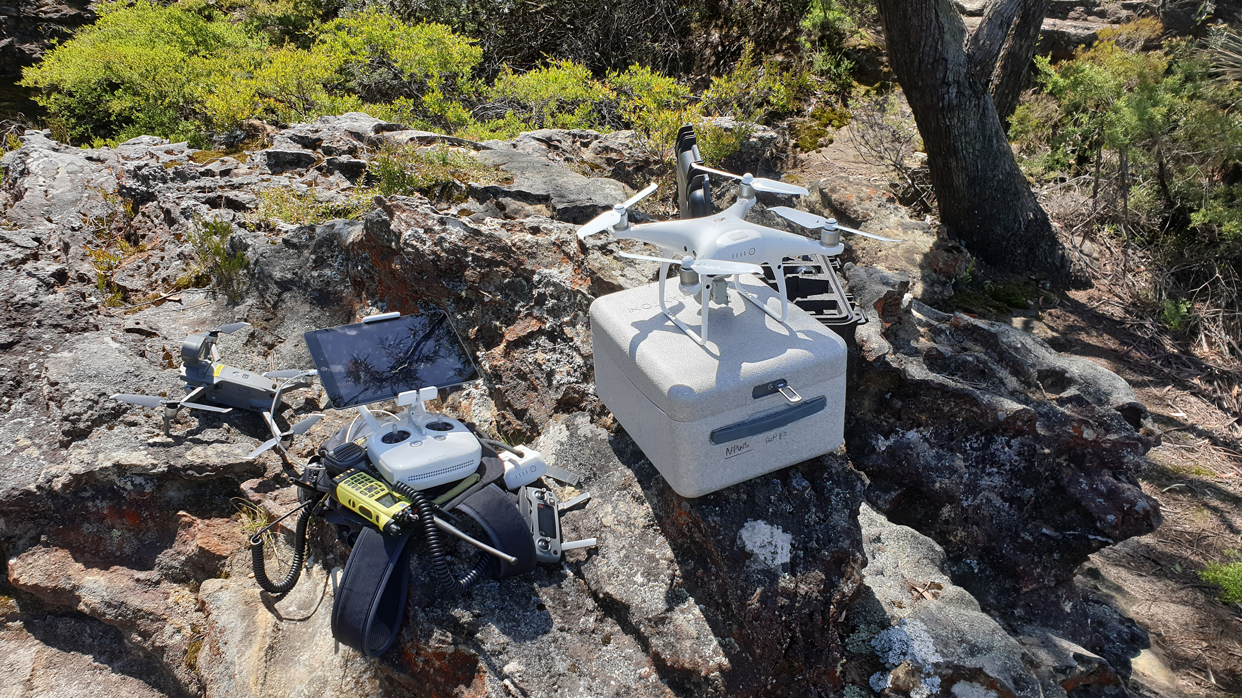 Photo Information
A drone, or what is technically called an RPAS (Remotely Piloted Aircraft System)
Scott Colefax / DPIE
Taking it back to basics, a drone, or what is technically called an RPAS (Remotely Piloted Aircraft System), can get a bird’s eye view of an area. In a fire, their superpower is they can literally see the bigger picture.
They aren’t the only eyes in the sky, with NPWS’ helicopters and small planes crucial for firefighting. But drones have two massive advantages:
1 – they can fly when it’s too dangerous for other aircraft and their pilots to be in the air, like when thick smoke makes it impossible to see.
2 – they are small and agile, so can get to areas where bigger aircraft can’t. Most drones NPWS uses for firefighting weigh just 1 – 2kg and fit in a box roughly the size of a briefcase.
NPWS’ drone pilots are fully trained firefighters with highly specialised skills and accreditation from the Civil Aviation Safety Authority (CASA). In teams of two, pilots launch and land drones from the fireground itself to put these nifty tech devices to work.
-
Night vision

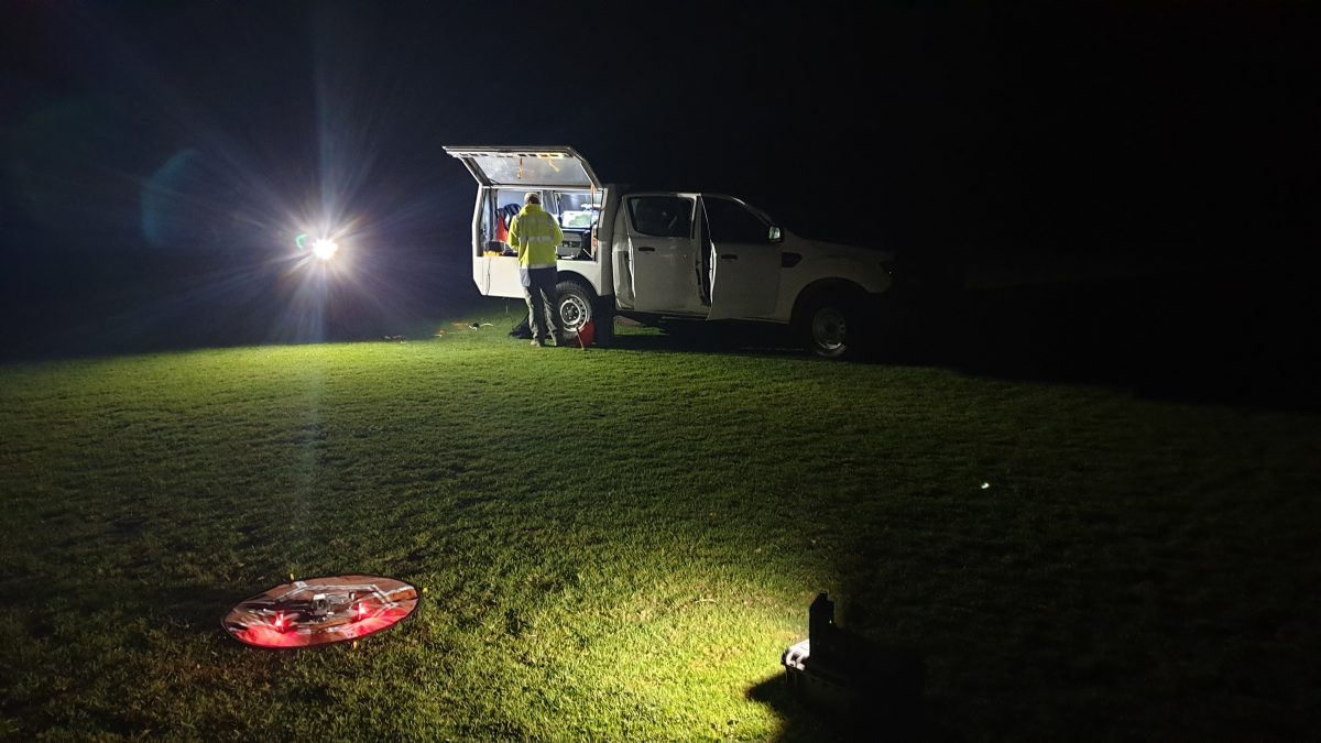 Photo Information
A NSW National Parks drone pilot gets the drone ready to pilot at night
Scott Colefax / DPIE
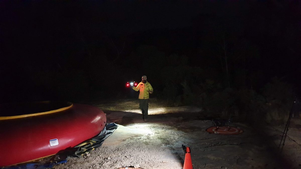 Photo Information
A NSW National Parks drone pilot gets the drone ready to pilot at night
Scott Colefax / DPIE
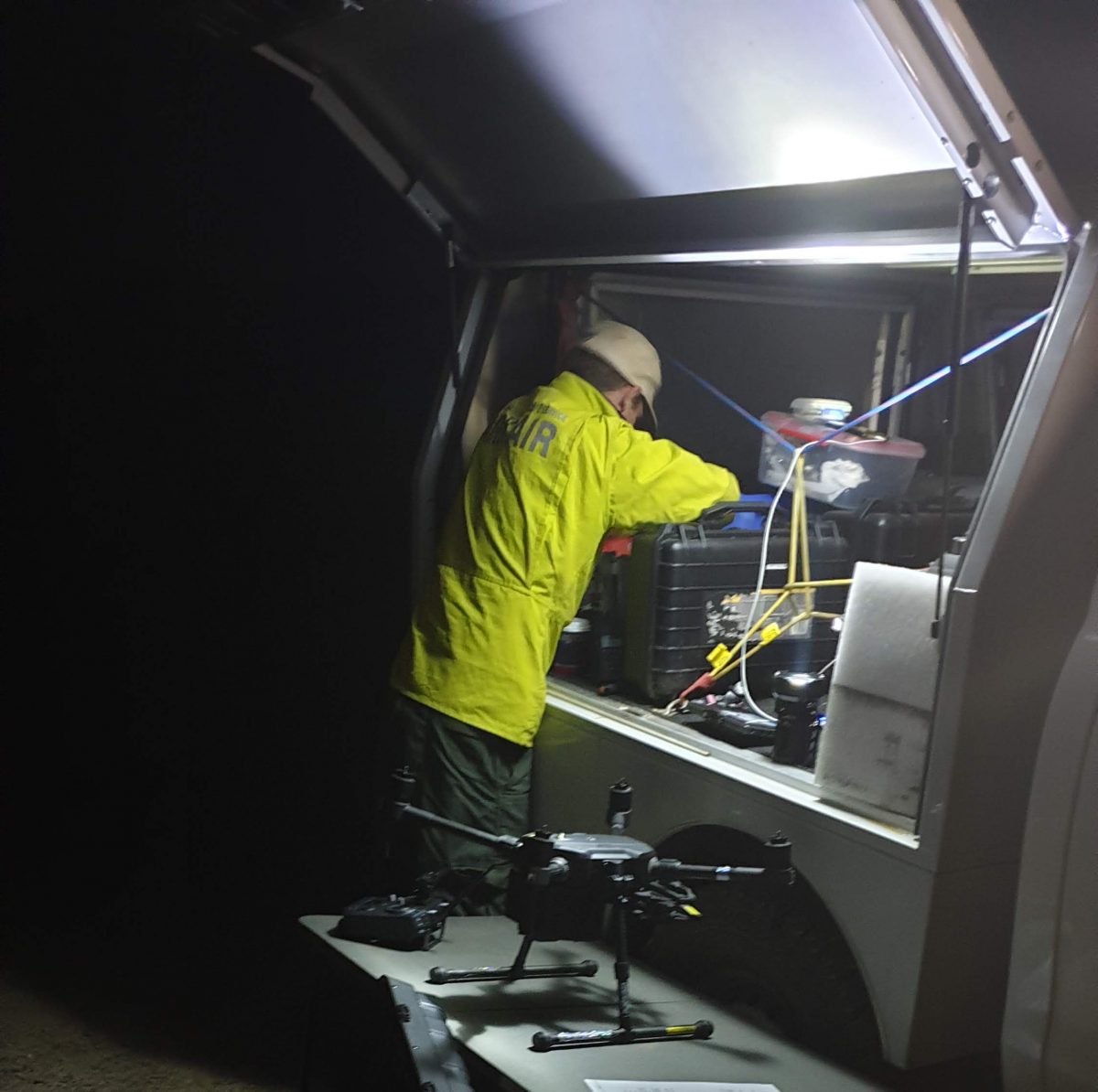 Photo Information
A NSW National Parks drone pilot gets the drone ready to pilot at night
Scott Colefax / DPIE
The most dangerous time on a fireground is often after the sun sets and things get dark. Fire helicopters can’t fly safely at night, and it’s incredibly hard for firefighters on the ground to track what direction a fire is moving and predict where it’s going next. This is when drones do some of their best work.
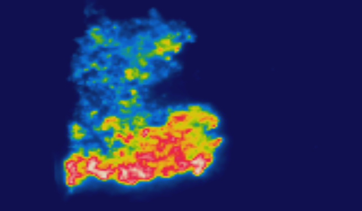 Photo Information
Night vision: A thermal line scan taken from the drone at night
Scott Colefax / DPIE
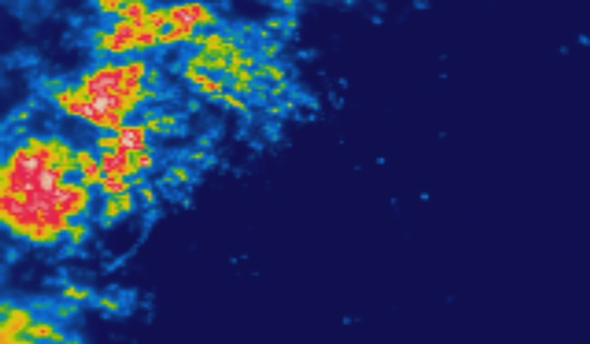 Photo Information
Night vision: A thermal line scan taken from the drone at night
Scott Colefax / DPIE
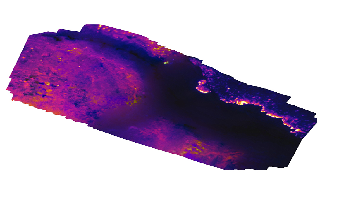 Photo Information
A series of thermal line scans stitched together to make one single thermal image
Scott Colefax / DPIE
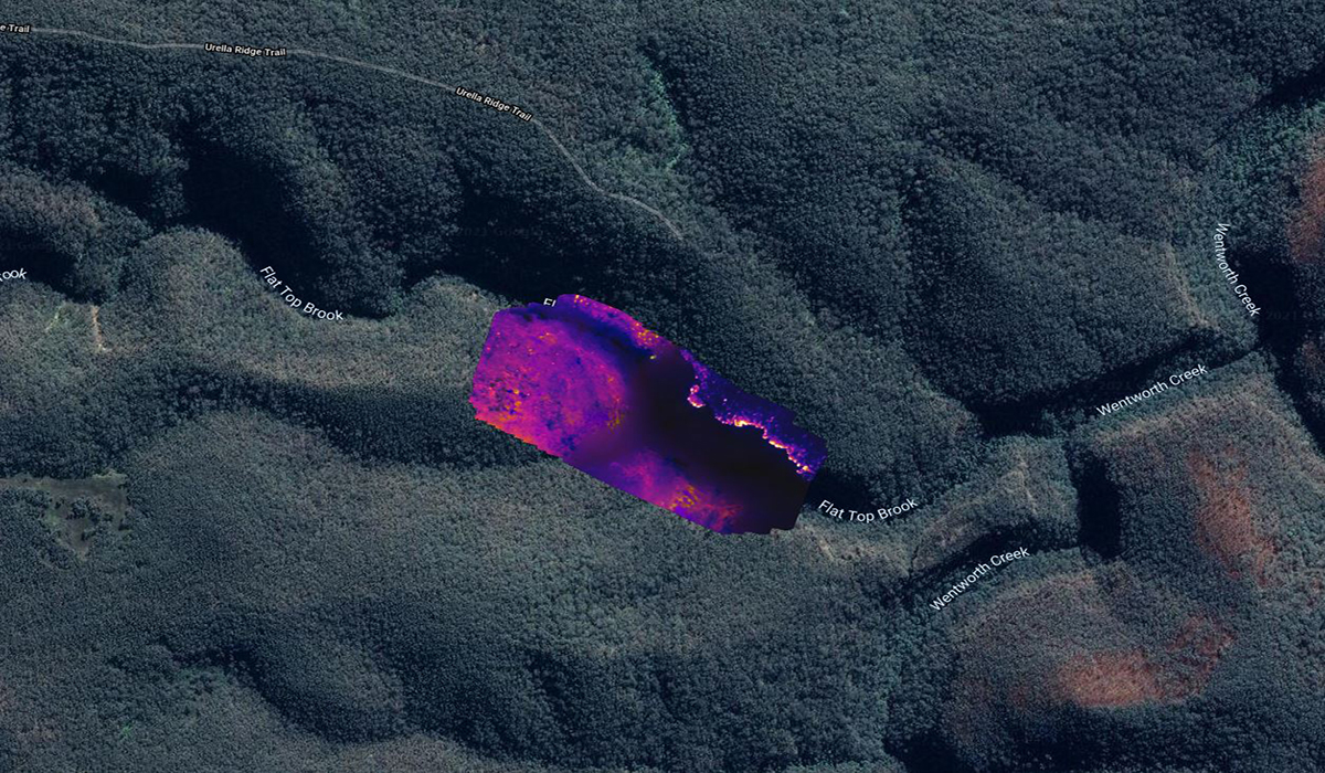 Photo Information
A series of thermal line scans stitched together to make one single thermal image then imposed into a map of the area
Scott Colefax / DPIE
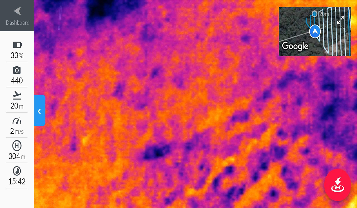 Photo Information
First person view: A thermal line scan from the drone pilots screen.
Scott Colefax / DPIE
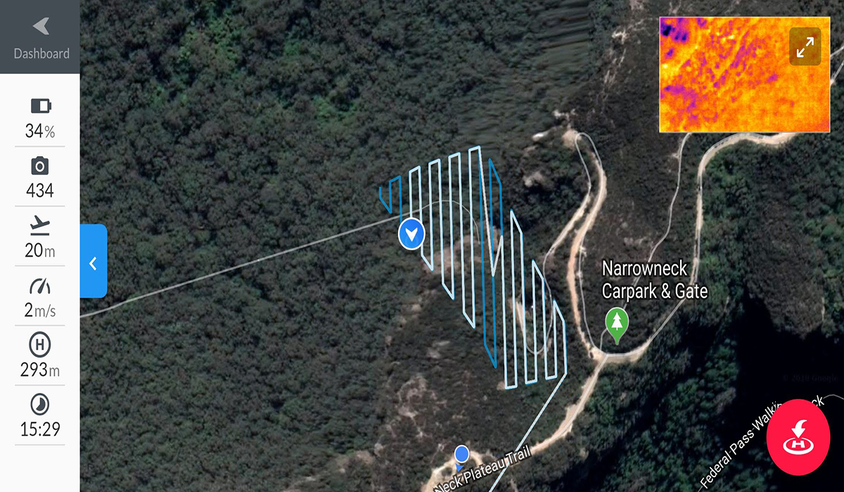 Photo Information
First person view: NSW NPWS drone pilots screen
Scott Colefax / DPIE
Drones with thermal cameras are used at night to detect hot areas to create thermal line scans. Drones are flown over a large area of the fireground and take hundreds, sometimes thousands of photos, which are digitally stitched together into a single thermal image. This high-res image gives a picture of the live fire, as well as showing up dangerous hotspots which could ignite next.
These night-vision style images are used by the command centre to help get ahead of the fire and decide where the next spots of greatest danger are – where ground teams or water-bombing aircraft should be sent at first light in the morning.
Did you know? A hotspot is an image pixel with high infrared intensity, indicating a heat source. It’s important to catch hotspots, as they are where the next flare-up of fire is likely to happen.
-
The aftermath
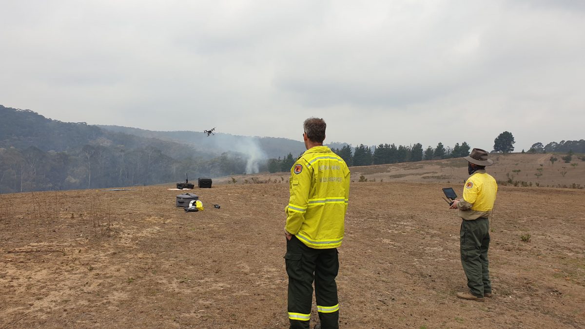 Photo Information
Drones are a crucial piece for pre, during and post bushfires.
Scott Colefax / DPIE
After a fire, NPWS teams need to find out the status of everything that could be damaged in the national park, including visitor centres, walking tracks and lookouts, cultural heritage sites, historical buildings, as well as helping the Rural Fire Service (RFS) assess houses and structures.
The problem is it’s often unsafe to get to these areas with trees blocking roads, powerlines and dangerous materials like asbestos from damaged buildings and small fires still burning.
NPWS’ drone pilots can check from the air if a building is damaged, destroyed or has survived, and can do this work twice as quickly as crews on foot.
One of the most important things in an event as traumatic as a bushfire is getting an update on what’s happened to your property. This is when tech can feel most human: when it can provide the relief that your home is still standing, or if it’s bad news, give answers and certainty quicker so you can start to come to terms with what has happened.
-
Prepare, prepare, prepare
Drones aren’t just in action in the middle of a wild inferno; they’re also used to prepare for fire season in planned, controlled hazard reduction burning.
In hazard reduction burns, drone footage of the fire’s progress is live-streamed back to the command centre, and to firefighters on the ground to their phones and tablets, allowing them to adjust how they are lighting and managing the fire.
Drone pilots are also on the lookout for any spot fires breaking out to make sure nothing gets out of control. After the burn, drone pilots patrol the edges of the fire area using drones with thermal cameras to make sure everything is completely extinguished and safe.
What is a Hazard reduction burn? A hazard reduction burn is a planned fire that is carried out to reduce fuel loads or the amount of bushland that can too easily and quickly catch alight. It can help suppress a bushfire if it breaks out in that area.
So next time you’re watching your kid cousin fly (and no doubt crash) their new toy drone in the backyard, take a moment to appreciate the way this clever little piece of tech, and its skilled pilot, are helping to prepare for and fight fires in national parks.
Thinking of flying your drone in a NSW national park? You’ll need to get the tick of approval with an official permit from the NPWS park office where you want to fly, and obey Civil Aviation Safety Authority (CASA) drone safety rules, like keeping a safe 30m distance from people, while you’re getting that shot.